Welcome to Hertfordshire Walker

Free walks available on any device

Walk 60: The Sculpture Trail

0.6 miles (1 km) with 17m of total ascent


Photograph of sculptures along Walk 60 by Hertfordshire Walker released via Creative commons BY-NC-SA 4.0
 
The Sculpture Trail is ideal for children and those who are finding long walks and lots of ups and downs too much. It's a gentle walk, with lots to see and plenty of benches for rests. Ideal for the young and old of heart.

Walk 59: The Burns Green South Loop

4.2 miles (6.7 km) with 111m of total ascent


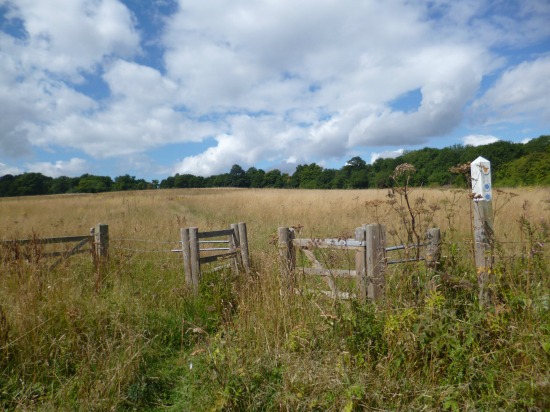
Photograph of footpath, fences and fields along Walk 59: The Burn's Green Loop
 
A mix of shaded footpaths and byways, woodland and wide-open views across beautiful, undulating Hertfordshire countryside around Burn's Green to the east of Stevenage. The walk starts and finishes at the excellent Lordship Arms pub, famous for its real ale.

Walk 58: The Wadesmill North-West Loop

5.8 miles (9.4 km) with 112m total ascent


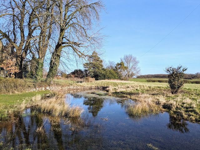
A pond just before point 8 on the walk
This is a lovely walk over undulating countryside with wide open views. There are well-signposted paths and a stretch along a deep cut waterway hidden by woodland and hedgerow. Apart from one short section this is a quiet walk where you will escape the sound of traffic. If you are lucky you might spot a herd of deer, the odd solitary muntjac, herons, kites, and buzzards. Along the way you will pass several signs urging dog owners to keep their pets on a lead. And you will cross a livestock field where you might meet friendly horses. There are two sections of the walk that can be muddy after rain. If you want refreshments there is a pub/restaurant and a cafe in Wadesmill close to the start and finish points.

Walk 57: Chapmore End Loop

4.9 miles (7.9 km) with 84m total ascent


Photograph of a stile over a stone wall on Walk 57: Chapmore End Loop
 
An undulating circular walk through woodland, a nature reserve, along a pretty river, across parkland, and with great views across the Hertfordshire countryside. There is a pub, The Woodman, and a cafe, The Conservatory at the start and finish point in Chapmore End.

Walk 56: Northaw Great Wood Yellow Trail

2.75 miles (4.4km) with 87m of total ascent


The yellow trail at Northaw Great Wood
The yellow trail at Northaw Great Wood is one of our favourite midweek walks. It's got plenty shade, and the woodland changes with the seasons making it feel like a different walk each time we do it. In the spring and summer the bracken and foxgloves stand tall, in the autumn sweet chestnuts and hazelnuts fall to the ground, and the woodland is beautiful after a fall of winter snow.

Walk 55: Ayot North-East Loop

3.2 miles (5.2km) with 65m total ascent


Photograph of a footbridge over the River Mimram on Walk 55: Ayot North East Loop
 
A pleasant circular from Ayot St Lawrence down to the River Mimram and back mostly on footpaths. The walk offers some great open views across the Hertfordshire countryside. And there is an option at the start and finish point for refreshments at The Brocket Arms. Check opening times.

Walk 54: Symondshyde Loop

5.6 miles (9 km) with 104m total ascent


One of the old byways along the route
This walk follows old deep and shaded byways which weave their way through fields and woodland. We rerouted it in May 2021 because parking at the old start point was discouraged. The walk used to be a 3.5 mile loop from Coleman Green. Now it’s a 5.9 mile loop from the car park on Nomansland Common south of Wheathampstead. We think the new route is a much better walk.

There is one pub along the way, the John Bunyan at Coleman Green, and another, the Elephant & Castle at Amwell, which is 900m from the start/finish point (location - https://w3w.co/answer.shock.season). You pass the '3 Brewers' brewery along the way.

Walk 53: Essendon East Loop

6.5 miles (10.5 km) with 194m total ascent


Photograph of the footbridge on Walk 53: Essendon East Loop
 
This walk from Essendon heads E to Howe Green then on to Bayford, S to Little Berkhamsted, and back to Essendon. This route crosses Essendon golf course twice and includes a fair amount of up and down. There are two pubs along the way.

Walk 52: Wildhill South-East Loop

4.5 miles (7.3 km) with 98m total ascent


The ridge between points 7 and 8
A circular walk starting and ending at The Woodman, Wildhill taking in some old byways and a ridge walk with great views. There is a particularly lovely section between points 7 and 8.

Walk 51: Mymmshall Wood Loop

3 miles (4.7 km) with 91m total ascent


The path through Mymmshall Wood towards the end of the walk
The path through Mymmshall Wood towards the end of the walk
A pleasant circular walk through pine woods, oak woodland, over open fields and down footpaths through deep hedgerows. In July and August look out for the Purple Emperor butterfly along the way. There are no pubs along this route, but two close by. The route does cross fields where sheep graze. There are notices during lambing season to keep dogs on leads. The starting point is 1.8 miles SW from Brookmans Park station by road. This route offers plenty of shade during hot summer days if started before 07:30. After that, points 1 to 2 and 3 to 4 are exposed to the sun.

Walk 50: Bayford - North Mymms Linear

8.6 miles (13.8 km) with 224m total ascent


Photograph of the footbridge through Bayford Wood on Walk 50: Bayford Linear
Bayford Wood
A linear walk from Bayford station going through Bayford, across fields and through woodland to Howe Green, over the golf course to Essendon, via West End, down to Wildhill via a secluded byway, and west over the fields via Bell Bar to Brookmans Park or Welham Green.

Walk 49: Ayot Short Loop

1.6 miles (2.6 km) with 19m total ascent


The ruins of the old St Lawrence Church
A pleasant and easy walk around the north side of the village of Ayot St Lawrence circling Ayot Park and passing Shaw’s Corner the former home of the author George Bernard Shaw. You will pass the new St Lawrence Church and the ruins of the old St Lawrence Church. The walk starts and finishes at The Brocket Arms pub/restaurant which has a lovely beer garden. 

Walk 48: Kimpton Loop

5.2 miles (8.3 km) with 123m total ascent


The bridleway between points 2 and 3
Rolling hills, secluded footpaths, bridleways and byways cutting through woodland and crossing farmland with open views. There is a pub at the start and finish point and one close to the halfway point. See if you can spot the wood carvings along the footpath between points 2 and 3. And if you need a rest there are a couple of well-placed benches between points 7 and 8 offering great views to the south.

Walk 47: Mimram Valley Loop

3.3 miles (5.3 km) with 63m total ascent


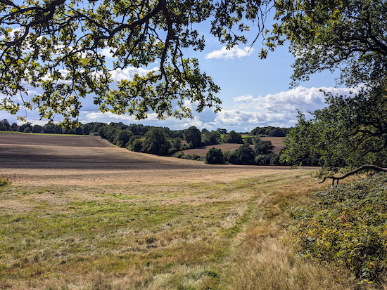
Photograph taken on a footpath through wheat fields on Walk 47: Mimram Valley Loop
 
A circular walk from Tewin down to the Mimram Valley and back via Home Wood. This walk takes in part of the route for Walk 45: The Tewin West East Loop but heads down to the River Mimram instead of crossing the fields.

Walk 46: Tewin North Loop

4.3 miles (6.9 km) with 48m total ascent


A bridleway along the route
An undulating circular walk around the village of Tewin crossing open fields, climbing some hills, following footpaths alongside woodland, and ending in a pub beer garden. This walk includes the option of visiting another pub at the halfway point.

Walk 45: Tewin West to East Loop

4.2 miles (6.8 km) with 81m total ascent


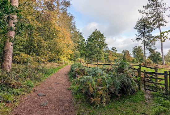
Photograph of woods and path from Walk 45: Tewin West East Loop
 
This is a pleasant circular walk from the village of Tewin following good paths throughout. It goes through woodland, crosses open farmland, and involves quite a bit of up and down. There is a pub at the start and finish point and a cafe close by.

Walk 44: Bramfield Loop

3.7 miles (5.85 km) with 60m total ascent


Picture of poppies in a field along Walk 44: Bramfield Loop
Poppies between points 2 & 3 in the walk
An undulating walk through farmland and woodland with the option of refreshments at The Grandison in Bramfield at the start, finish. There are some good wide paths for most of the way, and, if you are walking in June or July look out for the poppies between points 3 and 4 in the directions below. If you are walking in the winter it can be muddy, especially leading up to point 4 and leading up to point 7. The starting point for the walk is 2.7 miles NW of Hertford North Station by road.

Walk 43: Datchworth Loop

5.8 miles (9.3 km) with 37m total ascent


Photograph of footpath along Walk 43: Datchworth Loop
 
This is a pleasant walk across rolling Hertfordshire countryside along good tracks with good views. The route follows byways, bridleways and avoids roads apart from one short section of a quiet country lane at the end. 

Walk 42: North Mymms to Hatfield North-West Linear

7.1 miles (11.4 km) with 49m total ascent


Picture of fields and trees on Walk 42: Brookmans Park to Hatfield
 
This walks starts at Brookmans Park station, heads over to Water End, turns north along the A1(M) to the village of Roestock, over to Sleapshyde, then ends at Hatfield station where you can catch a train back to the starting point.

Walk 41: The Northaw Loop

14 miles (22.5 km) with 305m total ascent


Flowers along a footpath on Walk 41: The Northaw Loop
This circular walk starts and ends in Brookmans Park, then passes through Little Heath, on to Northaw, through the outskirts of Cuffley, on to Newgate Street, and across to Wildhill before heading back to Brookmans Park.

We have archived this walk because it follows a dangerous section of The Hertfordshire Way along Carbone Hill. We will republish when there is better pedestrian protect from traffic.

Walk 40: Ayot Greenway North Loop

5.4 miles (8.7 km) with 83m total ascent


Photograph taken along the route of Walk 40: Ayot Greenway North Loop
 
This walk starts and ends in the Ayot Greenway car park just north of Ayot Green. It crosses open fields, reaches the halfway point at Ayot St Lawrence where you can take a break at The Brocket Arms, and then returns through wooded paths and bridleways as they weave their way back to the car park via Ayot Greenway. There is an option of refreshments close to the start and finish point at The Waggoners in Ayot Green.

Walk 39: Ayot Greenway West Loop

4.8 miles (7.7 km) with 52m total ascent


Wheathampstead footpath 38 between points 12 & 13
This is a lovely walk along part of the Lea Valley Walk and Ayot Greenway, a former railway branch line. The wildflowers along the River Lea are impressive in the summer. The walk starts and finishes in a council car park at Wheathampstead. There are plenty of refreshment opportunities in the village.

Walk 38: Ayot Greenway South Loop

4.5 miles (7.2 km) with 85m total ascent


The River Lea at point 10 in the walk
This is a lovely walk that crosses a golf course, passes Brocket Hall, goes through woodland, follows a riverside footpath, and continues along the track of the old railway branch line between Hertford, Welwyn Garden City, Luton and Dunstable. The walk starts and finishes at The Waggoners pub/restaurant, Ayot Green. The starting point is two miles NW of Welwyn Garden City station by road.

Walk 37: Three Ridges Loop

9 miles (14.5 km) with 220m total ascent


Pond between points 2 & 3
This walk connects several of our earlier walks by adding one short path near Epping Green. The route crosses three ridges with excellent views and follows well-defined tracks most of the way. It can be hilly along the way with seven pubs either on the route or a short detour off it.

Walk 36: Lea Valley Long Loop

4.4 miles (7 km) with 101m total ascent


Essendon footpath 13 approaching the end of the walk
A pleasant circular that includes parts of a couple of shorter walks on this site, including Walk 5: The River Lea Loop, hence the name 'long' because it's longer than the original walk. The walk starts and ends at The Candlestick, West End, and includes a stretch of a bridleway along the Lea Valley before returning via the outskirts of Essendon.

Walk 35: Letty Green Loop

3 miles (4.8 km) with 27m total ascent


The Cole Green Way
The Cole Green Way
A short circular walk which starts along Cole Green Way, which is the route of the former Hertford to Luton and Dunstable branch line via Welwyn Junction. The walk starts and finishes at what was Cole Green Station and goes through woodland, along lanes and back following the route of the track to the car park. There is a pub, The Cowper Arms, close to the start/finish point.

Walk 34: Essendon South Loop

6 miles (9.6 km) with 186m total ascent


The ridge between point 7 and 8
This walk is a combination of two of our shorter walks which links the paths around Wildhill to those north-east of Little Berkhamsted. You might get muddy if you are walking after rain because there are two paths along the way that can get churned up. There are some nice views between points 7 and 8.

Walk 33: West End Double Loop

4.6 miles (7.3 km) with 112m total ascent


Picture taken of bridleway along Walk 33: West End Double Loop
 
This walk combines parts of two existing shorter walks on this site to make a new figure of eight with the option of refreshments at The Candlestick at the start and finish.

Walk 32: Brookmans Park South-West Loop

7.8 miles (12.5 km) with 140m total ascent


Photograph of fields and trees on Walk 32: Brookmans Park SW Loop
 
An undulating walk heading S from Brookmans Park through a local nature reserve, across a disused golf course, over a pine wood hill, and back to Brookmans Park. The route involves quite a bit of hill climbing and some paths can be muddy after rain.

Walk 31: North Mymms South-West Loop

6.5 miles (10.5 km) with 93m total ascent


North Mymms bridleway 90 at point 3 in the walk
This circular walk starts from St Mary’s Church, North Mymms, and heads S through Cangsley Grove then over the Potwells Valley then down to the Colne Valley and via Colney Heath before looping back to North Mymms.

Walk 30: Colney Heath South Loop

3.8 miles (6.1 km) with 31m total ascent


Photograph taken on Walk 30: Colney Heath South Loop
 
This is a pleasant circular heading S from the village of Colney Heath and looping around Willows Lakes which were renamed Albans Lakes in 2018. This is a great spot for bird watchers. The walk starts and finishes on Colney Heath where there is a pub and shops selling refreshments. The route passes by Willows Activity Farm on public rights of way.

Walk 29: Wildhill South-West Loop

7 miles (11.3 km) with 143m total ascent


Footpath at the start of the walk south of The Woodman
A good walk for views over the south Hertfordshire countryside. The route follows quiet rights of way and lanes through woodland. The route starts and finishes at The Woodman, Wildhill, but those living in Brookmans Park and Welham Green can pick up the walk at points six or eight, although doing so will probably add about a mile to the overall distance.

Walk 28: Brickendon Loop

6.5 miles (10.5 km) with 120m total ascent


Spital Brook towards the end of the walk
This walk follows secluded footpaths through deep, ancient woodland, crosses arable fields, winds along tree-lined byways, then follows Ermine Street, a Roman road. You will walk through three nature reserves, Balls Wood, Danemead, and Broxbourne Wood. A warning before you set off, this route can be extremely muddy in several places after rain, so it's probably best to save it for dry weather. If you try it when it's wet you might want to wear wellies.

Walk 27: Broxbourne Wood North Loop

6.5 miles (10.4 km) with 141m total ascent


Picture taken on Walk 27 - Broxbourne Wood North Loop
 
Another walk through Broxbourne Nature Reserve, this time taking the northern loop. The route is well-signposted throughout. Just follow the waymark posts with the green arrows and the White Admiral butterfly. When you have done this, try our Walk 26: Broxbourne Wood South Loop.

Walk 26: Broxbourne Wood South Loop

4.8 miles (7.8 km) with 109m total ascent


Photograph along Walk 26: Broxbourne Wood South Loop
 
A lovely walk through ancient woodland. It’s well signposted throughout. Just follow the waymark posts with the green arrows and the White Admiral butterfly. About half way round you could take a detour to The Woodman & Olive at Wormley West End (check opening times first). When you have done this walk try out Walk 27: Broxbourne Wood North Loop.

Walk 25: Little Berkhamsted North-East Loop

4.3 miles (7 km) with 137m total ascent


The footpath at point 16 in the walk
A pleasant walk from Little Berkhamsted village through fields and woodland over to Bayford. The walk includes open fields, shady woodland, footpaths, bridleways and has the benefit of a pub and village shop at the start/finish. Some parts of the route are along lanes where there is no footpath/pavement.

Walk 24: Lee Valley Middle Loop

3 miles (4.8 km) with 10m of total ascent


Barges from the bridge between points 11 & 12
Barges from the footbridge between points 11 & 12
This short walk explores part of the middle section of the Lee Valley Regional Park. The entire park is 26 miles long and covers 10,000 acres. It was created to act as a “green lung” for Hertfordshire, Essex, and London. This short walk is the first of three we have planned in this area. The others will explore the southern and northern sections. Please be aware that many of the tracks along this route are shared with cyclists and horse riders. If you are into birdwatching be sure to take your binoculars on this walk.

Walk 23: Hatfield-Wildhill-Brookmans Park

8.5 miles (13.7 km) with 182m total ascent


Image taken along Walk 23: Hatfield-Wildhill-Brookmans Park by David Brewer and released under Creative Commons
 
A station-to-station linear walk from Hatfield station, along the Lea Valley and over to West End, Essendon and then via Wildhill to Brookmans Park. Ideal if you want to leave the car at home and have a few pints along the way. The route can be muddy in places after rain. Some gentle hill climbing involved.

We have archived this walk becaue the crossing of the A414 dual carriageway at point 6 has become too dangerous. Sorry about that. Please choose another walk from the 290+ that are free to download. Thanks.

Walk 22: The North Mymms Way

11.8 miles (19 km) with 234m total ascent


Photograph of The path along Foxes Lane near Welham Green mentioned in point 13 below Image by Hertfordshire Walker released under Creative Commons BY-NC-SA 4.0
The path along Foxes Lane near Welham Green mentioned in point 13 below
A half-day walk, keeping, as close as possible using public footpaths, bridleway, byways, permissive paths, and quiet lanes to the boundary of the historic parish of North Mymms in south Hertfordshire, which is mentioned in the Domesday Book. Allow four to five hours.

Walk 21: Broxbourne Wood Short Loop

1.4 miles (2.3 km) with 33m of total ascent


The Broxbourne Wood medium trail
This is a really short walk in Broxbourne Wood. It has fairly flat paths, although there are a number of elevated walkways which are probably not suitable for wheelchair users. There are two free car parks (at the time of writing). The route follows both the Broxbourne Wood medium trail, which has purple topped posts, and the Broxbourne Wood National Nature Reserve Trail. There is the option of walking The Sculpture Trail to extend the walk by 1km at the end.

Walk 20: Essendon Loop

3.7 miles (6 km) with 106m total ascent


Little Berkhamsted bridleway 19 mentioned at point 13
This walk explores the rolling countryside east of Essendon then loops through Little Berkhamsted where there are two options for refreshments. You will cross Essendon golf course twice, walking across four fairways. Although short you will climb the equivalent of a 35-storey building. 

Walk 19: Welham Green South Loop

4.6 miles (7.4 km) with 32m total ascent


Approaching point 24 near the end of the walk
This walk is another in our collection of walks for those who want like to leave the car at home and travel by train. It starts and finishes at Welham Green Station and passes close to Brookmans Park Station, which is an alternative start and finish point.

About a third of the route is either through built-up areas (close to Welham Green Station) or along lanes and a road which has a pedestrian pavement. Because of this, dog owners might want to choose a different walk from the collection.

The walk passes The Woodman Inn at Water End and close to two other pubs along the way. There are cafes, restaurants, and shops in both Welham Green and Brookmans Park.

Walk 18: Tylers Causeway Loop

6 miles (9.5 km) with 103m total ascent


The view SW from point 3
This walk passes through Hornbeam woodland, and follows a bridleway along a ridge that offers wide open views across southern Hertfordshire. It passes two remnants of WWII defences and the site of a Cold War nuclear bunker. The walk starts and finishes at The Woodman, Wildhill. There is a small amount of lane walking involved but the lanes are usually quiet with little traffic.

Walk 17: Hornbeam Lane Loop

4.2 miles (6.6 km) with 118m total ascent


Hornbeam Lane between points 8 & 9
This is a lovely circular walk along footpaths, bridleways, quiet lanes, and through shaded woodland. Some of the paths can be muddy at certain times of the year, and there are nettles to deal with on some of the narrow paths in the summer months. The walk starts and finishes at The Woodman, Wildhill.

Facebook group rules

Facebook group rules
We have set 10 rules for our Hertfordshire Walker Facebook group which are designed to help keep the group focused on walking in the Hertfordshire countryside

Promoted charity: The Trussell Trust

Promoted charity: The Trussell Trust
Supporting those locked in poverty

Search This Site

How to benefit more from your walks

How to benefit more from your walks
Five ways to supercharge your walks written by Jack McNamara, Senior Lecturer in Clinical Exercise Physiology at the University of East London