1.6 miles (2.6 km) with 19m total ascent
 |
| The ruins of the old St Lawrence Church |
A pleasant and easy walk around the north side of the village of Ayot St Lawrence circling Ayot Park and passing
Shaw’s Corner the former home of the author
George Bernard Shaw. You will pass the new
St Lawrence Church and the ruins of
the old St Lawrence Church. The walk starts and finishes at The
Brocket Arms pub/restaurant which has a lovely beer garden.
Fly through preview of walk
If you want to check what sort of landscape you will be crossing before you set off on this walk you can view a short 3D video of the route below. It's created using the free version of
Relive.
Directions
 |
Map for Walk 49: Ayot Short Loop
Click on the map above for a larger version
Map created on Map Hub by Hertfordshire Walker
Elements © Thunderforest © OpenStreetMap contributors
There is an interactive map embedded at the end of these directions |
Those with GPS devices can download
GPX or
KML files for this walk. We've added
What3Words location references for those who use that system. If you print these walks you might want to use the green
PrintFriendly icon at the bottom of these directions to delete elements such as photographs.
 |
| The Brocket Arms at the start of the walk |
1: As you face the
The Brocket Arms (location -
https://w3w.co/sits.racks.broke) turn left then head ENE along Hill Farm Lane until you reach a bend (location -
https://w3w.co/fever.pound.owls), see image below.
 |
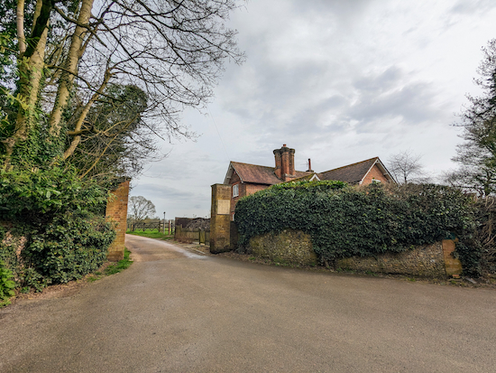
| Turn left on Ayot St Lawrence bridleway 10 |
Turn left on Ayot St Lawrence bridleway 10 then head NE then NNW for 630m passing
Ayot Manor on your left. Continue until you reach a footpath on the left (location -
https://w3w.co/driver.bucks.trucks), see image below.
 |
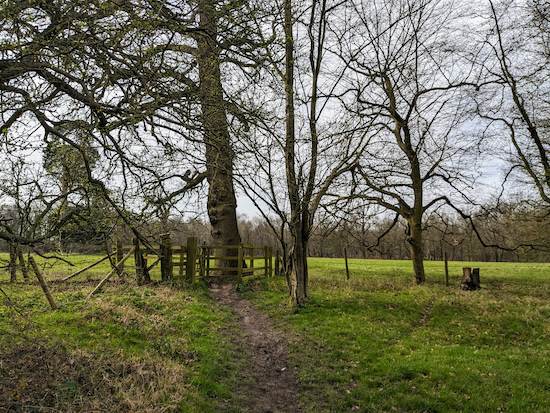
| Turn left on Codicote footpath 37 |
2: Turn left on Codicote footpath 37 then head SW for 410m, with the hedgerow on the left and the field on your right, until you reach a gate in the corner of the field (location -
https://w3w.co/zips.pill.meant), see image below.
 |
| Go through the gate then head S on Ayot St Lawrence footpath 5 |
3: Go through the gate then head S on Ayot St Lawrence footpath 5 for 300m until you reach a gate (location -
https://w3w.co/beans.given.orbit), see image below.
 |
| Go through the gate then turn right on Ayot St Lawrence footpath 6 |
4: Go through the gate then turn right on Ayot St Lawrence footpath 6.
* At this point you could head S and go through a metal gate to explore the Palladian Church of Ayot St Lawrence. According to Historic England, construction of the church was financed with profits from the slave trade.
Continue on Ayot St Lawrence footpath 6 heading SSW, with the church on the left, for 190m until you reach Bibbs Hall lane (location -
https://w3w.co/wash.range.weedy), see image below.
 |
| Turn right on Bibbs Hall Lane |
5: Turn right on Bibbs Hall Lane then head WSW for 45m until you reach a footpath on the left (location -
https://w3w.co/boats.string.order), see image below.
 |
| Turn left on Kimpton footpath 13 |
Turn left on Kimpton footpath 13 then head SSW for 170m until you reach a set of steps leading to a junction (location -
https://w3w.co/than.tower.swept), see image below.
 |
| Turn left on Wheathampstead footpath 99 |
6: Go down the steps then turn left on Wheathampstead footpath 99. Follow the footpath E for 390m until you reach a gate leading to Bride Hall Lane (location -
https://w3w.co/fears.jelly.soaks), see image below.
 |
| Turn left on Bride Hall Lane |
7: Turn left on Bride Hall Lane then follow it uphill and N for 145m until you reach Bibbs Hall Lane on the left and the entrance to
Shaw's Corner (location -
https://w3w.co/globe.desks.ears), see image below.
 |
| Shaw's Corner, Ayot St Lawrence |
8: Continue heading N, now on Hill Farm Lane, for 140m until the lane bends to the right (location -
https://w3w.co/grab.strong.pitch) then heads E for 125m back to The Brocket Arms and the starting point. On your way you will see the ruins of the old church on your left (location -
https://w3w.co/zones.meant.tape).
Interactive map


Hi Dave nice gentle walk late afternoon . Have done other walks of yours around here lovely area . + a pint of Brocket to finish or did that come first 😂🤣 Thanks. .IR.
ReplyDeleteYes, a nice short walk. And the Brocket is always good for a pint. Did you know their Brocket Arms bitter is Tring's 'Side Pocket For a Toad' rebranded for the pub?
DeleteI noticed it was brewed by Tring’s but did not know it was rebranded for the Pub. Thanks for information 👍
ReplyDeleteA fantastic walk with kids. The two churches on the route are fascinating, The newer, palladian church is very unusual and beautiful. If you are National Trust members you can easily add Shaw's Corner to the route (though if you want to visit the house you have to book the day before). The pub at the start/end is also great for kids - play equipment and secret zoo! Will definitely revisit this one!
ReplyDeleteSo glad you and the kids enjoyed the walk; the shortest in our collection. The Brocket Arms is a great pub, both for real ale drinkers and kids. Glad they had a great time. Dave & Ellie
Delete