5.2 miles (8.2km) with 113m of total ascent
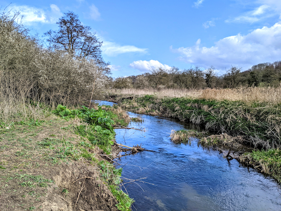 |
| The River Rib between points 2 and 3 |
Getting there
There are several bus stops in the village of Standon, the nearest being 'Standon Hadham Road opposite the old almshouses' location - https://w3w.co/contracts.croaking.figs) and 'Standon High Street Post Office' (location - https://w3w.co/painters.spite.crackling). These stops are served by the number 386 bus. There are other bus stops in Standon served by the numbers 36, 36A, 331, and 831. You can check bus times at Intalink.
Fly through preview of walk
If you want to check what sort of landscape you will be crossing before you set off on this walk you can view a short 3D video of the route below. It's created using the free version of Relive.
Directions
GPX or KML files for this walk. We've added What3Words location references for those who use that system. If you print these walks you might want to use the green PrintFriendly icon at the bottom of these directions to delete elements such as photographs.
1: With your back to The Star pub (location - https://w3w.co/transcribes.remotes.trickles) turn left then head N along High Street for 240m to Stortford Road (location - https://w3w.co/currently.walks.locked).
Turn left on Stortford Road then head W for 160m crossing the River Rib and continuing until you reach Station Road on your right (location - https://w3w.co/outbursts.jigsaw.winks).
Turn right on Station Road then head NW for 370m until you reach Meadow Walk on the right (location - https://w3w.co/spenders.logic.stuffy).
 |
| Standon footpath 12 after it passes between the houses on Meadow Walk |
 |
| The path comes closest to the River Rib at point 3 |
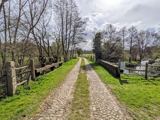 |
| Braughing footpath 19 heading ESE across the River Rib |
Continue on Braughing footpath 19 for 200m until you reach a cottage on the left and another bridge (location - https://w3w.co/sticky.cattle.excellent).
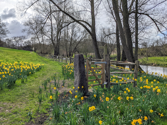 |
| Braughing footpath 19 after the second bridge |
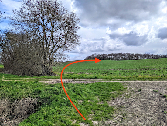 |
| Braughing footpath 19 crosses a field, but we took a detour |
7: From point 7 (location - https://w3w.co/october.enforced.hothouse) you would turn right on Braughing bridleway 16 then head S and downhill for 200m to point 8 (location - https://w3w.co/rollover.smarting.trespass).
However, when we tested this walk at the end of March 2022 Braughing footpath 19 had not been reinstated across the field following planting. So, because there were no obvious indications as to where the path should be, and because we didn't want to trample the crop, we decided to take a detour using the farm track (see image below), heading S for 200m to a bend (location - https://w3w.co/idealist.vintages.pulp) then heading E for 290m to pick up the route at point 8. Interestingly, when we got to point 8 there was a sign showing that the second part of the detour is a permissive path.
 |
| Map showing the detour we took in orange |
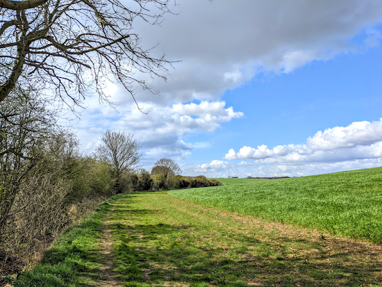 |
| Standon bridleway 3 heading SW from point 8 |
9: Turn right on Stortford Road then, walking along the pavement, head WSW for 120m until you reach an access lane called Half Acres on your left between cottages (location - https://w3w.co/awards.reclaim.purifier).
Follow this lane S for 100m until it becomes Standon footpath 4 (location - https://w3w.co/campsites.smoker.cross).
Continue on Standon footpath 4 heading SSE then S. After 160m you will reach a bench with a view (location - https://w3w.co/panthers.printers.contracts), see image (courtesy of Chris Dowsett) below.
.jpeg) |
| Bench alongside Standon footpath 4 Image courtesy of Chris Dowsett |
10: Turn right at the junction, now on Standon footpath 5, then head W for 40m until you reach Hadham Road (location - https://w3w.co/proves.camps.nails). Keep to your right on Hadham Road then head straight and W for 220m until you reach a footpath on your left between cottages (location - https://w3w.co/flickers.dart.cardinal).
11: Turn left on Standon footpath 24 then head S for 360m until you reach a gate leading into woodland (location - https://w3w.co/writers.attic.niece). There will be a track to the local sewage works on your left. Keep heading S through the woodland for 130m, still on Standon footpath 24, until you reach a left hand bend (location - https://w3w.co/panting.chest.enclosing) at the edge of the woodland.
12: Turn left then head ESE for 270m until you reach a junction (location - https://w3w.co/stables.sharpens.pipeline).
13: Turn right, still on Standon footpath 24, and head S for 380m until you reach a junction (location - https://w3w.co/desks.blows.under).
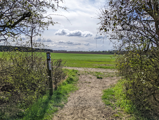 |
| Turn right on Standon bridleway 19 then head W |
15: Turn right on Standon bridleway 30 then head N for 970m until you reach Paper Mill Lane (location - https://w3w.co/ballpoint.gates.cascaded).
 |
| High Street Standon at the end of the walk |
There are two pubs and a bakery on Standon High Street. The pubs are The Star (location - https://w3w.co/protected.submerged.final) and The Bell (location - https://w3w.co/jingles.enthused.path), and Days Bakery (location - https://w3w.co/cubed.rhino.spaces) which is situated between the two pubs.
If you enjoyed this walk you might want to join our friendly Facebook group where fellow walkers are sharing photographs and experiences after following our walks in the Hertfordshire countryside.


Another lovely walk - thank you! Wanted to let you know that at the point where you took a detour, we were able to head straight across the field in a straight line between Points 6 and 7- there was a clear track (February 2023). Whether this will still be visible once the crops grow, I don't know.
ReplyDeleteThanks for the feedback regarding the path between pints 6 & 7. Good to know. Glad you enjoyed the walk.
DeleteTried to print this walk off , no icon????
ReplyDeleteHi, are you not able to see the green 'PrintFriendly' icon at the bottom of the page below the interactive map? Do you have an ad blocker running on your computer? That could be the problem. Our tips page explains how to use the PrintFriendly option.
Deletehttps://www.hertfordshirewalker.uk/p/tips.html#printing
Completed this lovely walk today with no issue. All sign posting & directions perfect. There are some intriguing side paths along the way that are ripe for a future visit and to prolong the distance if required. We parked outside the Star Pub on Standon High Street (they have a car park at the back too) and we ate there - made very welcome and excellent food. Thank you - glorious walk and not muddy
ReplyDeleteWe completed this lovely walk on Tuesday 29th April. Such a glorious day and a really pretty walk along the River Rib. We’ve not done a walk in Standon before and would definitely do another one as it’s a picturesque place. To make other walkers aware that Braughing Footpath 19 between points 7 and 8 has still not been reinstated. The farmer has ploughed over it. We did walk across the field though as Komoot flagged up the way.
ReplyDeleteThanks for the update. Glad you enjoyed the walk. The farmer must ensure that the public right of way "is restored to at least the minimum width so that it’s reasonably convenient to use within 14 days of first being cultivated for that crop and 24 hours of any subsequent cultivation, unless a longer period has been agreed in advance in writing by the highway authority". If you sense the right of way has not been reinstated as above would you mind reporting it to Hertfordshire County Councils Rights of Way team, please? Here is the link to the easy to use form. Thanks
Deletehttps://www.hertfordshire.gov.uk/services/highways-roads-and-pavements/report-a-problem/report-a-highway-fault/public-rights-of-way/public-rights-of-way.aspx
The farmer has now re-instated the footpath between points 6 and 7 (a metre wide) as of 28th June 2025
ReplyDeleteThanks for the update Rob. Good news!
Delete