5.2 miles (8.4 km) with 110m of total ascent
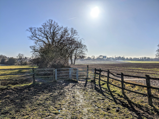 |
| The view approaching point 9 in the walk |
This linear walk from Knebworth station to Welwyn North station crosses the A1(M) twice then weaves its way south-west then south-east to the outskirts of old Welwyn where you can take a short detour for refreshments at one of the many pubs, restaurants and coffee shops. Because of the proximity to the motorway you will be aware of the noise of traffic, particularly between points 3 & 5 and 12 & 17, but, if you can try to ignore the sound, the views are rewarding.
There is some urban walking at the start and finish of this walk, some walking along country lanes, and a fair amount of up and down. You will cross livestock fields along the way. In one we were followed by two curious yet friendly horses. The route would be difficult for anyone with a pushchair.
When we tested the route, on a crisp sunny February day, the ground was firm, but this route it could be muddy in places after rain. There are eight pubs along the way (five accessed via a short detour), including one at the start and one at the finish. If you set off early you might make it back to the Deli Stop coffee shop at Welwyn North Station where we ended the walk sitting in the sun with a coffee and a scone. The Deli Stop opens early but closes at 2pm.
Fly through preview of walk
If you want to check what sort of landscape you will be crossing before you set off on this walk you can view a short 3D video of the route below. It's created using the free version of
Relive.
Directions
 |
Walk 226: Knebworth to Welwyn North Linear
Click here or on the map for a larger version
Map created on MapHub - copyright details here
There is an interactive map below the directions |
Those with GPS devices can download
GPX or
KML files for this walk. We've added
What3Words location references for those who use that system. If you print these walks you might want to use the green
PrintFriendly icon at the bottom of these directions to delete elements such as photographs.
1: Exit
Knebworth station (location -
https://w3w.co/rust.unable.cure) and, with
The Station pub (location -
https://w3w.co/heads.gallons.sings) in front of you turn left and head S down Station Approach for 60m until you reach Gun Lane (location -
https://w3w.co/sung.grass.club) which heads S with the railway line on your left for 110m until you reach
The British Legion club on the right (location -
https://w3w.co/tunnel.spark.critic) and a footpath on the right, see image below.
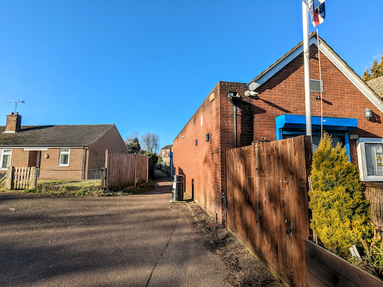 |
| Turn right immediately after passing The British Legion |
2: Immediately after passing The British Legion turn right on Knebworth footpath 8 then head SW for 120m until you reach a road called Lytton Fields (location -
https://w3w.co/locate.pines.reform). Cross Lytton Fields and continue heading SW, still on Knebworth footpath 8, passing a play area (location -
https://w3w.co/hoot.digits.pizza) on the right and continue for 100m until you reach a road called Stockens Dell (location -
https://w3w.co/loving.label.urgent). Continue heading SW along Stockens Dell for 185m until you reach the end and a footpath (location -
https://w3w.co/angle.class.chip). Continue, still on Knebworth footpath 8, until you reach Gipsy Lane (location -
https://w3w.co/pint.rift.grab), see image below.
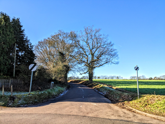 |
| Head SW then S along Gipsy Lane for 700m |
3: Head SW then S along Gipsy Lane for 700m until you reach a road on the right crossing the A1(M) (location -
https://w3w.co/serves.detail.swung).
4: Turn right on this road, Wych Elm Lane, then head W, crossing the A1(M) and continuing for 230m until you reach a left-hand bend (location -
https://w3w.co/rise.transit.master), see image below.
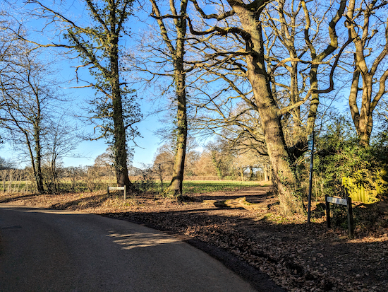 |
| Turn right on Knebworth footpath 10 |
5: Turn right on Knebworth footpath 10 then head W for 370m until you reach a gap on the right between wooden fencing in the hedgerow (location -
https://w3w.co/guards.whites.cried), see image below.
 |
| Go through the gap then immediately turn left through a gate |
6: Go through the gap then immediately turn left through a gate and enter a field on Codicote footpath 29 (location -
https://w3w.co/sings.emerge.ties). Your way is now SW across the field for 160m heading for an aluminium gate in the distant hedgerow (location -
https://w3w.co/rats.holly.grapes), see image below.
 |
| Cross the field heading for the aluminium gate |
7: Turn left when you reach the lane then head SW for 85m until you reach
The Robin Hood & Little John pub/restaurant on the right (location -
https://w3w.co/artist.leaves.hosts), immediately after the pub turn right on Rabley Heath Road, see images below.
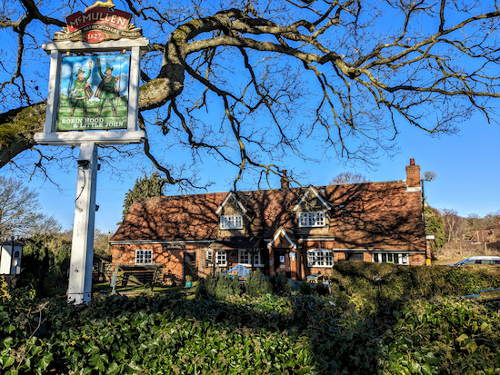 |
| The Robin Hood & Little John at Rabley Heath |
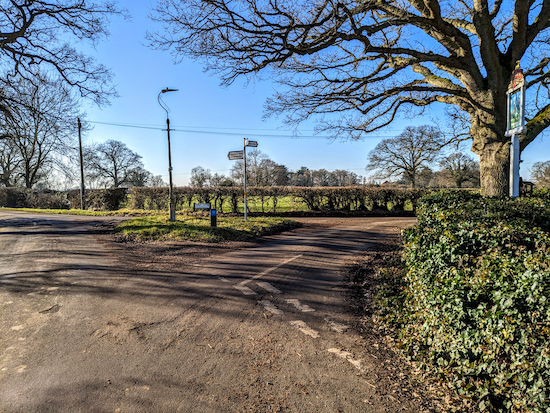 |
| After the pub turn right on Rabley Heath Road |
Continue heading SW along Rabley Heath Road for 720m until you reach a footpath on the left (location -
https://w3w.co/tube.vase.wiring), see image below.
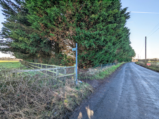 |
| Turn left on Codicote footpath 33 |
8: Turn left on Codicote footpath 33 then head SE for 360m then NE for 95m, then SE for 35m to a gate (location -
https://w3w.co/films.rocks.gloves). You will now cross a field, still on Codicote footpath 33. When we walked this way on February 6, 2023 we had the company of some really friendly horses who welcomed us. One followed us SW across the field for almost all of the 290m to a gate where we exited the field (location -
https://w3w.co/fine.saying.upgrading), see images of the field and the gate below.
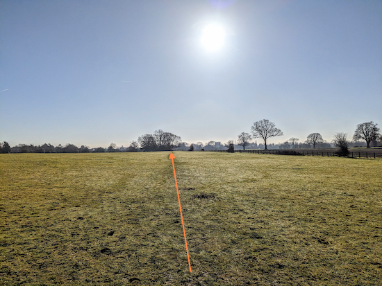 |
| Head SW across the field heading for a gate |
 |
| Go through the gate then keep to the left of the hedgerow |
9: Go through the gate then keep to the left of the hedgerow and head SE for 240m through another field of horses, now on Codicote footpath 34, until you reach a gate (location -
https://w3w.co/until.runs.sits), see image below.
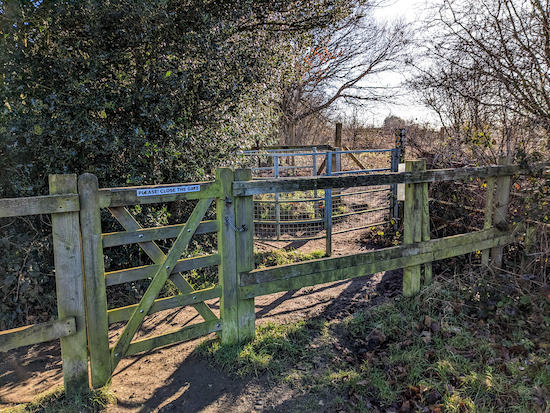 |
| Go through the gate then turn right |
10: Go through the gate then turn right, go through another gate (location -
https://w3w.co/editor.soil.truck), then head straight and SSE, now on Codicote footpath 31, for 240m to another gate (location -
https://w3w.co/fork.herb.noises), see image below.
 |
| Continue heading S along a track for 220m |
Continue heading S along a track for 220m until the path bends right and you reach a footpath on the left (location -
https://w3w.co/magic.ruins.points), see image below.
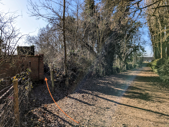 |
| Turn left, still on Codicote footpath 31 |
11: Turn left, still on Codicote footpath 31, for 100m until you reach a lane (location -
https://w3w.co/upset.really.tone). Turn left on the lane then head SE for 55m until you reach Danesbury Park Road (location -
https://w3w.co/arrive.roses.chefs). Turn right on Danesbury Park Road then head SW for 140m until you reach a footpath on the left (location -
https://w3w.co/admit.images.saying), see image below.
 |
| Turn left on Welwyn footpath 39 then head S |
12: Turn left on Welwyn footpath 39 then head S and downhill for 850m until you reach a gate (location -
https://w3w.co/sleep.pulse.slides). This is a really nice path, despite the growing proximity of the A1 (M).
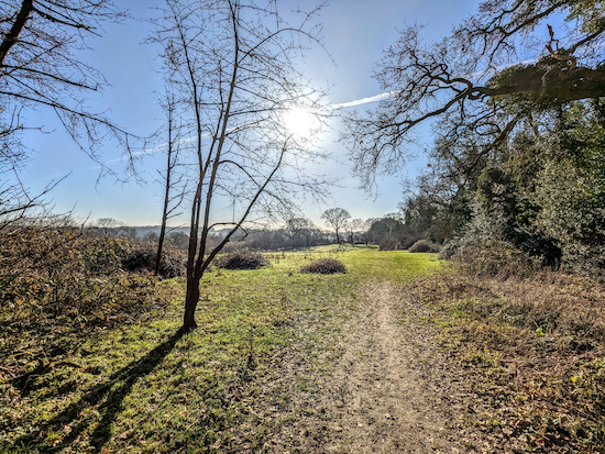 |
| Welwyn footpath 39 then head S and downhill |
13: Once through the gate continue heading S for 85m until you reach a track called Roman Road (location -
https://w3w.co/office.jabs.learn). Head SW along Roman Road with apartments on your left, for 180m until you reach Church Road (location -
https://w3w.co/lasts.riots.lofts), see image below.
 |
| Cross Church Road then head E for 30m |
* If you want refreshments you could take a short detour into Welwyn where you will find several pubs, restaurants and cafes. See map showing detour below. The detour takes you past public toilets (location - https://w3w.co/dips.lately.train). The pubs are The Rose & Crown (location - https://w3w.co/grin.scans.inspector), The White Horse (location - https://w3w.co/give.bids.notice), The Tavern (location - https://w3w.co/logo.ending.tile), The White Hart (location - https://w3w.co/copies.trial.taxi), and The Wellington (location - https://w3w.co/cliff.copper.rear).
 |
| The detour into old Welwyn from point 14 |
14: After crossing Church Road head E for 30m until you reach a side road on the right (location -
https://w3w.co/discrepancy.matter.almost). Turn right and follow the side road SSE for 140m, down to an underpass (location -
https://w3w.co/line.secret.wounds), see image below.
 |
| Turn left and head E through the underpass |
15: Turn left and head E through the underpass beneath the Welwyn Bypass, then, when on the other side head NNE then NE passing under the A1(M) and continuing for 160m until you reach a footpath on the right (location -
https://w3w.co/claps.chip.duty), see image below.
 |
| Turn right on Welwyn footpath 38 |
16: Turn right on Welwyn footpath 38 then head S for 120m with the A1(M) on your right until you reach a track (location -
https://w3w.co/pest.sector.thinks), see image below.
 |
| Cross the track then head SE and uphill |
17: Cross the track then head SE and uphill for 370m until the footpath crosses a farm track (location -
https://w3w.co/expand.splice.zest). Continue heading SE for 240m, still on Welwyn footpath 38, passing woodland on the left (location -
https://w3w.co/intervals.bonus.drips), see image below.
 |
| Continue heading SE with the woodland on the left |
Continue heading SE for 170m to a gate (location -
https://w3w.co/zoom.slice.jets). Go through the gate then head E and downhill. There are some great views from this gate, see image below.
 |
| There are some great views from this gate |
Continue, still on Welwyn footpath 38, for 450m until you reach woodland (location -
https://w3w.co/format.slip.ended) then, with the woodland on your right continue for 25m looking for a footpath on the right (location -
https://w3w.co/harp.dips.evenly), see image below.
 |
| Turn right on Welwyn footpath 51 |
18: Turn right on Welwyn footpath 51 then head SSW for 175m until the footpath reaches a junction (location -
https://w3w.co/oldest.direct.random), see image below.
 |
| Keep left at the junction then head uphill |
19: Keep left at the junction then head uphill, still on Welwyn footpath 51, for 120m to another junction (location -
https://w3w.co/export.flight.ocean), see image below.
 |
| Keep right at the junction then head SE on Welwyn footpath 53 |
Keep right at the junction then head SE, now on Welwyn footpath 53, for 75m to another junction (location -
https://w3w.co/live.inspector.chief), see image below.
 |
| Turn right on Welwyn footpath 54 |
20: Turn right on Welwyn footpath 54 then head S then SSW for 90m until you reach Warren Way (location -
https://w3w.co/city.scam.visit)
21: Turn left on Warren Way then follow it SSW for 180m until you reach Woodside Road (location -
https://w3w.co/audit.glory.join). Keep left on Woodside Road then head SE then S for 45m until you reach a road on the left (location -
https://w3w.co/degree.become.mirror) leading to a footpath (location -
https://w3w.co/pens.zoom.solved), see image below.
 |
| Follow the footpath SE to Welwyn North station |
22: Follow the footpath SE for 120m to the car park at Welwyn North station (location -
https://w3w.co/dining.these.preoccupied).
*If you want refreshments The Cowper Arms is just to the right out of the car park (location - https://w3w.co/limp.recent.code) and the The Deli Stop (which closes at 2pm) is part of the station complex (location - https://w3w.co/decks.sofa.mild).
Interactive map


Thanks for this. A great walk that felt longer than it was in a good way thanks to the variety. Incredible numbers of red kites about in January. They're a pretty common sighting now, but I'd never seen them in groups of a dozen+ before today!
ReplyDeleteYes, it's a good walk with lots of variety. I wonder whether the number of red kites is do to the proximity of the A1(M) and the likelihood of carrion along the route - just a thought.
DeleteIf you haven't already done so please consider joining our friendly Facebook group where fellow walkers are sharing their walking experiences and photographs. David
https://www.facebook.com/groups/hertfordshirewalker
Great walk once out in the countryside with some lovely views. Beware the section after point 8 - I did this section on walk 78 last July and it was 300m of over head height nettles and brambles with no escape once in it all! Currently, the nettles are knee high and quite easy to pass by but won't be soon! The horses in both fields approaching point 9 and to point 10 ignored me, but they were all on the other side of the fields at the time!
ReplyDeleteHi Gerry, Thanks for the tip about the nettles.
Delete