3.5 miles (5.70 km) with 75m of total ascent
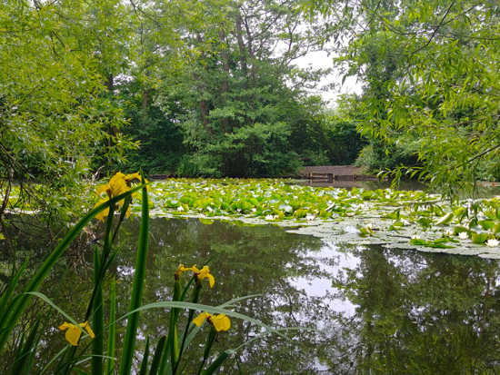 |
Yellow flag and water lilies on Gobions Pond towards the end of the walk
|
This is our second linear walk from Potters Bar station to Brookmans Park station. The first,
Walk 68, returned via the west side of the railway track skirting both
Furzefield Wood and Brick Kiln Wood. This walk returns via the east side of the railway track, crosses the former Potters Bar golf course, and passes through
Gobions Wood.
On the way across the old golf course you will come across two
WWII pillboxes. The journey between the start and finish points can be by train or by catching the 610 bus.
Directions
 |
Map for Walk 69: Brookmans Park South-East Linear
Created on Map Hub by Hertfordshire Walker
Elements © Thunderforest © OpenStreetMap contributors
There is an interactive map below these directions |
Those with GPS devices can download
GPX or
KML files for this walk. We've added
What3Words location references for those who use that system. If you print these walks you might want to use the green
PrintFriendly icon at the bottom of these directions to delete elements such as photographs.
1: Leave Potters Bar station via the westerly exit leading out to the car park. Turn right and walk N for 100m heading through the car park to a footpath on your right that runs NNW alongside the track (location -
https://w3w.co/bunks.gender.glitz). This is Potters Bar footpath 9. Follow it for 1km until you reach the Cranbourne Industrial Estate on your left.
 |
| The footpath sign mentioned in point 2 below |
2: Look out for a footpath sign pointing to a tunnel on your right (location -
https://w3w.co/puns.broad.fans). This is Potters Bar footpath 5. Go through the tunnel and turn right at the other side. Continue walking along Potters Bar footpath 5 heading SSE and SE for 330m with the railway track on your right until the path turns sharp left at the point where it reaches Potters Bar Brook (location -
https://w3w.co/full.lows.mice).
As you turn left here look to your right and you will see the remains of the first of two WWII pillboxes at grid reference
TL 24484 02353.
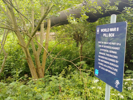 |
| The pillbox mentioned in point 2 above |
3: Continue across the golf course for 460m following the small posts that indicate the route of the public footpath first ENE, then E, then ESE passing a second WWII pillbox on your left (location -
https://w3w.co/play.eager.spite).
Continue heading E for another 90m before the path turns sharp right (location -
https://w3w.co/risks.voter.asks) and climbs through a shady wooded area. Continue along this path until you reach a gate on your left (location -
https://w3w.co/envy.saving.chase).
 |
| The second pillbox mentioned in point 3 above |
4: Go through the gate taking Potters Bar footpath 3 NNW for 180m. The path then becomes North Mymms footpath 13 and continues NNW for another 540m over fields. At the final field head for the five oak trees straight ahead on the horizon. At the top you reach a gate that leads out to Hawkshead Road (location -
https://w3w.co/frogs.filer.ship).
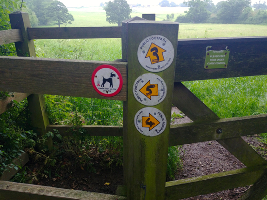 |
| Footpath 3 mentioned in point 4 above |
5: Don't go through the gate but, instead, turn right and walk E with the field on your right and the hedgerow on your left. This is a permissive path that runs between the
Royal Veterinary College (RVC) buildings. Pass Boltons Park Farm, cross Hawkshead Road, and continue walking E along the N side of Hawkshead Road for 500m. Look out for a footpath sign on your left just before you reach
Folly Arch (location -
https://w3w.co/change.island.spices).
 |
| The footpath from Hawkshead Road down to Gobions Wood |
6: Take this path, North Mymms footpath 11 and head downhill and NNW across the first field. When you reach a gate (location -
https://w3w.co/awake.club.volunteered), turn right, leaving North Mymms footpath 11, and head N for 220m with the hedge on your right and the field on your left along a permissive path until you reach a metal gate leading into Gobions Wood (location -
https://w3w.co/flip.bravo.brands).
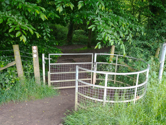 |
| The metal gate leading in to Gobions Wood mentioned in point 6 above |
7: Once in Gobions Wood turn right, cross the first footbridge, turn left, cross the second footbridge, and then continue straight heading N along a path to a gate leading to Gobions Open Space (location -
https://w3w.co/catch.snail.luck).
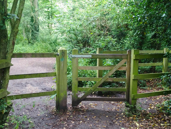 |
| The gate leading to Gobions Open Space, including Gobions Pond |
8: Go through the gate and turn to your right, then follow the path round to the left keeping Gobions Pond on your left. After 340m you reach an open field, Gobions Open Space (location -
https://w3w.co/handed.manliness.trades). Head NW for 140m across the field heading to the left of the play area (location -
https://w3w.co/visa.cried.desire).
9: Go through the gap in the hedge just below the play area and continue heading W for 300m with the field on your left and the hedgerow on your right until you reach the western end of the field (location -
https://w3w.co/trace.gears.snack).
Go though a gap in the hedge and reach the top of Bluebridge Avenue. Go through the gate, walk down Bluebridge Avenue until you reach Bluebridge Road (location -
https://w3w.co/goal.poppy.funny).
10: Turn right on Bluebridge Road and walk NNE back to Brookmans Park village centre.
There are two pubs on this walk, one at the start,
The Old Manor in Potters Bar, and one at the end,
Brookmans in Brookmans Park.
Interactive map


No comments:
Post a Comment
Comments and feedback
If you try any of the walks on this site, please let us know what you thought of them by adding a comment here or on our members-only Facebook group. Comments here are checked before they are published. Comments on the Facebook group go live immediately.