 |
| Quiet walks, shady walks, and flat walks |
We have had many request over the years for certain types of walks, such
quieter walks for those who like to escape the hustle and bustle and listen to birdsong and the wind in the trees,
shady walks for avoiding the sun on hot summer days, and
flat walks for those with wheelchairs or pushchairs. Below are some suggestions for those three types of walks.
Quieter walks
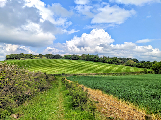 |
| Escaping noise pollution in the Hertfordshire countryside |
Traffic noise pollution is a problem in many parts of Hertfordshire with busy roads such as the M1, M25, A1(M), A10, A414, A6, A41, A602 and A505 framing most of the prettiest areas of the county.
There are many walks with quiet spots where you can hear birdsong; these are the routes that are furthest away from any of the roads listed above.
And there are walks that are not too far from these roads where you will drop out of earshot of the traffic and enjoy quiet sections. So don't write-off walks that start close to major roads.
The best way to find these routes is to click on
our interactive 'locations' map below then zoom in to find one of the colour-coded walking icons that mark the starting point of a walk.
As you zoom in further the names of the villages will appear, as will the routes of the busiest roads. Keep zooming in until you find a walk that is not too close to a major road.
Once you find the colour-coded walker icon click on it to reveal the walk and a link taking you through to the free directions, maps, photos, What3Word references and GPX navigation.
Here are a few suggestions, although all these will still involve less-busy A and B roads and, of course you are likely to hear occasional noise of air traffic from Luton, Stanstead, and Heathrow airports. The areas mentioned in this list are shown in blue shaded areas on the interactive map below. Click on the 'MapHub' label to view the map in full size and zoom in for more detail.
- North of the M25, east of the A1(M), west of the A10, and south of the A414, including Wildhill, Little Berkhamstead, south and west of Bayford, north of Northaw, east of Newgate Street, south of Brickendon, and Broxbourne Woods, and west of Wormley West End.
- East of the A10 and west of the M11 including Anstey, Nuthampstead, Furneux Pelham, Brent Pelham, Stocking Pelham Little Hormead, east from Braughing, Much Hadham, Barkway, Barley, and the countryside south and south-east of Standon including Wareside, Barwick Ford, Hadham Cross and Perry Green.
- In the triangle east of the A1(M), north of the A414, and west of the A602 including the villages of Bramfield, Tewin, Burnham Green, and south of Datchworth.
- North of the A602, east of the A1(M), west of the A10 and south of the A505, including north and east of Bennington, east of Walkern, north-east of Dane End, south of Ardeley, south-east of Weston, south-east of Clothall, south-west of Wallington, Rushden, Sandon, Kelshall, and south of Therfield.
- West of the A1(M), south of the A505, east of the M1, north of the A414, including north of Wheathampstead, in particular The Ayots south of Kimpton, north of Whitwell, south of Preston, King's Walden, St Pauls Walden, Whitwell, Kimpton, Peter's Green, Ley Green, north of Codicote, and Old Knebworth.
- East of the A6 and north of the A505, including south-east of Hexton, south from Pegsdon, and south-west from Pirton.
- North and east of the A41 and west of the M1, including east of Aldbury, Little Gaddesden, north of Great Gaddesden, north and east of Frithsden.
We have created an interactive map showing some of the quieter areas of Hertfordshire.
As mentioned earlier it's hard to escape all noise pollution when walking in the Hertfordshire countryside. Another factor is the direction of the wind. You can be walking close to a major road and not hear any traffic noise if the wind is blowing in a certain direction but be deafened as soon as the wind changes.
And noise pollution is usually worse in the autumn and winter when the leaves have been blown off the trees.
Shady walks
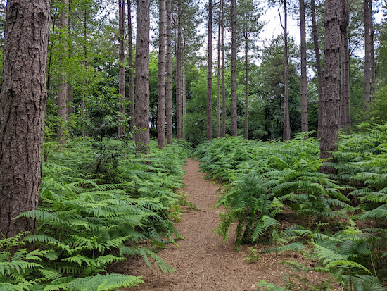 |
| Mimmshall Wood, North Mymms |
It's hard to find walks that are completely in the shade; almost all involve sections exposed to the sun. However there are a few, and I have suggested adaptations to others. If you are looking for a shaded walk you might want to browse through some of the suggestions below.
If you are going to try some of the adaptations please take a map or download the map we have provided for the walk so you don't get lost. And it might be worth reading
our walking tips page before you set off.
 |
| A river in the shade on the Danemead Loop |
We added this walk to the shaded walks list following a post on our new
Hertfordshire Walker Facebook Group by Pascale who posted that nearly all of the route is in the shade. Thanks for the reminder Pascale, I had forgotten to add this one.
 |
| The Ayot Greenway |
This walk can be adapted to avoid too much sun. Park at point 7 where, at the time of writing there is a free car park, then head west along the Ayot Greenway to point 6 before returning to the start point. This adaptation to the route is 2.9 miles (4.6 km) return. Most of the way is in shade or partial shade.
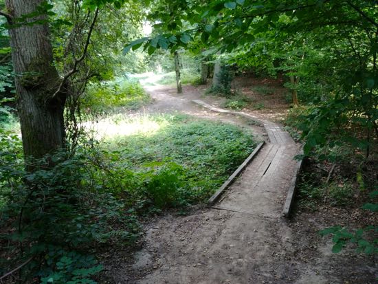 |
| The yellow route through The Great Wood Northaw |
The Great Wood has three official routes, all are mostly through thick woodland. The blue route is less than a mile, the red route is one and a half miles, and the yellow route is almost three miles. There is a car park with an honesty box and a toilet block.
 |
Folly Arch taken from Gobions Wood
|
A walk through what was once the 18th century pleasure garden belonging to
the former Gobions Estate. The site is now
a woodland reserve famous for its bluebells, wood anemones, fungi, and birdlife. It is managed by
the Herts and Middlesex Wildlife Trust, is open all year round, and entry is free of charge. There is free parking in the nearby local authority car park which is off Moffats Lane in Brookmans Park . The start of this walk is three quarters of a mile east from Brookmans Park station by road.
 |
| The coal tax marker at point 7 along the Wormley Wood Loop |
This walk is mostly through deep woodland. Wormley Wood is part of Broxbourne Wood, Hertfordshire's only National Nature Reserve. There are a number of free parking areas (at the time of writing). Look out for the
coal tax marker at point 7 on the walk.
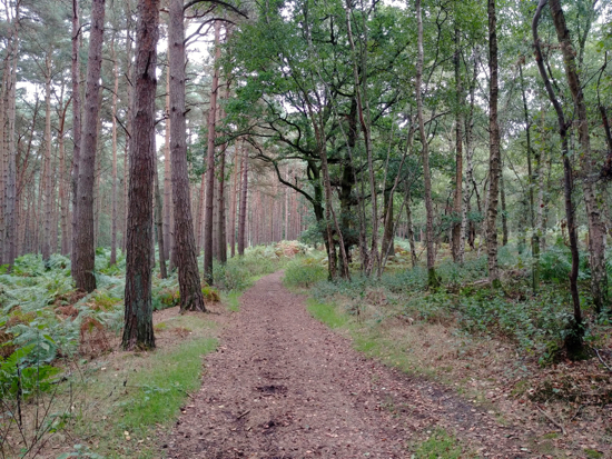 |
| Mymmshall Wood between points 5 & 6 |
About half of this walk is in woodland. There is partial shade for other sections, and you will walk through sections in open sunlight. To reduce walking along open stretches consider parking alongside the road at point 5 then, when you reach point 8, turn left alongside Cangsley Grove in order to rejoin the route at point 3. This adaptation to the route is 3 miles (4.8 km).
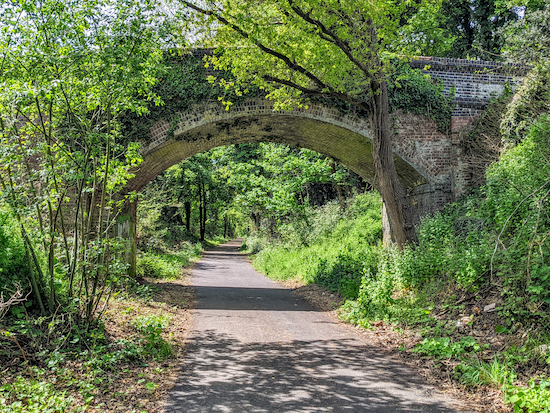 |
| The Cole Green Way |
For maximum shade we suggest you do this linear walk in reverse, starting at point four then turning back at point three. The adaptation to the walk is 4.4 miles (7.1 km) return. You can park at the former Cole Green station, then head east to point three before turning back to the start point. The Cole Green station car park is free of charge at the time of writing.
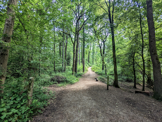 |
| Sharrardspark Wood, Welwyn Garden City |
The route starts and finishes in the car park at Campus West in Welwyn Garden City then heads west along the eastern section of Ayot Greenway through Sharrardspark Wood, which is one of Hertfordshire's largest and most important oak and hornbeam woodlands, before returning the same way.
Flat walks
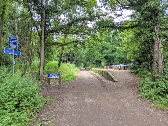 |
| The route, platform, ramp, and car park at Cole Green |
While there are sections of many of our routes that would be suitable for both wheelchairs and pushchairs, most of the walks involve a mix of stiles, gates, steps, footbridges, narrow tracks, steep hills, and muddy or rutted bridleways.
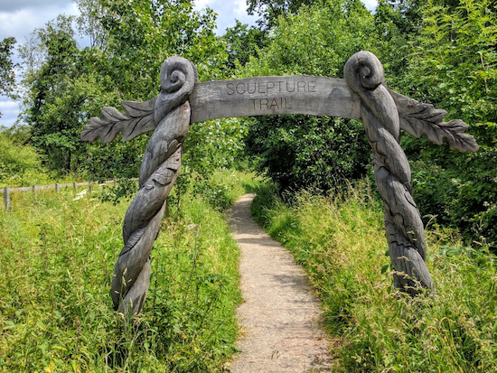 |
| One of the two entrances to The Sculpture Trail |
One route on this site,
Walk 60: The Sculpture Trail (1 mile), would be suitable with access from a free (at time of writing) car park (location -
https://w3w.co/beats.sheep.exists).
However there are a number of former railway lines in Hertfordshire which have been converted into recreational routes which might be suitable. We are not accessibility experts, and we have no idea whether these routes have been approved as accessible, but we have put together a list for those who are looking for suggestions and who want to check them out. As with all our walks, those following the routes do so at their own risk. Some of the information below is taken from
Wikipedia.
Alban Way
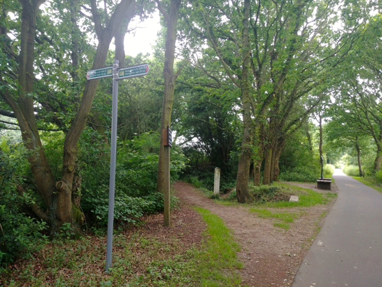 |
| The Alban Way (right) west of Nast Hyde Halt |
The Alban Way (7.5 miles) runs from St Albans to Hatfield, ending close to Hatfield railway station. The route is part of the
National Cycle Network Route 61. The route is paved throughout making it usable all year round. There is free car parking (at time of writing, July 2021) at the site of the former Smallford station, off Smallford Lane (location -
https://w3w.co/keeps.proven.panic).
Ayot Greenway
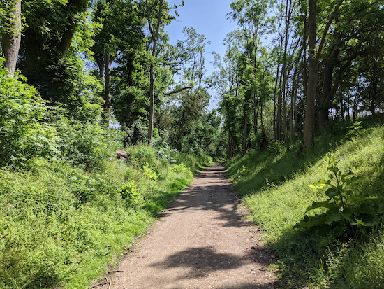 |
| The Ayot Greenway close to Wheathampstead |
The Ayot Greenway (3 miles) runs from Ayot St. Peter to Wheathampstead. It's part of the
National Cycle Network Route 57. The route follows the former
branch line from Welwyn Garden City railway station towards Luton and Dunstable. There is free car parking (at time of writing, July 2021) on the right along Ayot St Peter Road as you drive north from Ayot Green (location -
https://w3w.co/discrepancy.lives.bucked).
Cole Green Way
 |
| The Cole Green Way alongside the platform at the former Cole Green station |
The Cole Green Way runs east-west between Hertford and Welwyn Garden City. It's part of the
National Cycle Network Route 61, and the
Lea Valley Walk. The route stretches for more than six miles along the former
Hertford, Luton & Dunstable branch line. There is free car parking (at time of writing, July 2021) with limited spaces off Station Road, Cole Green, alongside the former platform at Cole Green Station (location -
https://w3w.co/drum.blitz.filed).
Heartwood Forest
 |
| One of the unpaved tracks in Heartwood Forest |
Another possibility is
Heartwood Forest in Sandridge (location -
https://w3w.co/cope.caller.clots), which is managed by
The Woodland Trust. There is free parking (at time of writing, July 2021) and several paved paths from the car park. A user of this site wrote to say that a friend on an electric-powered wheelchair was able to enjoy part of the network of routes (see comment below). A map of the routes in Heartwood Forest is embedded below.
Nickey Line
 |
| The Nickey Line approaching Harpenden |
The Nickey Line (7 miles) once linked the towns of Hemel Hempstead, Luton, and Harpenden via Redbourn. Most of the route has been redeveloped as a cycle and walking path. It's part of
the Oxford to Welwyn Garden City route of the National Cycle Network. According to
Friends of The Nickey Line, "Park Hill in Harpenden normally has easy parking with level access for disabled people. Take care over parking restrictions especially during school times." (location -
https://w3w.co/cliff.tones.parts) and (location -
https://w3w.co/strut.invent.invite).
Panshanger Park
 |
| One of the tracks in Panshanger Park |
There is also a linear section of
Walk 80: Panshanger Park long loop would work if you went from the car park and headed west from point 1 to points 16, 15, then keep heading west along the flat track to 9 before returning the same way (total of 2 miles).
There is a car park at Panshanger park off Thieves Lane (location -
https://w3w.co/invent.dices.insect). A flat day rate car park charge of £2.50 for all vehicles, including motorbikes and scooters was introduced at the park on 15 July, 2021.
According to the park's website, the charge will initially be in place between 08:30 and 17:30, Thursday – Monday, with the intention to charge seven days a week in the near future.
If you have any suggestions for flat routes in Hertfordshire that might be accessible for wheelchair users or pushchair pushers, please add them to the comment box below. And if you are a wheelchair user and try any of the routes mentioned, please share any tips and suggestions that might benefit others. Thanks.


No comments:
Post a Comment
Comments and feedback
If you try any of the walks on this site, please let us know what you thought of them by adding a comment here or on our members-only Facebook group. Comments here are checked before they are published. Comments on the Facebook group go live immediately.