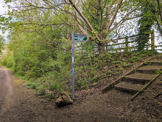
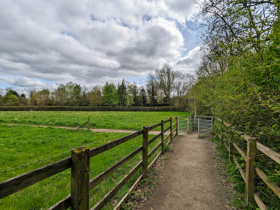
4.8 miles (7.7 km) with 52m total ascent
 |
| Wheathampstead footpath 38 between points 12 & 13 |
This is a lovely walk along part of the
Lea Valley Walk and
Ayot Greenway, a former railway branch line. The wildflowers along the River Lea are impressive in the summer. The walk starts and finishes in a council car park at Wheathampstead. There are plenty of refreshment opportunities in the village.
Directions
 |
Map for Walk 39: Ayot Greenway West Loop
Click on the map for a larger version
Created on Map Hub by Hertfordshire Walker
Elements © Thunderforest © OpenStreetMap contributors
An interactive map is embedded at the end of these directions |
Those with GPS devices can download
GPX or
KML files for this walk. We've added
What3Words location references for those who use that system. If you print these walks you might want to use the green
PrintFriendly icon at the bottom of these directions to delete elements such as photographs.
The walk starts and finishes in the East Lane Car Park in Wheathampstead (location -
https://w3w.co/riders.print.chain). The car park is managed by Wheathampstead Parish Council and, at the time of writing, was free of charge. Please check this is still the case before leaving your car. And make sure you don't park in the adjacent car park which belongs to The Bull (location -
https://w3w.co/begin.empty.market) which is for customers only and which will incur a fine if used by non-customers.
.jpeg) |
| The East Lane Car Park, Wheathampstead |
1: Leave the East Lane Car Park then turn left. Head E along East Lane then continue as the lane bends NE then becomes Meads Lane. Continue for 220m until Meads Lane ends and becomes a track leading into a park (location -
https://w3w.co/shady.cafe.signal).
2: Continue heading NE, now on Wheathampstead
footpath 71, for 75m until you reach a footpath on the left leading to a footbridge over the River Lea (location -
https://w3w.co/ranges.comet.club), see image below with an orange arrow showing the direction of travel.
 |
| Turn left then cross the River Lea on a footbridge |
3: Turn left then cross the River Lea on a footbridge. This seems to be a popular spot for people to take their children and dogs for a paddle in the river.
 |
| Immediately after crossing the River Lea turn right |
Immediately after crossing the River Lea turn right (location -
https://w3w.co/quite.needed.cable) then follow the path NE then E for 220m until you join Wheathampstead
bridleway 12 (location -
https://w3w.co/twig.builds.bunk), see image below.
 |
| Turn right on Wheathampstead bridleway 12 |
4: Turn right then follow Wheathampstead bridleway 12 as it heads SE for 330m until you reach a gate where the path bends right (location -
https://w3w.co/hired.edges.sport).
5: Go through the gate then follow Wheathampstead bridleway 12 as it heads SSE, for 135m until you reach a left turn leading to a junction (location -
https://w3w.co/legend.finishing.grain), see image below.
* As you walk this stretch you will notice a gap in the hedgerow on the left (location - https://w3w.co/called.calms.stray) leading to stairs. This is a shortcut to the next right of way and avoids what can be a flooded section after rain.
 |
| Turn left on Wheathampstead BOAT 4 |
6: Turn left on Wheathampstead BOAT 4 (
byway open to all traffic) then head NNE for 55m until you reach an underpass.
* Just before the underpass you will see the bottom of the steps (location - https://w3w.co/patch.woke.help) mentioned in the shortcut above.
Continue through the underpass until you reach a footpath on the right (location -
https://w3w.co/hugs.lists.hood), see image below.
 |
| Turn right on Wheathampstead footpath 67 |
7: Turn right on Wheathampstead footpath 67 then head SSE for 90m before the footpath bends left at a gate (location -
https://w3w.co/deck.fancy.lawn), see image below.
 |
| Turn left then continue on Wheathampstead footpath 67 |
Turn left then continue on Wheathampstead footpath 67, now heading NE, with the River Lea on the right.
Continue in an easterly direction along the Lea Valley Way for 1.4km passing through two gates until you reach a junction (location -
https://w3w.co/poster.juror.useful), see image below.
 |
| Turn left on Wheathampstead bridleway 18 |
8: Turn left on Wheathampstead bridleway 18, then head NNE for 250m until you reach Ayot Greenway (location -
https://w3w.co/leave.became.pines).
 |
| Turn left on Ayot Greenway |
9: Turn left on Ayot Greenway then follow the track of the old railway as it heads W for 1.4km until you reach a crossing (location -
https://w3w.co/points.mugs.final).
 |
| Turn right on Wheathampstead BOAT 4 |
10: Turn right on Wheathampstead BOAT 4 then head NNE. This section can be muddy after rain. Continue for 580m until you reach Codicote Road (location -
https://w3w.co/cloak.swing.social).
 |
| Cross Codicote Road then take Wheathampstead footpath 40 |
11: Cross Codicote Road then take Wheathampstead footpath 40. Continue heading NNE, with the hedgerow on the left and field on the right, for 220m until you reach a junction (location -
https://w3w.co/looked.picked.narrow).
 |
| Turn left on Wheathampstead footpath 38 |
12: Turn left on Wheathampstead footpath 38 then follow it for 540m until you meet a footpath on the left (location -
https://w3w.co/universally.skirt.slips).
 |
| Turn left on Wheathampstead footpath 39 |
13: Turn left on Wheathampstead footpath 39 then head S for 470m back to Codicote Road.
 |
| Cross Codicote Road to reach Wheathampstead footpath 63 |
14: Cross Codicote Road to reach Wheathampstead footpath 63 (location -
https://w3w.co/period.pipes.flip). Head SSE for 390m until you reach a gate leading to Ayot Greenway (location -
https://w3w.co/fantastic.tested.police), see image below.
 |
| Go through the gate then cross Ayot Greenway |
15: Go through the gate, cross Ayot Greenway, then follow Wheathampstead footpath 63 up to a gate (location -
https://w3w.co/gallons.vibrates.plug), see image below.
 |
| Follow Wheathampstead footpath 63 up to a gate |
Go through the gate then continue heading SSE, still on Wheathampstead footpath 63, for 85m until you reach a gate leading to a junction (location -
https://w3w.co/pens.punt.tides), see image below.
 |
| Turn right on Wheathampstead BOAT 4 |
16: Turn right on Wheathampstead BOAT 4 then head SSW for 225m until you reach the junction you visited at point 6 earlier in the walk (location -
https://w3w.co/loves.engine.twig).
17: Turn right then retrace your steps for 1.1km back to Wheathampstead.
There are several refreshment opportunities in the village including The Bull, The Swan, The Reading Rooms, Loafers Cafe, and Marley's Cafe.
Interactive map

.jpeg)


A beautiful walk through some lovely countryside with easy to follow directions. Once we left Wheathampstead behind we only saw one other family although the weather was glorious. Despite the recent heavy rain, there was hardly any mud and only a few puddles. So good to see these wonderful parts of Hertfordshire
ReplyDeleteHi Susie, glad you enjoyed the walk. It is a nice route. David
Delete