8.4 miles (13.6 km) with 177m total ascent
 |
The walk starts and finishes at Potters Bar station (location - https://w3w.co/fine.client.spray). It passes close to The Woodman Inn at Water End (needs a slight detour), goes past The Black Horse in South Mimms, before ending close to The Old Manor on your return to Potters Bar.
The route includes a hill climb from North Mymms to Cangsley Grove. Paths can become overgrown with weeds and nettles at times and, as with most walks, this route can be muddy in parts after heavy rain.
Directions
 |
| Map for Walk 65: Mimmshall Brook Loop Click here or on the map for a larger version Created on Map Hub by Hertfordshire Walker Elements © Thunderforest © OpenStreetMap contributors There is an interactive map below these directions |
 |
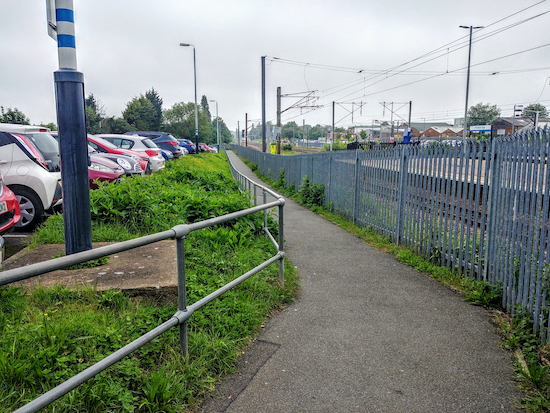
| Potters Bar footpath 9 heading NNW alongside the track |
 |
| Potters Bar footpath 15 |
Cross the road but do not take the path that goes through a green metal gate to Furzefield Wood but take the footpath to the right of the gate. This is Potters Bar footpath 15 slightly to your right (location - https://w3w.co/debate.rips.glee). Continue along the footpath heading W for 600m with Potters Bar Brook on your left until you reach Warrengate Farm (location - https://w3w.co/rider.calm.skill).
 |
| At the junction take the left fork, Potters Bar footpath 12 |
4: Turn left on Hawkshead Lane, cross the bridge, head straight ahead, WSW, along a lane with a bungalow on the right and a field with horses on the left (location - https://w3w.co/crazy.upset.city).
After 80m you reach Swanland Road. Cross with care then take the footbridge (location - https://w3w.co/armed.dock.boot), North Mymms restricted byway 83 over the A1(M).
On the other side you reach a junction in the track. Turn right then follow Love Lane, North Mymms restricted byway 3, for 160m NNW at which point the track you are on becomes North Mymms BOAT 4 (byway open to all traffic). Head in a northwesterly direction for 430m passing an old wind pump on the left (location - https://w3w.co/doing.visual.phones). Continue to a junction in the track (location - https://w3w.co/atomic.lime.pots) where there is a bench if you need a rest.
Take the left fork, North Mymms bridleway 4, then head NW for 270m to a crossing in the tracks (location - https://w3w.co/oddly.tips.noon).
5: Turn right on North Mymms bridleway 1 then head NE for 770m until you reach the A1 (M). Turn left then follow North Mymms BOAT 5 NNW for 170m until you reach a footbridge (location - https://w3w.co/hedge.tour.forced).
 |
| The Woodman Inn, Water End - a short detour from the route |
Go through a gate then follow North Mymms footpath 6. Straight ahead you will see North Mymms Cricket Club. Veer right then walk WNW for 490m heading for St Mary's Church. Continue until you reach St Mary's Church Road (location - https://w3w.co/depend.easy.sulk).
 |
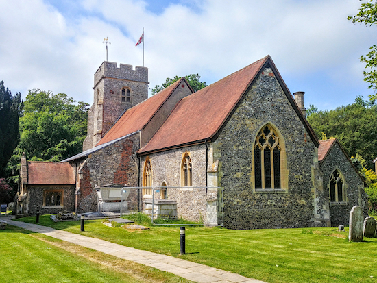
| St Mary's Church, North Mymms |
 |
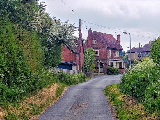
| The path from North Mymms to South Mimms passing Cangsley Grove |
 |
| Purple Emperor butterfly Image by Bernard Dupont via Wikimedia Commons |
 |
| Head SSE on Blackhorse Lane passing The Black Horse pub on the left |
9: Take this path, South Mimms footpath 33, which can be muddy, and follow it SE across fields for 550m. After the first field you will come to a wooden marker pointing straight ahead. At certain times of the year the path is sown with crop, so it might be best to walk round the edge of the field - first slightly S then E - until you meet a footbridge (location - https://w3w.co/flank.moment.sums) where the path continues then heads SSE along the W side of the A1 (M) for 330m to St Albans Road (location - https://w3w.co/fats.pizza.dared).
10: When you reach St Albans Road turn left then head SE for 130m crossing the bridge over the A1(M) to Swanland Road (location - https://w3w.co/pools.blast.ropes). Turn left on Swanland Road, then cross and walk along the E side of the road heading NNE.
After you pass Wash Lane on the right continue for another 150m until you reach a footpath on your right (location - https://w3w.co/error.loudly.cards). Take this path, Potters Bar footpath 41, which become Potters Bar footpath 40, and follow it ENE for 400m to a picturesque triple-arched bridge crossing Mimmshall Brook (location - https://w3w.co/feared.roofs.solved).
 |
| Bridgefoot Bridge over Mimmshall Brook, South Mimms |
 |
| The route through Potters Bar between points 12 and 15 Created on Map Hub by Hertfordshire Walker Elements © Thunderforest © OpenStreetMap contributors |
13: Turn left on Wellesley Crescent then head NNE for 120m until you reach The Shrublands on the right (location - https://w3w.co/task.robe.chains). Turn right on The Shrublands then head ESE for 30m looking out for a path on the left (location - https://w3w.co/encounter.heap.rate). Turn left then follow the path NE for 100m until you reach Elmfield Road (location - https://w3w.co/poem.sleeps.costs). Turn right on Elmfield Road then head SE for 110m looking out for a path on the left (location - https://w3w.co/intelligible.heat.long).
14: Turn left then follow the path NE for 270m until you reach Heather Way on the right (location - https://w3w.co/visits.ducks.barn). Turn right on Heather Way then head SE for 210m until you reach Baker Street (location - https://w3w.co/third.donor.elaborate).
15: Turn left on Baker Street then head NE for 350m back to Potters Bar station (location - https://w3w.co/volume.petal.speaks). If you fancy refreshments you pass The Old Manor pub and restaurant just before you reach the station. There are many cafes, coffee shops, restaurants and bars in the area to choose from.
The Haunted Bridge
Taken from the “Brief Historical Notes” section of the 1952 edition of the Official Guide published by Potters Bar Urban District Council and shared with this site by local historian and archivist, Peter Miller, one of the team responsible for the North Mymms History Project. We've reproduced the text about ghostly sightings at the bridge as it was written.
The Ghost of South Mimms
“The neighbourhood around Barnet is said to have been the hunting ground of the notorious Dick Turpin, and it is therefore not surprising, that his ghost is believed to make its appearance at intervals at the South Mimms Wash. Another supernatural phenomenon said to be seen in this vicinity is a Shadow and a swarm of black flies. The story is told that once an old woman lived in the South Mimms neighbourhood who was regarded as a witch. One morning she was discovered at the Wash, and some people thought she had been murdered. She was not buried in the churchyard, being a witch, and was interred at the crossroads, a stake being driven through her to prevent her ghost from wandering. Despite this, people declared that they saw a Shadow at night time on the road leading to the Wash which they believed to be the spirit of the old witch and it always came to a standstill at the place where she lay buried. People also said that at this place were a swarm of repulsive black flies which appeared to wait for the Shadow, and then both disappeared in mysterious fashion. Naturally one cannot vouch for the authenticity of the stories that have been handed down for many years, but they always seem to have a fascination for people.”


Thanks for this, a very pleasant afternoon walk. The section over Potswell valley was especially lovely, and I extended it by taking a C shaped detour through the valley fields. No apparitions witnessed on the bridge for me either, although some malign entities had dumped a couple of tyres in the stream.
ReplyDeleteA couple of minor comments. The w3w reference in part 9 for the footbridge appears to be incorrect, and is the same as in 8. I also couldn't find the path after entering the housing estate in part 12, but it was simple enough to take an alternate route.
Great, glad you enjoyed the walk. Thanks for the details feedback. I have 1) fixed the incorrect W3W link, 2) revised the directions through the estate to the south of Potters Bar, 3) added some more W3W for each junction, and 4) inserted a map of that particular stretch to try to help make it clearer. Really appreciate you taking the time to help me improve the directions.
DeleteDavid
I enjoyed this walk back in April 24 and reported the bridge between the fields in Point 9 as a few of the planks were completely broken . I have received an email today to say it has been fixed so hopefully it has.
ReplyDeleteThanks Emma.
Delete