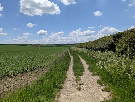
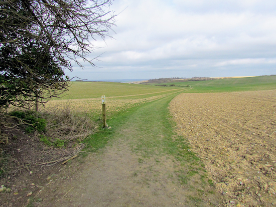
6.1 miles (9.7 km) with 174m of total ascent
 |
| View between points 2 and 3 |
Fly through preview of walk
If you want to check what sort of landscape you will be crossing before you set off on this walk you can view a short 3D video of the route below. It's created using the free version of Relive.
Directions
GPX or KML files for the walk. We've added What3Words references for those who use that system. If you print these walks you might want to use the green PrintFriendly icon at the bottom of these directions to delete elements.
1: From Police Row (location - https://w3w.co/ketchup.aunts.tulip) in Therfield village head W and then NNW along Pedlars Lane for 370m until you reach a T-junction (location - https://w3w.co/ready.sprinkle.hospitals).
2: Turn left then head WSW for 80m until you reach a footpath on the right (location - https://w3w.co/pasting.handsets.engaging).
 |
| Therfield footpath 2 at the beginning of the walk |
 |
| The view north from footpath 2 mentioned in point 2 above |
4: Continue on Therfield footpath 2, still heading NW, for 1.1 km to Thrift Farm (location - https://w3w.co/relishing.birds.cotton).
5: When you reach Thrift Farm, ignore a footpath on your right but, instead, continue between the buildings leaving the farmyard at a gate (location - https://w3w.co/discrepancy.scrubbing.rice).
 |
| Once through the gate turn right on a track |
Take this path, the Hertfordshire Way, which at this point is an official ‘recreational route’ rather than a public right of way. After 220m the Hertfordshire Way crosses a track to the stables (location - https://w3w.co/squeezed.cities.irrigated).
 |
| Continue heading E with the trees on your right |
Continue heading ENE for 840m with the trees on your right until you come to the point where the path bends to the right through the trees (location - https://w3w.co/score.sapping.selling), see image below.
 |
| Follow the path to the right through the trees |
 |
| Then follow the path as it bends left to a junction |
9: Turn right on Therfield footpath 5 then head S for 115m until you reach a footpath on the left (location - https://w3w.co/ounce.zoomed.growl).
 |
| Take the path on the left |
 |
| Enter the reserve and turn sharp left |
12: Cross Therfield Road then follow Therfield footpath 6 as it heads NE for 340m towards Therfield Heath, which is an area of common land with most of it forming a nature reserve and a Site of Special Scientific Interest. It is also an area of significant geological and archaeological importance which is owned by the Therfield Regulation Trust.
You pass the site of a long barrow on your left (location - https://w3w.co/mavericks.milky.represent), which is listed by Historic England.
Follow the track ESE for 840m then SW for 290m until you climb a hill to reach the Icknield Way Trail, a 170-mile long-distance path, which, at this point is also Therfield footpath 11 (location - https://w3w.co/fingernails.stoppage.patting).
 |
| Therfield footpath 11 leading S from Therfield Heath |
Continue on this bridleway, which soon becomes Therfield bridleway 12, as it heads SSW for 1.3km until you reach a junction where the main track swings to the right (location - https://w3w.co/brightens.proclaims.runs).
 |
| Ignore the right turn and continue straight |
15: Ignore the right turn and instead continue straight, walking to the left of a bench (location - https://w3w.co/professed.bypasses.guesswork) and heading for a footpath sign at a gap in the hedge (location - https://w3w.co/harnessed.juices.prices), see image of junction below.
 |
| Where the path bends to the right you continue heading straight to a gap in the hedge |
17: Go through the gap, still on Therfield footpath 42, then head WSW for 280m back to Police Row in the village of Therfield.
We have another walk from Therfield village, Walk 121: Therfield Loop South.


Thank you; this is an excellent walk with far ranging views. We walked it yesterday for the first time and found the route instructions clear and easy to follow. The path was generally dry. We took a picnic lunch but please note that if thinking of walking this route the Fox and Duck is currently closed on Mondays and not serving food on Tuesdays. We hope to walk this path again later in the year when the Chalkhill Blues are flying on Therfield Heath.
ReplyDeleteWe love that walk. Glad you enjoyed it. David
DeleteThanks for this walk - lovely. Pub at the end is a winner too!
ReplyDeleteWe love that walk too. Have done it several times. The pub has never let us down.
DeleteWonderful walk today saw the rare pasque flowers just before Fox covert nature reserve .
ReplyDeleteWell done spotting the flowers. We really like that walk, especially that area by the Fox Covert Nature Reserve. Thanks for the feedback. David
Deletehope to do a bit of this walk tomorrow (12/5/24)
ReplyDeleteHope you enjoy it, it's a lovely route.
DeleteReally beautiful walk on a summers day , which I enjoyed this week . The gap in the hedge after point four , turning left up the slope is rather overgrown and very easy to miss. Poppy fields were worth a visit on their own . Marvellous / recommended..
ReplyDeleteThanks for the tip regarding point 4. That will be helpful for other walkers. Overgrown paths is a problem this time of the year. Thanks for taking the time to mention the issue. David
Delete