4.5 miles (7.3 km) with 24m total ascent
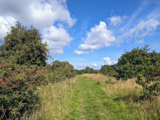 |
| Colney Heath footpath 14 between points 6 & 7 |
This is a perfect walk if you are getting your car serviced along Hatfield Road and need to kill a few hours while the mechanics are doing their stuff. The route starts and finishes at what was Smallford Station on the former
Hatfield to St Albans railway line, now
The Alban Way. There is free car parking at the site (at the time of writing - August 2023). Along the way you will cross livestock fields and a farmyard where there are signs asking dog owners to keep their pets on a lead.
We tested this route in early August when there were nettles and brambles at several points along the way. So it might be worth wearing long trousers or taking a stick or secateurs to help deal with any overgrown footpaths.
Getting there
There are bus stops on Smallford Lane (location -
https://w3w.co/lands.system.strong) close to the start of the walk which are served by the number 305 bus. There are also bus stops 540m NNW of the start of the walk close to Smallford Roundabout on Hatfield Road (location -
https://w3w.co/scare.whites.eager), which are served by the number 301, 302, 303, 305, 330, 601, 602, and 612 buses. You can check bus times at
Intalink.
Fly through preview of walk
If you want to check what sort of landscape you will be crossing before you set off on this walk you can view a short 3D video of the route below. It's created using the free version of
Relive.
Directions
 |
Map for Walk 242: Smallford North Loop
Click on the map above for a larger version
Map created on MapHub - copyright details here
Elements © Thunderforest © OpenStreetMap contributors
There is an interactive map embedded at the end of these direction |
Those with GPS devices can download
GPX or
KML files for this walk. We've added
What3Words location references for those who use that system. If you print these walks you might want to use the green
PrintFriendly icon at the bottom of these directions to delete elements such as photographs.
 |
The information sign close to Smallford Station
Click on the image for a larger version |
1: From the car park off Station Road, Smallford (location -
https://w3w.co/solve.heats.scouts) head S (away from the road) until you reach The Alban Way - where once steam trains would travel between Hatfield and St Albans. On your right will be the platform for Smallford Station (location -
https://w3w.co/depend.line.alone). Turn left on The Alban Way then head E and under the bridge for 30m until you reach a footpath on the left (location -
https://w3w.co/beans.ship.festivity), see images below.
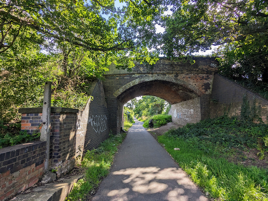 |
| Turn left on The Alban Way head E under the bridge |
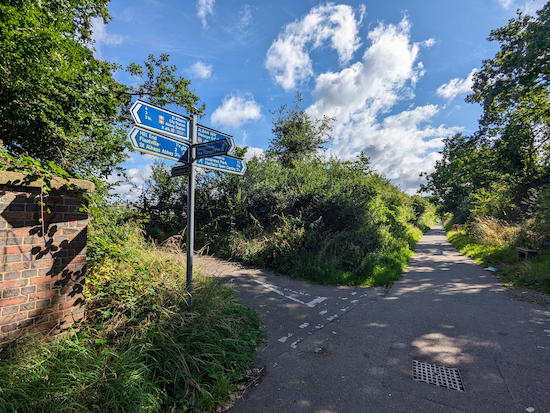 |
| Turn left on the footpath on your left after the bridge |
Turn left on the footpath then head NNE for 80m until you reach Wilkin's Green Lane on the right. Turn right on Wilkin's Green Lane then head ENE for 85m until you reach a
footpath on the left (location -
https://w3w.co/hardly.ideal.before), see image below.
 |
| Turn left on Colney Heath footpath 12 |
2: Turn left on Colney Heath footpath 12 then head NNW for 460m until you reach Hatfield Road (location -
https://w3w.co/global.body.beyond), see image below.
* The Three Horseshoes pub (location - https://w3w.co/learns.dips.grass), the Notcutts Garden Centre cafe (location - https://w3w.co/cubes.hopes.entry), and the Smallford Farm Shop Cafe (location - https://w3w.co/lines.editor.dating) are a short detour left along Hatfield Road.
 |
| Cross Hatfield Road then follow Colney Heath footpath 15 |
3: Cross Hatfield Road then head NNW on Colney Heath footpath 15 for 240m until the footpath reaches a bend (location -
https://w3w.co/copies.achieving.pulled). Here attention is needed because it could be easy to take the wrong path. I have added a satellite image map below with the route in orange to help.
 |
| The route (in orange) described in the directions below |
 |
| Cross the track to continue on Colney Heath footpath 15 |
4: Follow Colney Heath footpath 15 at the bend as it heads to the right, crosses a track, then bends left (location -
https://w3w.co/rust.advice.vivid) to continue heading NNW (see orange line on the map of route above). Then follow Colney Heath footpath 15 NNW for 165m, with a playing field and a new housing development on your left, until you reach another bend (location -
https://w3w.co/tune.data.hoot), see image below.
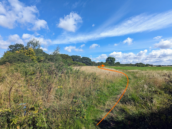 |
| Head NE with the hedgerow on the left and fields on the right |
5: Here you leave Colney Heath footpath 15 then head NE for 320m ignoring the first footpath on the left (location -
https://w3w.co/rams.loves.clouds) and continuing, with the hedgerow on the left and field on the right, until you reach a gap in the hedgerow on the left (location -
https://w3w.co/happen.river.equal), see image below.
 |
| Turn left on Colney Heath footpath 14 |
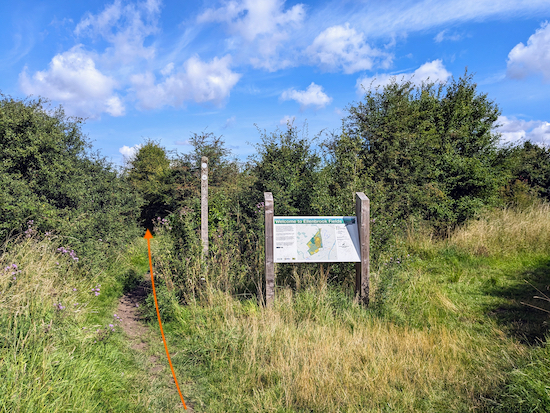
6: Turn left on Colney Heath footpath 14 then enter
Ellenbrook Fields (location -
https://w3w.co/head.fend.jets), see images below.
 |
The sign at Ellenbrook Fields
Click on the image for a larger version |
 |
| Walk past the sign and continue on Colney Heath footpath 14 |
Continue heading NW on Colney Heath footpath 14 for 420m until you reach a junction (location -
https://w3w.co/payer.flags.study), see image below.
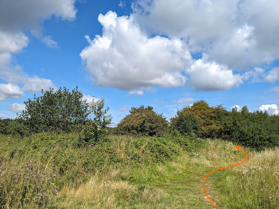 |
| Follow Colney Heath footpath 14 as it bends right then left |
7: This is another spot where attention is needed. Follow Colney Heath footpath 14 as it bends right at the first fork then, 5m further on, bends left at the second (location -
https://w3w.co/buddy.gave.tapes), see orange line on the map below.
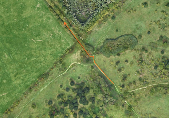 |
| The route (in orange) described in the directions above |
Continue heading NW on Colney Heath footpath 14 for 260m until you reach a track and a bridge over a quarry conveyor belt (location -
https://w3w.co/incomes.claim.socket), see images below.
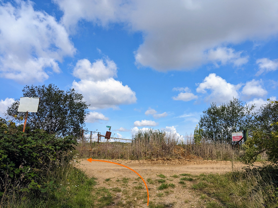 |
| Turn left on the track ... |
 |
| ... then turn right over the bridge then left after the bridge |
8: Turn left on the track then turn right to cross the bridge over the conveyor belt. Once over the bridge turn left, still on Colney Heath footpath 14, then head SWS for 120m until the path bends right (location -
https://w3w.co/cross.urban.summer). At this point the footpath you are on crosses the parish boundary and you continue on Sandridge footpath 52.
Follow Sandridge footpath 52 NW and W for 250m passing farm buildings on the right and continuing until you reach a farm road (location -
https://w3w.co/thin.films.causes), see image below.
 |
| Turn left on the farm road, which is still Sandridge footpath 52 |
9: Turn left on the farm road, which is still Sandridge footpath 52, then head W for 160m until you reach a footpath sign on the left (location -
https://w3w.co/dress.stops.attend), see image below.
 |
| Turn left, still on Sandridge footpath 52 |
10: Turn left, still on Sandridge footpath 52 then follow the path WSW first through woodland and then parallel to a lane for 240m until you reach a junction (location -
https://w3w.co/powder.input.firmly) see image below.
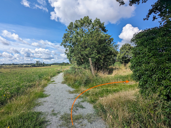 |
| Turn right at the junction then cross Coopers Green Lane |
11: Turn right at the junction to reach Coopers Green Lane (location -
https://w3w.co/aspect.decreased.strict), see image below.
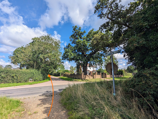 |
| Cross Coopers Green Lane then follow Sandridge bridleway 48 |
Cross Coopers Green Lane then head NW on Sandridge
bridleway 48 for 190m until you reach a farmyard (location -
https://w3w.co/loaded.glue.aspect), see image below.
 |
| Turn left through the farmyard on Sandridge footpath 49 |
12: Turn left through the farmyard on Sandridge footpath 49. If you have dogs you are asked to put them on a lead along this stretch.
 |
| Sign at farm asking for dogs to be put on a lead |
Head SW through the farmyard for 60m to a gate (location -
https://w3w.co/basis.study.tanks), see image below.
 |
| Go through the gate still on Sandridge footpath 49 |
Go through the gate then head WSW on Sandridge footpath 49 for 120m until you reach a metal gate leading to an arable field (location -
https://w3w.co/task.occurs.wants).
 |
| Go through the metal gate then continue on Sandridge footpath 49 |
13: Go through the metal gate then keep left and head SW, still on Sandridge footpath 49, with the hedgerow on the left and field on the right for 40m until you reach the end of the hedgerow and cross an open field (location -
https://w3w.co/farms.twig.bake), see image below.
 |
| Cross the arable field still on Sandridge footpath 49 |
Cross the arable field still on Sandridge footpath 49 heading SW for 350m until you reach House Lane (location -
https://w3w.co/cared.strain.spins).
14: Cross House Lane then turn left and head S for 90m until you reach Sandpit Lane, with the roundabout on your left (location -
https://w3w.co/every.reason.reds). Cross Sandpit Lane then take Sandridge bridleway 51 opposite (location -
https://w3w.co/remain.couches.volume) see image below.
 |
| Head S on Sandridge bridleway 51 |
15: Head S on Sandridge bridleway 51 for 474m until the bridleway you are on crosses a parish boundary (location -
https://w3w.co/appear.orange.email) and becomes Colney Heath bridleway 3, see image below.
 |
| Sandridge bridleway 51 approaching the parish boundary |
Continue on Colney Heath bridleway 3 for 500m as it passes through the grounds of Oaklands College and reaches a junction (location -
https://w3w.co/lunch.fixed.trials), see image below.
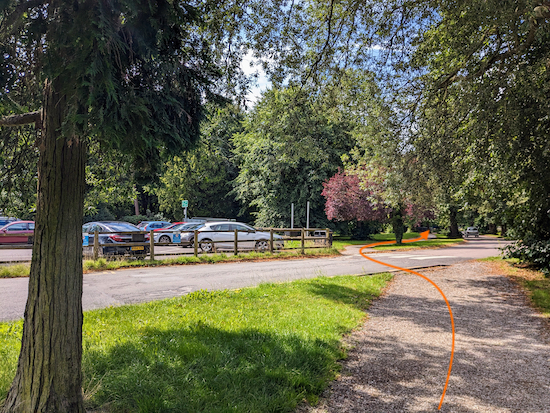 |
| Continue heading SW, now on South Drive |
16: Continue heading SW, now on South Drive for 405m until you reach Hatfield Road (location -
https://w3w.co/green.finest.doors).
* The Speckled Hen pub (location - https://w3w.co/oppose.remind.layers) is 300m to your right along Hatfield Road.
17: Cross Hatfield Road, turn left, then head E for 70m until you reach Colney Heath Lane on the right (location -
https://w3w.co/wipes.decay.poem).
Turn right on Colney Heath Lane then head SSW for 155m to a mini-roundabout (location -
https://w3w.co/tables.souk.fall). Turn left, still on Colney Heath Lane, then head SE for 145m until you reach a footpath on the left just before a bridge (location -
https://w3w.co/counts.trains.giant), see image below.
 |
| Turn left on the footpath just before the bridge |
18: Turn left on the footpath just before the bridge then follow it SE 30m until you reach The Alban Way (location -
https://w3w.co/grab.until.spring). Turn left on The Alban Way then follow it W for 1.8km until you reach Smallford Station on the left (location -
https://w3w.co/clip.invite.vote), see image below.
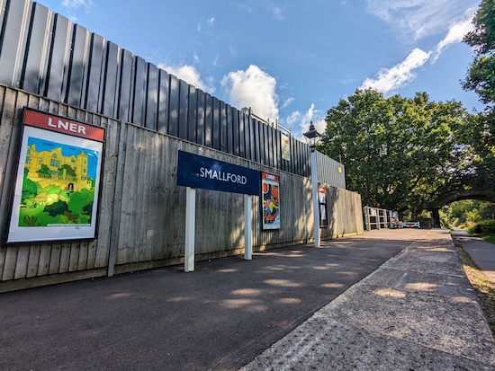 |
| Turn left after Smallford Station and return to the starting point |
Turn left after Smallford Station and return to the starting point.
Interactive map


We did a slight variation of this walk. Clocked up 4.12 miles. A beautiful Bank Holiday walk with clouds and no sun, perfect 👌
ReplyDeleteHi Lorraine & Neil, so glad you enjoyed our "what to do when getting the car serviced" walk. Sometimes we do it the other way round. It's also nice to have a couple of cafes near the start and finish point if we still need to kill time. :-)
DeleteLoved this walk and the instructions were super clear! Thank you! My only comment is about point 13 - this field is presently being farmed for crops and so it’s tricky to pass through without causing damage. Try to circumnavigate the field if possible.
ReplyDeleteThanks fo the feedback and the tip about circumnavigating the field. Very helpful. David
Delete