7.1 miles (11.4 km) with 105m of total ascent
 |
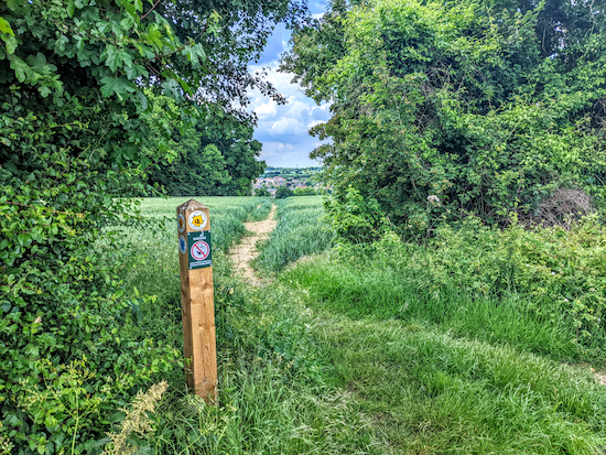
| Walkern footpath 41 soon after the start of the walk |
A wonderful walk through the rolling countryside to the S and W of Walkern, a village which appeared in the Domesday book of 1086 as
Walchra. The route heads SW to Aston End and then to Aston before returning along footpaths following the banks of the River Beane. There are pubs at Aston End and Aston and two in Walkern close to the start/finish point. The starting point is 4.7 miles ENE from Stevenage station by road.
Getting there
There are bus stops on Stevenage Road and High Street in Walkern (location -
https://w3w.co/beans.boat.lushly), which are close to the start and finish point. They are served by the number 38 bus. You can check bus times at
Intalink.
Fly through preview of walk
If you want to check what sort of landscape you will be crossing before you set off on this walk you can view a short 3D video of the route below. It's created using the free version of
Relive.
Directions
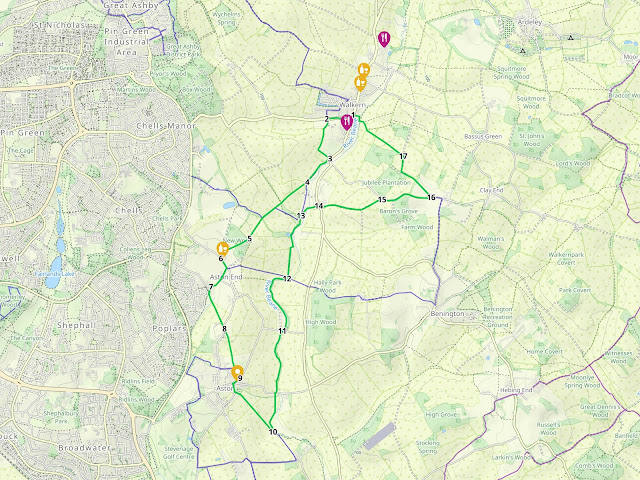 |
Map for Walk 183: Walkern South Loop
Click on the map for a larger version
Created on Map Hub by Hertfordshire Walker
Elements © Thunderforest © OpenStreetMap contributors
There is an interactive map below the directions |
Those with GPS devices can download
GPX or
KML files for this walk. We've added
What3Words location references for those who use that system. If you print these walks you might want to use the green
PrintFriendly icon at the bottom of these directions to delete elements such as photographs.
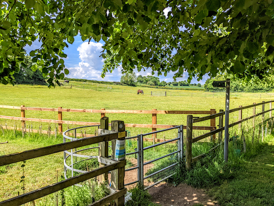 |
| Walkern footpath 41 heading S off Stevenage Road |
1: Facing the garage and petrol station on High Street in Walkern (location -
https://w3w.co/ambition.chatted.nosedive), turn right then head S for 60m to the junction of High Street and Stevenage Road (location -
https://w3w.co/informs.loitering.tornado). Turn right at the junction then head W on Stevenage Road for 300m looking out for a footpath on the left (location -
https://w3w.co/suspend.await.lifestyle), see image above.
 |
| Go through the gate then head SE for 175m to another gate |
2: Turn left on Walkern footpath 41 then head S, SW, then S again for 390m until the path goes through a metal gate on the left (location -
https://w3w.co/dreams.fingertip.grasp), see image above. Go through the gate then head SE, with the hedgerow on your left and the field on your right, for 175m until you reach another gate leading to High Street (location -
https://w3w.co/visual.cover.tributes), see image below.
Don't go through the gate.
 |
| Turn right on Walkern footpath 20 immediately before the gate |
3: Turn right without going through the gate to take Walkern footpath 20, see orange arrow in image above. Head SW on Walkern footpath 20 for 150m to a gate (location -
https://w3w.co/classic.gladiators.blemishes). Go through the gate then continue for 240m, with the hedgerow on your right and field on your left, until you reach a footpath junction (location -
https://w3w.co/stardom.informs.ballooned), see image below.
 |
| Take the footpath on the right, Walkern footpath 20A |
4: Keep right at the junction then continue heading SW, now on Walkern footpath 20A for 400m to another junction (location -
https://w3w.co/splice.rotate.informer), see image below.
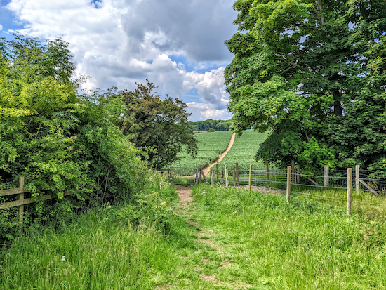 |
| Walkern footpath 20A approaching Walkern bridleway 21 |
Continue heading SW and uphill through crop (see line of route on image above) for 295m, now on Walkern bridleway 21, until you reach a junction and a gap in the hedge (location -
https://w3w.co/fevered.clogging.belonged), see image below.
 |
| Go through the gap and continue on Aston footpath 14 |
The bridleway you were on turns right here, but you leave it to go through the gap in the hedge on Aston footpath 14, which you follow SW for 280m until you reach woodland (location -
https://w3w.co/engages.chum.bedrooms).
 |
| Once in the woodland take the path on the right |
5: Enter the woodland then turn right on Aston footpath 20 which you follow through New Wood for 185m and then across a field for 160m until you reach Holders Lane (location -
https://w3w.co/prospers.asset.blows). Turn left on Holders Lane then head SSE for 90m until you reach Long Lane (location -
https://w3w.co/linguists.ants.shortage).
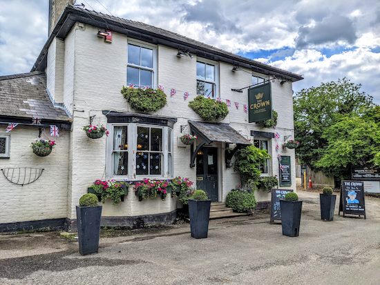 |
| The Crown at Aston End |
6: Turn left on Long Lane, pass
The Crown pub/restaurant on your left, then head SSE for 130m until you reach Tatlers Lane on the right (location -
https://w3w.co/nightfall.lance.tasteful). Turn right on Tatlers Lane then follow it SSW for 170m until you reach a road junction on the left (location -
https://w3w.co/division.easily.proofs). Ignore this road junction and continue along Tatlers Lane heading SW for another 135m until you reach a second road junction on the left (location -
https://w3w.co/query.achieving.pronouns), see image below.
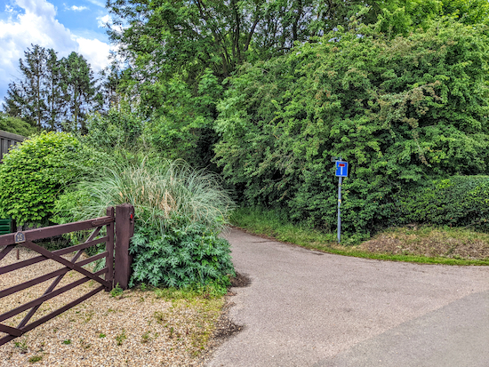 |
| Turn left then head SSW on the dead end lane |
7: Turn left then head SSW along a dead end lane for 90m until you reach a footpath (location -
https://w3w.co/rephrase.issuer.chins). Take this path, Aston footpath 7, then head SSE for 390m crossing fields and a footbridge and continuing until you reach the hedgerow (location -
https://w3w.co/cupboards.subsystem.populate). Here you will cross a private drive then continue, still on Aston footpath 7, for 50m until you reach Aston End Road. (location -
https://w3w.co/rave.remission.glides).
 |
| Follow the line of the orange arrow on the photograph above |
8: Cross Aston End Road then take the footpath on the other side, Aston footpath 22, which leads to a gate (location -
https://w3w.co/mailing.printout.mentioned), see image above. Go through the gate then cross the field following the line of the orange arrow on the photo above. After 110m you will reach a gate in the hedgerow (location -
https://w3w.co/grin.handsets.raced).
 |
| Continue heading SSE across the next field |
Go through the gate then continue heading SSE across the next field for 210m, still on Aston footpath 22, (see direction of orange arrow on the photograph above) until you reach the hedgerow (location -
https://w3w.co/massaging.host.totals). Continue heading SSE for 140m until you reach a play area on the left (location -
https://w3w.co/glass.router.cupboards).
 |
| Aston footpath 22 continuing through Wrights Orchard |
Follow Aston footpath 22 beyond the play area and into a residential area called Wrights Orchard. Keep heading SSE along Wrights Orchard until you reach a footpath (location -
https://w3w.co/doses.librarian.intervals), see image above. This is still Aston footpath 22 which you follow for 65m to New Park Lane (location -
https://w3w.co/collapsed.stoops.lifetimes).
 |
| The Pig & Whistle, Aston |
9: Turn right on New Park Lane then head WSW for 90m, passing a cut through which leads to
The Pig & Whistle, a Grade II listed building, on the left (location -
https://w3w.co/curries.beep.opinion). If you don't take the cut through to the pub, continue heading WSW on New Park Lane for 30m until you reach the junction with Benington Road (location -
https://w3w.co/morphing.perusing.copycat). Turn right on Benington Road then take the first road on the left, Stringers Lane (location -
https://w3w.co/traps.unleashed.discussed) and head SSE.
 |
| Aston footpath 24 off Stringers Lane |
Follow Stringers Lane SSE for 105m until you reach a footpath on the left (location -
https://w3w.co/driveway.goodnight.motive), see image above.
 |
| Aston footpath 24 crosses two fields before reaching a junction |
Take this path, Aston footpath 24, then head SE for 660m crossing two fields until you reach a junction by the River Beane (location -
https://w3w.co/height.quieter.ruled), see image below.
 |
| Turn left before the gate and take Aston footpath 25 |
10: Turn left before the gate and take Aston footpath 25 then follow it NNW then NE, with the hedgerow on the right and the field on the left, for 250m until the path leaves the hedgerow (location -
https://w3w.co/sweeping.investors.sending), see image below, then heads diagonally N across a field to reach Benington Road (location -
https://w3w.co/shepherds.slug.soaps).
 |
| Aston footpath 25 heading N across the field to Benington Road |
Cross Benington Road then continue heading N, now on Aston footpath 17, for 775m until you reach Ford Lane (location -
https://w3w.co/being.overtones.shade), see image below.
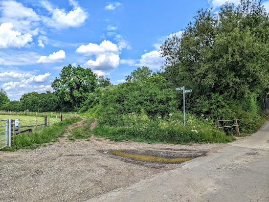 |
| Cross Ford Lane and continue heading N on Aston footpath 17 |
11: Cross Ford Lane and continue heading N, still on Aston footpath 17, and still following the River Beane, for 870m, until you reach a junction (location -
https://w3w.co/grumbles.spider.super), see image below.
* Beyond this junction and on your right is a bench overlooking the River Beane and a footbridge; a possible spot for a picnic.
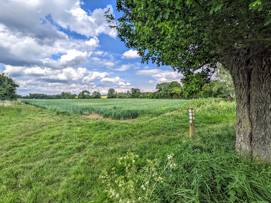 |
| Continue heading N at the junction, still on Aston footpath 17 |
12: Take the second left at the junction then continue heading N, still on Aston footpath 17, with the hedgerow on the left and the field on the right, for 360m at which point the footpath you are on crosses a parish boundary and becomes Walkern footpath 20 (location -
https://w3w.co/encourage.sunflower.rebirth). Continue heading NNE on Walkern footpath 20 until you reach a gate leading to a footbridge (location -
https://w3w.co/pace.recruiter.tutored), see image below.
 |
| Walkern footpath 20 crossing a footbridge, point 12 above |
13: At this point Walkern footpath 20 crosses the footbridge while, alongside, Walkern bridleway 21 crosses the same stream to reach a gate. You should cross the footbridge on Walkern footpath 20, then, as soon as you are on the other side of the stream, keep right on Walkern bridleway 21, heading diagonally across the field in the direction of the houses in the distance. Continue until you reach a gravel track (location -
https://w3w.co/cooking.branch.variously).
 |
| The footbridge crossing the River Beane |
Turn right on the gravel track then head ENE, cross a footbridge alongside a ford then continue, now on Benington bridleway 1, for 120m to reach Benington Road.
 |
| Benington bridleway 44 off Benington Road |
14: Turn right on Benington Road then head S for 40m looking out for a track on the left (location -
https://w3w.co/mammal.blatantly.campers). Turn left on Benington bridleway 44 and follow it E for 500m until you reach Walkern Lodge on the left (location -
https://w3w.co/pounces.garden.topmost).
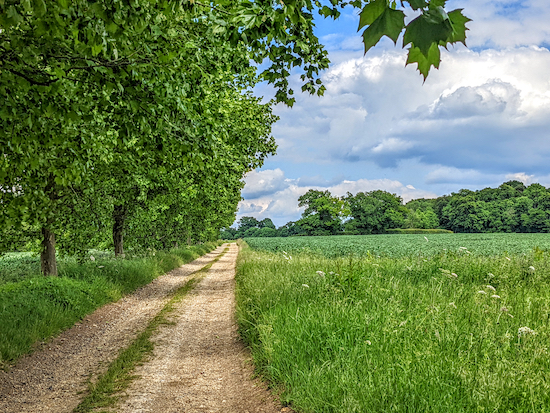 |
| Walkern bridleway 28 heading ENE |
At this point the track you are on becomes Walkern bridleway 28 which you follow ENE for 270m until you reach a lane (location -
https://w3w.co/fallback.headrest.gravest).
15: Turn right on the lane then follow it E for 630m looking out for a footpath on the left (location -
https://w3w.co/ritual.unfocused.chairing).
* There is no pedestrian pavement along this lane, but there are opportunities to step aside if a vehicle approaches. We saw one slow moving vehicle along the entire stretch.
 |
| Walkern bridleway 11 heading NW |
16: Turn left on Walkern bridleway 11 then follow it NW then N for 650m to a junction (location -
https://w3w.co/glimmers.swatting.sizing), see image below.
 |
| Turn left at the junction on Walkern footpath 12 |
17: Turn left at the junction on Walkern footpath 12 then follow it NW for 690m, ignoring footpaths to the left and right, and continuing until you cross the River Beane (location -
https://w3w.co/officials.enough.gliders). Turn right in front of the houses and follow Walkern footpath 12 N with the River Beane on your right, then W for 130m back to High Street, Walkern, and the starting point.
* If you need refreshments, there is The Brewery Tearoom (location - https://w3w.co/grandest.situation.solar), the Yew Tree pub (location - https://w3w.co/tint.hurricane.spoiled) which was seeking new tenants when we last updated this walk, The White Lion (location - https://w3w.co/husband.steepest.speaker), and Mulberry's which serves teas at (location - https://w3w.co/coffee.dimension.obstinate). Check websites for opening hours.
We are grateful to virtual walking chum Dave Cattell for suggesting we map a walk that included Aston End. Thanks Dave.
Interactive map


I did this walk yesterday, a lovely sunny day in June. It has a good variety of open fields, undulating countryside, short stretches of woodland, pretty cottages, quiet country lanes and friendly horses who like a bit of a chat! I found a parking spot on the main road near the start/finish and clocked up 7.5 miles. Great gpx file downloaded into OS map on my phone very easy to follow. Would recommend 👍
ReplyDeleteSo glad you enjoyed it. A lovely route. Thanks for the feedback. David
DeleteDavid Brewer one thing I didn’t mention was the field of very friendly horses - you don’t have to walk through it if you don’t want to- just follow the footpath round the 2 sides of the field and pick up the path again in the corner
ReplyDeleteThanks for the tip, Angela. Very helpful. David.
DeleteBoth pubs in Walkern have closed down
ReplyDeleteThanks for the update
Delete