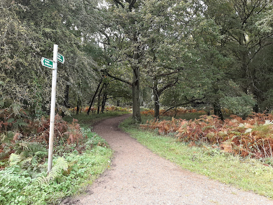
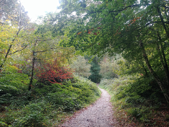
5.9 miles (9.5 km) with 176m total ascent
 |
| Great Gaddesden bridleway 10 mentioned in point 4 |
Fly through preview of walk
If you want to check what sort of landscape you will be crossing before you set off on this walk you can view a short 3D video of the route below. It's created using the free version of Relive.
Directions
GPX or KML files for this walk. We've added What3Words references for those who use that system. If you print these walks you might want to use the green PrintFriendly icon at the bottom of these directions to delete elements such as photographs.
Park along the lane outside The Alford Arms, but please check whether any parking restrictions have been introduced since this walk was written. (Location https://w3w.co/harp.land.rails).
 |
| Spooky Lane and Devil's Bridge - see point 1 below |
2: Turn left on Nettledon Road then head WNW for 50m until you reach a footpath on the right. Turn right on Nettledon with Potten End footpath 9 then head N for 590m at which point your path crosses a parish boundary and becomes Great Gaddesden footpath 76. Continue heading NNE for 310m until you reach a lane called St Margarets.
3: Turn left on St Margarets then pass the Amaravati Buddhist Monastery on the left. Follow the lane NW for 690m until it becomes a track. Continue NW along this byway, Little Gaddesden BOAT 9 (byway open to all traffic) for 1.4km until you reach a bridleway on the left (location - https://w3w.co/relegate.angle.sticks).
4: Turn left on Great Gaddesden bridleway 10 then walk downhill for 920m as the bridleway heads SW, then bends SSE and then bends SW again before it reaches Nettleden Road, Little Gaddesden.
 |
| Footpath 7 continues between low brick walls to a metal gate - see point 5 |
 |
| At the metal gate continue diagonally left and downhill on footpath 7 |
Turn left on Little Gaddesden footpath 7 then head SSW through the woodland following the path as it cuts between some low brick edging before reaching a metal gate (see images above).
Continue SSW following Little Gaddesden footpath 7 downhill through the woodland to a clearing.
Continue heading SSW and uphill, still on Little Gaddesden footpath 7, for 1.1km to Hillingdon Road.
 |
| Footpath 33 entering Frithsden Beeches - see point 6 below |
Continue for 120m keeping the woodland on your left and the field on your right until you cross a paved track.
Cross this track and continue heading S for 220m on Northchurch bridleway 49 through the woodland until you enter Frithsden Beeches.
 |
| Bridleway 33 through Frithsden Beeches |
At this point you could take a short detour, recommended by a regular user of Hertfordshire Walker, Gerry Gross, to visit the site of a 'labyrinth' of WWI training trenches. To reach them continue heading S on Northchurch bridleway 54 for 100m to a junction (location - https://w3w.co/quicker.selling.accented). Turn left on Northchurch bridleway 55 then head SE for 530m to reach the trenches (location - https://w3w.co/elevate.delighted.regretted), see image below.
 |
| Image of site of trenches courtesy of Gerry Gross |
The First World War training trenches and associated earthworks south of Berkhamsted Cricket Club off Castle Hill are listed by Historic England as a 'scheduled monument'. In September 1914, a month after the declaration of WWI, a training camp was set up on Berkhamsted Common. Around 2,000 men from the Inns of Court Officers' Training Corps also known as 'The Devil's Own' were accommodated, mostly in tents. In July 1917, the trainng trenches were dug to enable soldiers to get used to trench warfare. They continued to be operational until June 1919. Around 13km of training trenches had been dug across the Northchurch and Berkhamsted Commons.8: If you don't take the detour to visit the WWI training trenches, turn left on Northchurch bridleway 33 then head SE through woodland and across a golf course for 600m to the point where the track splits (location - https://w3w.co/booklets.kiosk.lives).
Take the left fork then continue on Northchurch bridleway 33 across the golf course fairway for 170m until you reach a lane (location - https://w3w.co/chains.tricycle.reporting).
9: Cross the lane then continue heading SE now along Nettledon with Potten End bridleway 24 for 650m ignoring the first junction on the left. Continue to the second footpath junction on your left (location - https://w3w.co/wiped.talent.verse).
10: Turn left then head NE along Nettledon with Potten End footpath 17 for 900m back to The Alford Arms.


A wonderful walk! Walked today with a friend who lives nearby but had never walked the area, and we were not disappointed - a little out of breath maybe, with the hills, but the effort required was well worth it! Spooky Lane is just amazing, the countryside fabulous and the woodlands wonderful. A lovely route, with great, easy to follow instructions - thank you x
ReplyDeleteHi Cathy,
DeleteGlad you enjoyed it. We have done that walk a few times and it never disappoints.
Thanks for the feedback.
David
Enjoyed the work but managed to get really lost at stage 5. When you emerge from the woodland it isn't immediately obvious which path to take. Best advice is to ignore paths into woodland or the one following the valley floor. Head uphill on grassland with wood on your right and you will eventually reach a metal gate and the welcome sign saying footpath 7.
ReplyDeleteSorry you got lost. That is a difficult stretch to describe, which is why I added pictures, What3Words, and GPS files. I hope it didn't spoil your walk.
DeleteDave
Hi Dave you do say it’s an up and down walk and I knew it would be having walked a previous walk from The Alford Arms. Great stretch past the monastery, the the amazing Beech Trees.. Thanks yet again. IR.
ReplyDeleteHi Ian, Yes, this walk certainly get's the muscles and heart working. We love it. And we usually try to fit in a visit to the excellent Alford Arms after the walk. Glad you liked it.
DeleteHi I totally agree, I asked if I could park in their car park and returned for refreshments 🤣😂
ReplyDeleteI usually park in the lane. Nice to know they were helpful regarding parking.
DeleteHow long does this walk take please?
ReplyDeleteIt's really hard to say without knowing how fit you are and how fast you walk. The walk is 5.9 miles long. The average walking speed is between 2.5 to 4 mph. So let's guess you walk about 3 miles per hour, then it will take you about 2 hours. If you walk slower it will be longer, and if you stop to admire the view, even longer. Sorry I can't be more specific. I suggest you allow 3 hours to be on the safe side. I hope you enjoy the walk.
DeleteDid this walk 9 February - will have to return when we have time to sample the pub!
ReplyDeleteHi Andrew, it's a lovely walk in the summer and The Alford Arms is well worth a visit. David
DeleteThe start of this walk is uphill, downhill and then uphill again. In the first 0.8 miles my watch registered 27 floors of ascent and a total of 61 floors for the whole walk! I did make a detour at point 8 rejoining the walk at point 10 so I could visit some World War 1 trenches - well worth the detour and good views along the way as well. I'm sending David details, and hopefully he will add them to the route details for others to benefit.
ReplyDeleteThanks Gerry
Delete