4.1 miles (6.6 km) with 110m total ascent
An undulating walk from The Candlestick pub/restaurant at West End down to the River Lea then over to Essendon and back. The route offers wide, open views north over the River Lea valley. There is quite a bit of up and down and there is a short stretch of a quiet country lane. The starting point is 3.5 miles NE of Welham Green Station by road.
 |
| One of the Hatfield Park signs along the route |
Along this route you will come across several signs informing you that you are crossing the Hatfield Park estate. But don't worry, this is not the section of the park for which there is an admission charge. Our route doesn't go into that area of the park and there is no charge for use public rights of way to cross the estate.
Getting there
The nearest bus stops to the route are 170m east of point 9 (location -
https://w3w.co/train.yoga.newest) and are served by the number 200, 201, and 341 buses. You can check bus times at
Intalink.
Fly through preview of walk
If you want to check what sort of landscape you will be crossing before you set off on this walk you can view a short 3D video of the route below. It's created using the free version of
Relive.
Directions
 |
Map for Walk 13: The Candlestick Loop
Click on the map for a larger version
Created on Map Hub by Hertfordshire Walker
Elements © Thunderforest © OpenStreetMap contributors
There is an interactive map at the foot of this page |
Those with GPS devices can download
GPX or
KML files for this walk. We've added
What3Words references for those who use that system. If you print these walks you might want to use the green
PrintFriendly icon at the bottom of these directions to delete elements such as photographs.
If you are planning on having refreshments at
The Candlestick before or after the walk, management are happy for you to park in the pub car park; if not there are usually spaces on the road next to the car park (location -
https://w3w.co/theme.grape.index).
 |
| The Candlestick, West End Lane, West End |
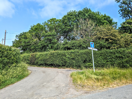
1: As you face the Candlestick turn left then head N for 30m then turn left up a dead end lane (see orange arrow on the photograph above and image below).
 |
| Head W along the lane until you reach the last cottage on the right |
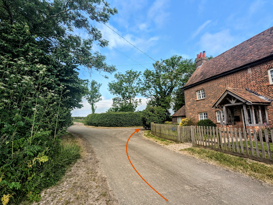
Head W along the lane for 370m until you reach the last cottage on the right (location -
https://w3w.co/little.flips.leaves). Just beyond the cottage you will come to a
footpath on the right, see image below.
 |
| Turn right on Essendon footpath 11 |
2: Turn right on Essendon footpath 11. Follow this footpath as it weaves its way downhill for 1km until you reach Hill End Lodge (location -
https://w3w.co/trip.swaps.alone), see image below.
 |
| Head N along the lane, which is also Essendon footpath 11 |
3: Head N along the lane, which is also Essendon footpath 11, for 900m to the point where the road turns left (location -
https://w3w.co/reap.safety.pets), see image below.
 |
| Turn right on Hatfield bridleway 75 |
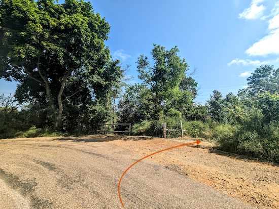
4: Turn right on Hatfield
bridleway 75 then head E for 100m at which point the track you are on crosses a parish boundary and becomes Essendon bridleway 6 (location -
https://w3w.co/pits.mock.demand).
Follow this bridleway, with the river Lea on your left, until you meet a bridleway the right (location -
https://w3w.co/holds.sugars.ranges), see image below.
 |
| Turn right on Essendon bridleway 10 then head S |
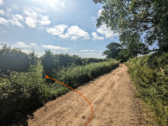
5: Turn right on Essendon bridleway 10 then head S for 560m where you will pass a farm track on your right (location -
https://w3w.co/error.about.force). Continue heading S for another 45m, still on Essendon bridleway 10, looking out for a footpath in the hedgerow on your left (location -
https://w3w.co/toward.nature.drops), see image below.
 |
| Turn left on Essendon footpath 8 |
6: Turn left on Essendon footpath 8 then head SE across an arable field for 310m until you reach a farm track (location -
https://w3w.co/shakes.edits.pitch), see direction of the route shown with an orange arrow on the image below.
 |
| Cross the arable field until you reach a farm track |
Cross the track then follow Essendon footpath 8 through the hedgerow and across a wooden footbridge to another field (location -
https://w3w.co/privately.burn.parade), see image below.
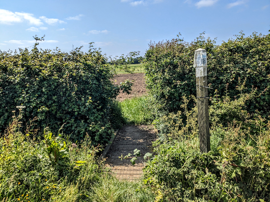 |
| Essendon footpath 8 crosses a wooden footbridge |
At this point Essendon footpath 8 continues heading SE across a corner of an arable field, however, at certain times of the year the path might not have been reinstated after ploughing. If this is the case you might want to walk round the edge of the field and rejoin footpath 8 where it reaches Larkinshill Grove (location -
https://w3w.co/soda.limes.third), see detour map below.
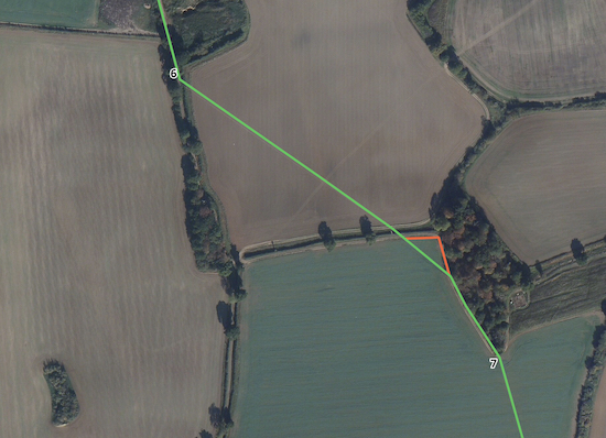 |
| The short detour (show in orange) if the footpath hasn't been reinstated |
When you reach Larkinshill Grove head SSE for 100m with the field on your right until you reach the end of the woodland and reach an arable field (location -
https://w3w.co/hired.since.cuts), see image below.
 |
| Head SSE across a field for 230m until you reach West End Lane |
7: Head SSE across a field for 230m until you reach the hedgerow and a path cutting through to West End Lane (location -
https://w3w.co/latter.water.over).
8: Turn left on West End Lane. This is a quiet, single-track lane with no pedestrian pavement. Follow it as it climbs the hill for 670m until you reach the outskirts of Essendon village where you will find a footpath on the right before the first house on the right (location -
https://w3w.co/robots.crust.poetic), see image below.
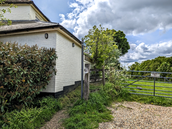 |
| Turn right on Essendon footpath 7 |
9: Turn right on Essendon footpath 7 then head SSW for 45m until you reach a gate (location -
https://w3w.co/giant.became.seat), see image below.
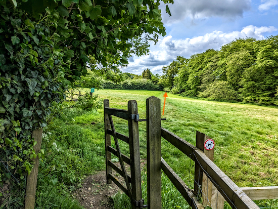 |
| Go through the gate then head diagonally SW across a field |
Go through the gate then head diagonally SW across a field to another gate (location -
https://w3w.co/lift.pads.awards), see image below.
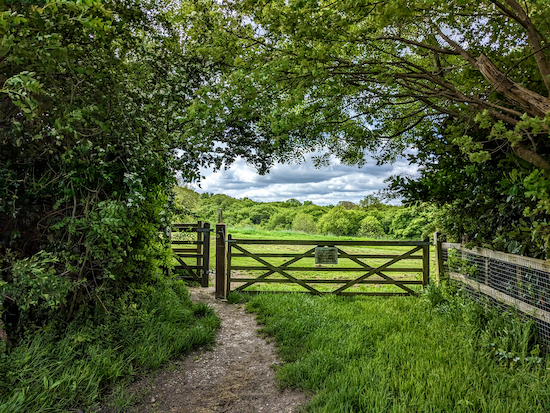 |
| Go through the gate then keep left and head SE |
Go through the gate then keep left and head SE, with the hedgerow on the left and field on the right, for 85m to another gate (location -
https://w3w.co/camera.will.joins), see image below.
 |
| Go through the gate then head diagonally SW |
Go through the gate then head diagonally and downhill to your right (SW) for 110m until you reach a gate leading to woodland (location -
https://w3w.co/stone.eager.each).
 |
| Turn right on Essendon Footpath 13 |
* At this point you have the option of turning left then heading ENE for 210m to High Street Essendon then turning right and heading SSE for 75 to visit The Rose & Crown (please check opening times to avoid disappointment).
10: When you reach the woodland turn right on Essendon Footpath 13 which heads WSW downhill for 410m to a footbridge crossing the stream (location -
https://w3w.co/hoot.length.crown), see image below.
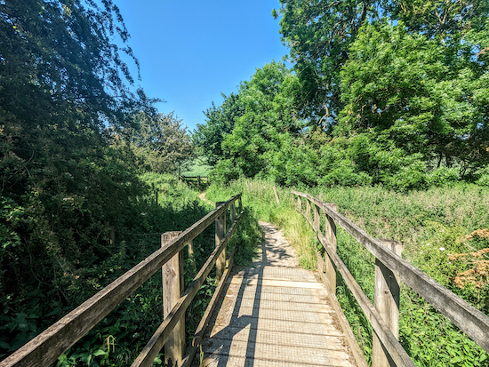 |
| Cross the footbridge then head uphill on Essendon Footpath 13 |
11: Cross the footbridge then keep going straight through another gate and then straight on heading W up the hill with fields on either side. After 240m beyond the footbridge you will reach Essendon BOAT 14 (
byway open to all traffic) (location -
https://w3w.co/nodded.transfers.doing), see image below.
 |
| Turn left on Essendon BOAT 14 |
12: Turn left on Essendon BOAT 14, then, almost immediately (after 25m) take the first footpath on the right (location -
https://w3w.co/dawn.guard.lives), see image below.
 |
| Turn right on what is a continuation of Essendon footpath 13 |
This is a continuation of Essendon footpath 13 which you follow uphill, with the fields on your left and the hedge on your right, for 430m until you reach The Candlestick and the starting point.
Interactive map


I walked this route on a glorious morning yesterday (9th October 2018). The route directions were easy to follow, which was just as well because the path running from just beyond Hill End Farm to West End Lane had been ploughed out in some fields and cropped over in another.
ReplyDeleteGreat route - we did it last week. Worth noting the Candlestick Pub is only open Weds-Sat; also if you want a shorter/ easier walk you could just go from point 8 back to point 1 as the hill climb from 8 to 9 may be too challenging for some.
ReplyDeleteThanks for the feedback. Glad you enjoyed it.
DeleteWalked this today. Exceptionally muddy between points 10 and 11. However did see some white wallabies. Pub was open today, lovely location at the beginning or end.
ReplyDeleteSo glad you saw the white wallabies. Thanks for the feedback. David
DeleteTried this walk today! (10 Oct '24)
ReplyDeleteSome of which is part of a regular walk we do. This is the 1st time I've not screenshotted ( if there is such a word) all the route - so of course, my signal disappeared mid walk & by the time it came back the rain had set in. So we cut Walk 13 short, reverting back to our regular route. Will try again soon. Walk 13 looks nicer than our route.
Sorry you lost your signal. I presume by that you mean your connectivity? One trick is to download a pdf of the route to your phone so that you have it if you lose the phone signal. Another is to save the route offline in a free tool such as Komoot then you will still be able to follow the GPX marker showing you the way even if you lose connectivity.
DeleteLoved this walk - pretty hot today but the countryside looked beautiful and there is a range of landscape to enjoy, including a little paddle in the river. Thank you for sharing this 🩵
ReplyDelete