4.4 miles (7 km) with 101m total ascent
.jpg) |
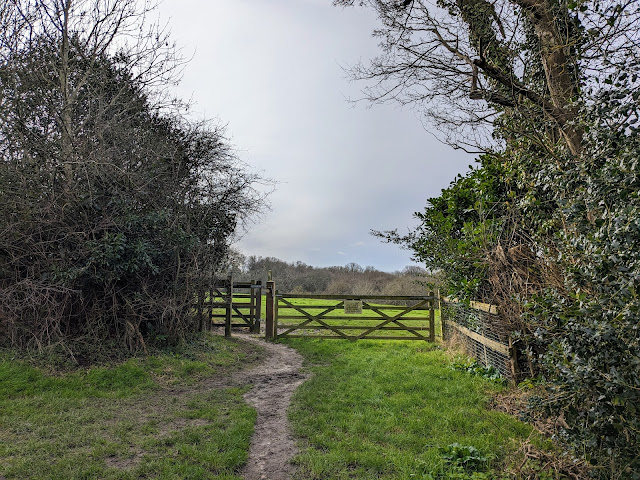
| Essendon footpath 13 approaching the end of the walk |
A pleasant circular that includes parts of a couple of shorter walks on this site, including
Walk 5: The River Lea Loop, hence the name 'long' because it's longer than the original walk. The walk starts and ends at The Candlestick, West End, and includes a stretch of a bridleway along the Lea Valley before returning via the outskirts of Essendon.
 |
| One of the Hatfield Park signs along the route |
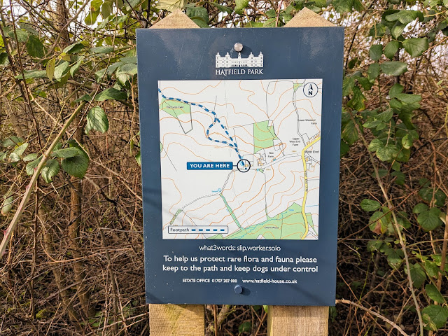
Along this route you will come across several signs informing you that you are crossing the Hatfield Park estate. But don't worry, this is not the section of the park for which there is an admission charge. Our route doesn't go into that area of the park and there is no charge for use public rights of way to cross the estate.
Getting there
The number 200 and 201 buses stop outside
The Woodman, Wildhill (location -
https://w3w.co/luxury.woods.march). Please check bus times at
Intalink. The landlord at The Woodman says walkers are welcome to use the pub car park if they intend to purchase refreshments before or after their walk.
Fly through preview of walk
If you want to check what sort of landscape you will be crossing before you set off on this walk you can view a short 3D video of the route below. It's created using the free version of
Relive.
Directions
 |
Map for Walk 36: Lea Valley Long Loop
Click on the map above for a larger version
Map created on Map Hub by Hertfordshire Walker
Elements © Thunderforest © OpenStreetMap contributors
There is an interactive map at the foot of this page |
Those with GPS devices can download
GPX or
KML files for this walk. We've added
What3Words location references for those who use that system. If you print these walks you might want to use the green
PrintFriendly icon at the bottom of these directions to delete elements such as photographs.
 |
| The Candlestick at West End, Essendon |
1: With your back to
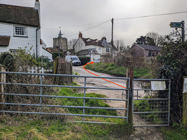
The Candlestick turn right then head N for 30m until you reach a lane on the left (location -
https://w3w.co/pets.ranked.heat), see image below.
 |
| Turn left on this lane then head WSW for 370m |
Turn left on this lane then head WSW for 370m, continuing until you reach the last cottage on the right and a footpath immediately after (location -
https://w3w.co/little.flips.leaves), see image below.
 |
| Turn right on Essendon footpath 11 |
2: Turn right on Essendon footpath 11. There are signs along several sections of this walk asking dog owners to keep their pets under control, see image below.
 |
| An area of rare flora and fauna |
Follow Essendon footpath 11 as it weaves in a north-westerly direction for 990m until you reach a gate and a stile (location -
https://w3w.co/trim.bath.fixed), see image below.
 |
| Continue heading N down a lane which is still Essendon footpath 11 |
3: Continue heading N down a lane, which is still Essendon footpath 11, for 450m until you reach Hill End Farm on the right (location -
https://w3w.co/gain.gravel.luxury). At this point the lane you are on crosses a parish boundary and becomes Hatfield footpath 96. Continue heading N for 440m until the lane bends to the left (location -
https://w3w.co/tame.sober.trail), see image below.
 |
| Turn right on Hatfield bridleway 75 |
4: Turn right on Hatfield bridleway 75 then head E for 100m at which point (location -
https://w3w.co/pump.snap.insect) the path becomes Essendon bridleway 6. Continue on Essendon bridleway 6 for 840m until you reach a junction (location -
https://w3w.co/curiosity.opera.beast), see image below.
 |
| Continue straight head E still on Essendon bridleway 6 |
5: Ignore the bridleway on the right then continue heading straight and E on Essendon bridleway 6 for 1.4km until the bridleway reaches a track (location -
https://w3w.co/marble.with.motor), see image below.
 |
| Turn right then head ESE for 30m until you reach Essendon Hill |
6: Turn right on the track then head ESE for 30m until you reach Essendon Hill, the B158 (location -
https://w3w.co/rising.stir.cool). Cross the road then turn right and walk up the pedestrian pavement heading S alongside Essendon Hill for 660m until you reach a footpath on the right (location -
https://w3w.co/live.lamp.raft), see image below.
 |
| Take Essendon footpath 5 on the right |
7: Take Essendon footpath 5 on the right then follow it diagonally SW and uphill across a field, see images below.
 |
| Follow Essendon footpath 5 diagonally SW and uphill across a field |
 |
| Head to the right of the last house |
Continue for 350m heading to the right of the last house where you will emerge on West End Lane (location -
https://w3w.co/look.tennis.cover), see image below.
 |
| Turn left on West End Lane then right on Essendon footpath 17 |
8: Turn left on West End Lane then walk SE for 30m until you reach Essendon footpath 17 on your right (location -
https://w3w.co/filer.really.torn).
Turn right on Essendon footpath 17 then follow it for 45m until you reach a gate (location -
https://w3w.co/worth.cliff.bells), see image below.
 |
| Go through the gate then head SW and downhill |
Go through the gate then head SW and downhill for 120m to another gate (location -
https://w3w.co/lift.pads.awards), see image below.
 |
| Go through the gate then continue on Essendon footpath 17 |
9: Go through the gate then continue on Essendon footpath 17 but now heading SE with the hedgerow on the left for 90m to another gate (location -
https://w3w.co/tunes.cycle.cakes).
 |
| Head SW and downhill on Essendon footpath 17 |
10: Go through the gate then continue on Essendon footpath 17 but now heading SW and downhill for 120m until you reach woodland (location -
https://w3w.co/flight.dogs.poem), see image below.
 |
| Go through the gate then turn right on Essendon footpath 13 |
11: When you reach the woodland turn right then follow Essendon footpath 13 SW for 400m through the woodland and downhill to a footbridge (location -
https://w3w.co/price.fight.sizes), see image below.
 |
| Cross the footbridge then climb the hill, still on Essendon footpath 13 |
12: Cross the footbridge then climb the hill, still on Essendon footpath 13, for 240m until you reach a T-junction (location -
https://w3w.co/sums.holds.ranch), see image below.
 |
| Turn left on Essendon BOAT 14 |
13: Turn left on Essendon BOAT 14 (
byway open to all traffic) then head S for 20m before turning right on Essendon footpath 13 (location -
https://w3w.co/storm.monday.season), see image below.
 |
| Follow Essendon footpath 13 NNW back to the starting point |
Follow Essendon footpath 13 NNW for 430m back to the starting point.
Interactive Map
.jpg)


Thank you so much for this. Just right for a slow Sunday afternoon walk. Loved the views from the start and then watching the fish in the River Lea. Well sign-posted walk. No diffculties. One downside might be the roar of the traffic on the A414 but it became easy to ignore after a while. Thanks again
ReplyDeleteGlad you enjoyed it. Yes, the A414 noise is annoying for a section of the walk but, like you, I am able to blank it out. Thanks for the feedback.
ReplyDeleteDavid
Did this walk today and it was very muddy in places but still very enjoyable and we met very few people. I think we've done it before in the summer without the mud. Yesterday we used Walk no 45 Tewin W-E Loop and that had great paths for muddy days. Any other walks you recommend that have good paths in the winter?
ReplyDeleteYou could try the latest walk we added last week, Walk 165: Amwell Loop. 3.6 miles with 150ft of ascent. Fairly good underfoot.
Deletehttps://www.hertfordshirewalker.uk/2021/12/walk-165-amwell-loop.html
David
Hi,
ReplyDeleteThat is a tricky one. So many paths that are dry in the summer are difficult in the winter. The four walks that feature Heartwood Forest at Sandridge might be okay. We walked in wellies today on a walk round Gobions Wood which was mud all the way.
David
Haha we've been on the Gobions Wood walk when its thick with mud and very slippery, but I suppose its good fun. Yes Heartwood is probably ok. We just love all your walks so thank you for listing them all.
ReplyDelete