4.6 miles (7.4km) with 102m total ascent
 |
| The River Mimram close to the village of Welwyn |
This walk starts in a small car park at the eastern end of the
Ayot Greenway then crosses some lovely rolling countryside before dropping down to
Welwyn, often called Old Welwyn, a village in the valley of the
River Mimram, where you will find several pubs, restaurants, cafes and shops selling refreshments. At a few sections of this walk you will be aware of the sound of the A1(M) and there is some urban walking as you enter and leave Welwyn. A couple of sections of the route can be muddy after rain.
Fly through preview of walk
If you want to check what sort of landscape you will be crossing before you set off on this walk you can view a short 3D video of the route below. It's created using the free version of
Relive.
Directions
 |
Map for Walk 12: Old Welwyn Loop
Click on the map above for a larger version
Map created on MapHub - copyright details here
There is an interactive map embedded at the end of these directions |
Those with GPS devices can download
GPX or
KML files for this walk. We've added
What3Words references for those who use that system. If you print these walks you might want to use the green
PrintFriendly icon at the bottom of these directions to delete elements such as photographs.
1: Park in the Ayot Greenway car park (location -
https://w3w.co/crowd.remedy.fixed) off Ayot St Peter Road. This car park, which is accessed along a track and then through a narrow gap between two poles, was free-of-charge when we revisited this walk in February 2024. Exit the car park through the narrow entrance then take the footpath on the left immediately after exiting the car park (location -
https://w3w.co/stow.vocal.dimes), see image below.
 |
| Turn left then follow Ayot St Peter footpath 11 |
Turn left on Ayot St Peter footpath 11 then head SW across an arable field for 150m until you reach the hedgerow (location -
https://w3w.co/cake.values.hoping), see image below.
 |
| Exit the field through the hedgerow |
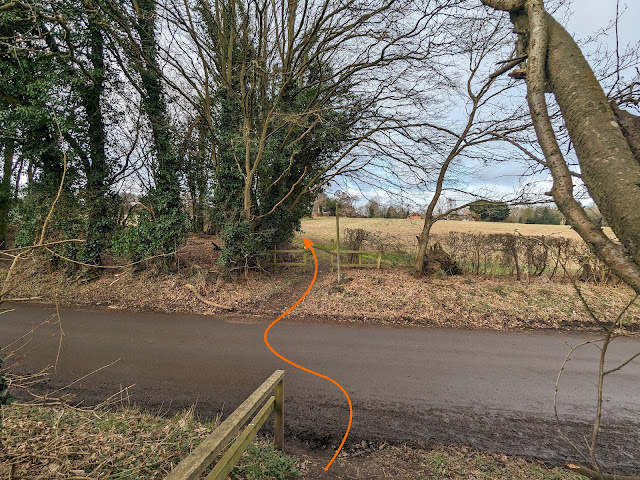
2: Exit the field through the hedgerow then drop down to Ayot St Peter Road. Cross the road then take the footpath directly opposite, Ayot St Peter footpath 14 (location -
https://w3w.co/wishes.hook.truly), see image below.
 |
| Follow Ayot St Peter footpath 14 as it heads WNW |
After crossing Ayot St Peter Road follow Ayot St Peter footpath 14 as it heads WNW for 220m then bends right then left (location -
https://w3w.co/heavy.badly.sums), see image below.
 |
| Turn left after the building |
3: Follow Ayot St Peter footpath 14 W for 15m until you reach a gravel drive in front of a house, keep right heading NW for 25m to reach Ayot Little Green Lane (location -
https://w3w.co/luxury.slip.valid), see image below.
 |
| Turn left on Ayot Little Green Lane |
Turn left on Ayot Little Green Lane then follow it WSW for 170m to a junction (location -
https://w3w.co/parade.sharp.crisis), see image below.
 |
| Turn right on Waterend Lane |
4: Turn right on Waterend Lane then head NW for 140m until you reach a footpath on the right (location -
https://w3w.co/salsa.dragon.kept), see image below.
 |
| Turn right on Ayot St Peter footpath 20 |
5: Turn right on Ayot St Peter footpath 20 then head NW for 280m down a pretty tree-lined path continuing until you leave the woodland and come to a fork (location -
https://w3w.co/lied.years.tile), see image below.
 |
| Head straight and N, still on Ayot St Peter footpath 20 |
6: Head straight and N, still on Ayot St Peter footpath 20, with the telegraph pole on the left and continuing for 60m until you reach a T-junction (location -
https://w3w.co/blitz.fluid.complains), see image below.
 |
| Turn right on Ayot St Peter Footpath 17 |
7: Turn right on Ayot St Peter footpath 17 then head E for 70m with the hedgerow on the left until the footpath bends left to cut through the hedgerow and meet
Ayot Greenway, which is the former branch line from Welwyn Garden City railway station towards Luton and Dunstable and now a leisure trail (location -
https://w3w.co/salt.rear.edit), see image below.
 |
| Cross Ayot Greenway then follow Ayot St Peter footpath 17 |
8: Cross Ayot Greenway then continue on Ayot St Peter footpath 17 following it to the right, see image below.
 |
| Continue on Ayot St Peter footpath 17 through Saul’s Wood |
Continue on Ayot St Peter footpath 17 heading N and NE through Saul’s Wood for 510m until you reach Ayot St Peter Road (location -
https://w3w.co/fans.sunset.feast).
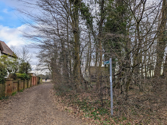
9: Turn right on Ayot St Peter Road then head SE for 10m looking for a footpath on the left immediately after School Lane on the left (location -
https://w3w.co/snows.goats.phones), see image below.
 |
| Turn left on Ayot St Peter Footpath 22 |
Turn left on Ayot St Peter Footpath 22 then head E for 155m until the footpath enters Gregg's Wood (location -
https://w3w.co/depend.upon.glare), see image below.
 |
| Follow Ayot St Peter Footpath 22 E through Gregg's Wood |
10: Follow Ayot St Peter Footpath 22 E through Gregg's Wood for 220m until you exit the woodland at a gate (location -
https://w3w.co/cycles.shakes.both), see image below.
 |
| Exit the woodland, still on Ayot St Peter Footpath 22 |
11: Exit the woodland, still on Ayot St Peter Footpath 22, then continue heading NE for 175m with the hedgerow on the right until you reach White Hill (location -
https://w3w.co/hugs.serve.melt).
12: Turn left on White Hill then head NE for 220m until you reach a footpath on your right (location -
https://w3w.co/apple.behind.calms), see image below.
 |
| Turn right off White Hill then take the footpath immediately on the left |
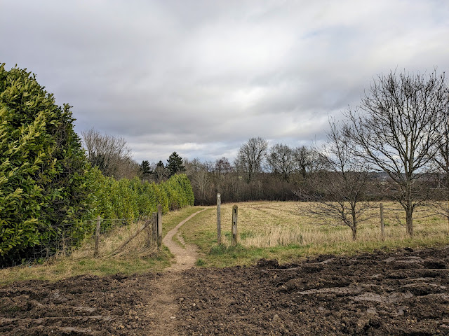
13: Turn right off White Hill then take the footpath immediately on the left. This is Welwyn footpath 43 which you follow NE diagonally downhill across an arable field which can be muddy after rain. Continue down this footpath for 330m until you leave the field (location -
https://w3w.co/points.flags.spoil), see image below.
 |
| Continue heading NE on Welwyn footpath 43 to a fork |
14: Continue heading NE on Welwyn footpath 43 for 50m until you reach a fork (location -
https://w3w.co/noting.trains.live), see image below.
 |
| Head NE on Welwyn footpath 43 to Ottoway Walk |
Ignore paths to your right and left and continue heading NE on Welwyn footpath 43 for 120m until you reach Ottoway Walk (location -
https://w3w.co/stray.turkey.voters).
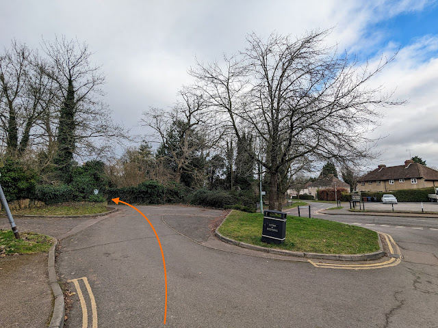
15: Follow Ottoway Walk, which is also Welwyn footpath 43, as it heads NE, with the playing fields on the left, for 270m until you reach Hobbs Hill on the left (location -
https://w3w.co/issues.cheek.fake), see image below.
The Steamer pub will be on your right (location -
https://w3w.co/slows.glee.given).
 |
| Turn left then continue on Welwyn Footpath 43 |
16: Turn left (see orange arrow on the photograph above) then continue on Welwyn Footpath 43.
 |
| Follow Welwyn Footpath 43 until you reach School Lane |
Follow Welwyn Footpath 43 NNW for 245m until you reach School Lane (location -
https://w3w.co/tags.arrow.safety).
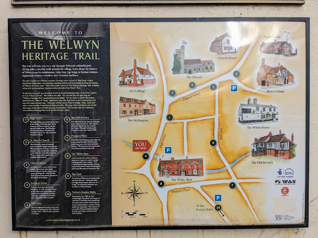
* At this point you can leave the walk to visit the old town of Welwyn where you will find several pubs serving food, cafe's and bakeries, and shops selling refreshments. The pubs include The White Hart (location - https://w3w.co/barn.dairy.silks), The White Horse (location - https://w3w.co/give.bids.notice), The Wellington (location - https://w3w.co/miss.minute.puns), and The Tavern (location - https://w3w.co/happy.bikes.recent). The cafes include Laura Kate (location - https://w3w.co/tile.hype.epic), Katie's Bakery (location - https://w3w.co/views.gown.camera), and Brew & Cru (location - https://w3w.co/guard.linen.pound). Please check opening hours if you are planning to take refreshments at the establishments mentioned. There is a 'Heritage Trail' through old Welwyn which those interested in history might want to explore (see image below)
 |
| The Heritage Trail in Welwyn |
17: If you don't take the detour into old Welwyn, turn left on School Lane then head SW for 330m, This is probably the least attractive part of the walk but it's necessary in order to create a loop through some lovely rolling countryside ahead. Continue until you reach a fork in the road (location
https://w3w.co/museum.ranch.employ), see image below.
 |
| Keep right at the fork, still on School Lane |
18: Keep right at the fork, still on School Lane, then continue heading in a south-westerly direction for 360m until you reach a footpath on the right (location -
https://w3w.co/haven.verse.palace), see image below.
 |
| Turn right on Ayot St Peter Footpath 3 |
19: Turn right on Ayot St Peter Footpath 3, then follow it NW for 105m until it bends left (location -
https://w3w.co/fact.woods.spout), see image below.
 |
| Continue on Ayot St Peter Footpath 3, now heading W |
20: Continue on Ayot St Peter Footpath 3, now heading W, for 280m to a footpath crossing (location -
https://w3w.co/mercy.blocks.green), see image below.
 |
| Continue on Ayot St Peter Footpath 3 |
21: Cross the junction and continue on Ayot St Peter Footpath 3 as it weaves its way in a westerly direction for 750m to a junction (location -
https://w3w.co/charge.nature.edgy), see image below.
 |
| Turn left on Ayot St Peter Footpath 7 |
22: Turn left on Ayot St Peter Footpath 7 then head S, with the hedgerow on your left, for 250m until you reach a cottage on your right and then Ayot St Peter Road (location -
https://w3w.co/royal.with.bikes), see image below.
 |
| Turn right on Ayot St Peter Road then head S |
23: Turn right on Ayot St Peter Road then head S, passing a churchyard on the left. This is not a busy road, but there isn't a pedestrian pavement so you will have to step on the grass verge if traffic approaches. Continue for 255m until you reach a right-hand bend. Here you leave the road and head for a gate (location -
https://w3w.co/spare.clouds.space), see image below.
 |
| Follow Ayot St Peter footpath 19 through a door |
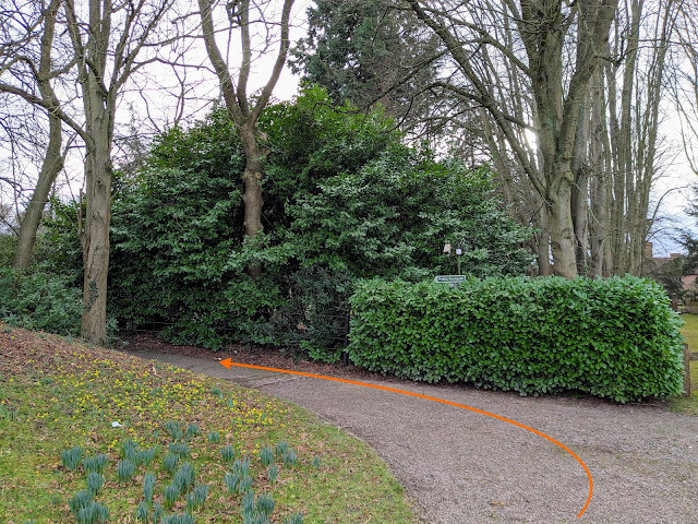
24: Follow Ayot St Peter footpath 19 through a door in the gate to a country house (see image above). Go through a second door then head SSW on Ayot St Peter footpath 19 until you reach a bend (location -
https://w3w.co/rents.villa.bars), see image below.
 |
| Turn left, still on Ayot St Peter footpath 19 |
25: Turn left, still on Ayot St Peter footpath 19 then head SSE for 180m until you reach a footpath on your left (location -
https://w3w.co/opens.start.cube), see image below.
 |
| Turn left on Ayot St Peter Footpath 18 |
26: Turn left on Ayot St Peter Footpath 18, then head SE across an arable field, see image below.
 |
| Follow Ayot St Peter Footpath 18 SE across an arable field |
Continue on Ayot St Peter Footpath 18 across the arable field for 345m until you meet Ayot Greenway at the junction you passed at point 8 in the walk (location -
https://w3w.co/late.discouraged.acted), see image below.
 |
| Turn left on Ayot Greenway |
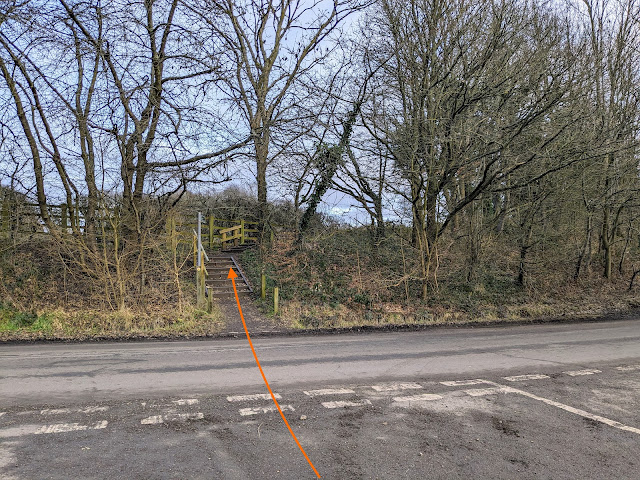
27: Turn left on the Ayot Greenway then follow it as it bends in a south-easterly direction for 490m until it meets Ayot St Peter Road (location -
https://w3w.co/closer.fully.polite).
 |
| Take the path on the left off the Ayot Greenway to reach Ayot St Peter Road |
 |
| Cross Ayot St Peter Road then take Ayot St Peter footpath 15 |
28: Cross Ayot St Peter Road then take the footpath on the other side, Ayot St Peter footpath 15, then follow it ESE for 230m back to the car park and the starting point (location -
https://w3w.co/grapes.sushi.short).
* There are two pubs close to the start/finish point. They are The Waggoners at Ayot Green (location - https://w3w.co/report.trip.stove) and The Red Lion on Digswell Hill (location - https://w3w.co/aspect.risk.edge).
Interactive Map


Another lovely walk David . Paths very much dry and clear . Chose to start in Old Welwyn at point 17 so we could stop at the end for food drink in the town afterwards. Cafe Brew & Cru was vg.
ReplyDeleteMick
Hi Mick, glad you enjoyed it and thanks for the cafe recommendation. David
DeleteReally enjoyable walk in the autumn sunshine. Probably gets muddy after the rain but perfect conditions today. Also stopped at Cafe Brew and Cru and agree with the comment above - it was very good and friendly too - great for a stop half way round.
ReplyDeleteHi Deborah, since Mick mentioned it, and now you have endorsed it, I have added Cafe Brew and Cru to the walk details. Glad you enjoyed it. Thanks for the feedback. David
DeleteA great walk in the sunshine today, also stopped for refreshments in Welwyn. Plenty of signs of spring. Enjoyed looking at Ayor St Peter's Church, beautiful Arts & Crafts building and the Old churchyard on it's former site.
ReplyDeleteI just finished this walk and it was absolutely lovely in the late afternoon summer sunshine. Ironically I have avoided it for years because I think the Ayot Greenway is the dullest walk in Hertfordshire (great for cycling though), and I only did it today because it was a convenient opportunity to test out the routing capability of my new smart watch, but I'm so glad I did. You're only on the Greenway for 5 mins and it's well worth it to experience the rest of the walk. The little church yard at point 23 has an interesting information board and is well worth a visit.
ReplyDeleteAnd you really spoil us David by offering the GPX and KML files as well - it worked a treat on my watch
Hi James, thanks for the feedback. So glad you enjoyed it. I hope the test run of the smart watch was a success. David
Delete