4.7 miles (7.5 km) with 67m of total ascent
 |
| Kimpton bridleway 5 approaching point 4 |
This lovely walk, with some excellent views south over the
River Lea valley, includes sections from five other routes in our collection, so regular followers of Hertfordshire Walker might find some of the junctions familiar. However, all the paths that appear in previous routes are walked in reverse, so the views are different and the whole experience feels new. A list of the five walks is included at the foot of these directions.
This route includes two sections of lane walking totalling about a mile (1.6km), but they are rural lanes which, when we tested the route, were quiet and felt safe to walk. The walk crosses
Gustard Wood Common, now a golf course, so be on the lookout for golf balls.
There is a local legend that the famous highwaywoman, the "Wicked Lady", generally believed (although only after her death) to have been
Lady Katherine Ferrers, carried out highway robbery in the area in the 17th century.
Getting there
There are bus stops on Kimpton Road at its junction with The Slype (location -
https://w3w.co/images.object.below) close to the start of the walk which are served by the number 45 and 304 buses. You can check bus times at the
Intalink site.
Fly through preview of walk
If you want to check what sort of landscape you will be crossing before you set off on this walk you can view a short 3D video of the route below. It's created using the free version of
Relive.
Directions
 |
Map for Walk 231: Gustard Wood West Loop
Click on the map above for a larger version
Created on Map Hub by Hertfordshire Walker
Elements © Thunderforest © OpenStreetMap contributors
There is an interactive map below these directions |
Those with GPS devices can download
GPX or
KML files for this walk. We've added
What3Words location references for those who use that system. If you print these walks you might want to use the green
PrintFriendly icon at the bottom of these directions to delete elements such as photographs.
 |
| The walk starts in a small car park off Lamer Lane |
The walk starts in a small car park off Lamer Lane in
Gustard Wood (location -
https://w3w.co/expand.hurt.bowls). The car park, which has space for about five vehicles, was free of charge at the time of writing (June 2023).
 |
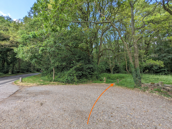
| Take the footpath in the NE corner of the car park |
1: From the NE corner of the car park off Lamer Lane (location -
https://w3w.co/major.slams.cotton) take the path that heads N for 142m to a junction (location -
https://w3w.co/afford.influencing.hips), see image below.
 |
| Turn left on Wheathampstead bridleway 101 |
Turn left on Wheathampstead
bridleway 101 then head N for 170m until you reach Ballslough Hill (location -
https://w3w.co/family.fumes.second), see image below.
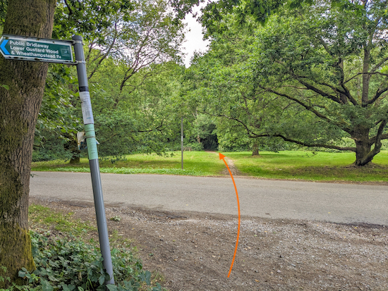 |
| Cross Ballslough Hill then continue on Wheathampstead bridleway 101 |
2: Cross Ballslough Hill then head NE. If you look to your right you will see
The Cross Keys (location -
https://w3w.co/motor.reason.doors) on the right.
 |
| The Cross Keys at Gustard Wood |
Continue, still on Wheathampstead bridleway 101, for 230m until you reach Kimpton Road (location -
https://w3w.co/gaps.fall.tells), see image below.
 |
| Cross Kimpton Road then turn right and head N on the left side of the road |
3: Cross Kimpton Road then turn right and head N on the left side of the road for 50m until you pass a bus stop then reach a
permissive path on the right across the road (location -
https://w3w.co/points.barks.orders), see images below.
 |
| Cross the road then turn left on the permissive path |
 |
| The entrance to the permissive path |
Turn left to follow the permissive path as it heads in a northerly direciton, with the hedge on the left and the field on the right. Continue for 735m until you reach a footpath junction (location -
https://w3w.co/funded.kick.owner), see image below.
 |
| Keep left at the junction, now on Kimpton bridleway 5 |
4: Keep left at the junction, now on Kimpton bridleway 5, then head NW for 20m until you reach Kimpton Road again (location -
https://w3w.co/stress.played.payer), see image below.
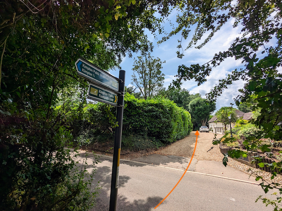 |
| Cross Kimpton Road then head SW along Kimpton footpath 48 |
Cross Kimpton Road then head SW down what looks like a private gravelled drive but which is also Kimpton footpath 48. Continue for 210m to where the footpath bends right (location -
https://w3w.co/bucked.apples.sparks), see image below.
 |
| Keep right, still on Kimpton footpath 48 |
Turn right, still on Kimpton footpath 48, then head NW for 370m, with the hedgerow on the right and field on the left, until you reach Porter's End Lane (location -
https://w3w.co/called.hosts.proper), see image below.
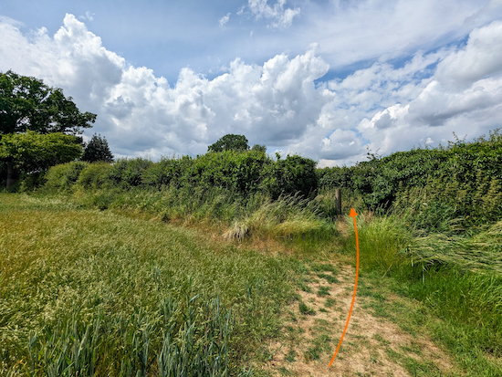 |
| Go through the gap in the hedge then turn left on Porter's End Lane |
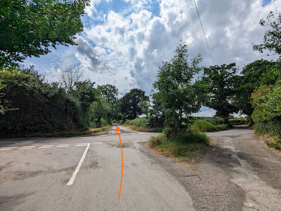
5: Turn left on Porter's End Lane then head SW for 1.1km until you reach a junction (location -
https://w3w.co/local.path.images), see image below.
 |
| Cross the junction then head SW along Mackerye End Lane |
6: Cross the junction then head SW along Mackerye End Lane for 290m until you reach a footpath on the left (location -
https://w3w.co/spring.bike.thick), see image below.
 |
| Turn left on Wheathampstead footpath 32 |
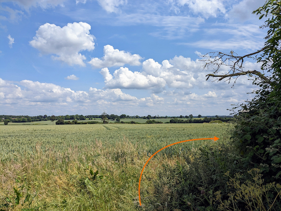
7: Turn left on Wheathampstead footpath 32 then head ESE for 270m until the footpath bends to the right (location -
https://w3w.co/sailor.mouth.tribe), see image below.
 |
| Turn right, still on Wheathampstead footpath 32 |
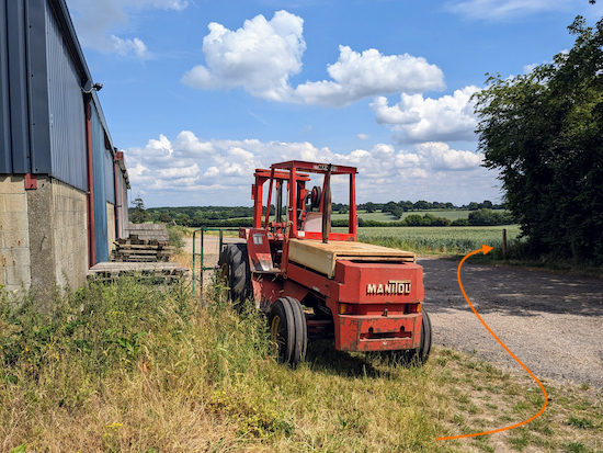
Turn right, still on Wheathampstead footpath 32, then head S for 135m until you reach Turnershall Farm on the left and a farm track (location -
https://w3w.co/ranks.boats.bill), see image below.
 |
| Turn left on the farm track then immediately right |
8: Turn left on the farm track then immediately right (see orange arrow on the photograph above) then continue heading S, now on Wheathampstead footpath 34, for 260m until you reach a byway (location -
https://w3w.co/desk.riders.sobs), see image below.
 |
| Cross the byway then head SSW on Wheathampstead footpath 29 |
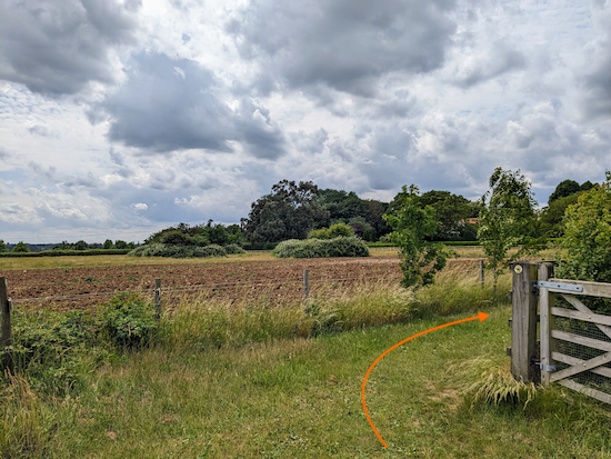
9: Cross the byway then head SSW for 225m on Wheathampstead footpath 29 to a bend (location -
https://w3w.co/begins.voices.salon), see image below.
 |
| Keep to your right as the footpath bends right |
Keep to your right as the footpath bends right then heads WNW for 80m before it bends left at a gate (location -
https://w3w.co/ended.museum.stole) then heads SSW for 130m until it reaches a lane called Mackerye End (location -
https://w3w.co/gown.finely.famous). Mackerye End is the name of a
Grade I listed building, a large manor house built in 1665 (location -
https://w3w.co/small.hammer.latter).
10: Turn left on the lane then follow it SE for 530m to a junction (location -
https://w3w.co/elbow.pound.fuzzy), see image below.
 |
| Turn right on Marshalls Heath Lane then take the footpath on the left |
11: Turn right at the junction on Marshalls Heath Lane then head S for 55m until you reach a footpath on the left (location -
https://w3w.co/public.front.ritual), see image below.
 |
| Turn left on Wheathampstead bridleway 10 |
Turn left on Wheathampstead bridleway 10 then follow it ESE and uphill for 295m until you reach a perfectly positioned bench on the left (location -
https://w3w.co/sharp.beams.expert), see images below.
 |
| The bench which has great views over the River Lea valley |
 |
| The view from the bench |
 |
| Wheathampstead bridleway 10 heading E after the bench |
Continue, now heading E then ENE on Wheathampstead bridleway 10 for 620m until you reach a junction (location -
https://w3w.co/inner.colleague.cope), see image below.
 |
| Turn left at the junction on Wheathampstead bridleway 58 |
12: Turn left at the junction on Wheathampstead bridleway 58 then head N for 270m until you reach a barn on the right (location -
https://w3w.co/hats.milky.probe), see image below.
 |
| Turn right, still on Wheathampstead bridleway 58 |
13: Turn right immediately before the barn, still on Wheathampstead bridleway 58, then head E (with the barn on your left) for 35m then turn left and head N (with the barn on your left) for 115m until you reach a junction (location -
https://w3w.co/tiger.transfers.vibrate), see image below.
 |
| Turn right on Wheathampstead bridleway 102 |
14: Turn right on Wheathampstead bridleway 102 then follow it E as it crosses a golf course. As you walk this stretch look to your left and right as you cross a couple of fairways. Continue on Wheathampstead bridleway 102 for 550m until you reach Lamer Lane (location -
https://w3w.co/grows.proud.things).
15: Turn left on Lamer Lane then head NNW for 95m until you reach a footpath on your right on the other side of the lane (location -
https://w3w.co/cones.mixer.penny), see image below.
 |
| Cross Lamer Lane then follow Wheathampstead bridleway 101 |
Cross Lamer Lane then turn left on Wheathampstead bridleway 101 and follow it N for 250m until you reach a path on the left (location -
https://w3w.co/order.boots.shins) leading to a picnic table, see image below.
 |
| Turn left then follow the track back to the car park |
Turn left then follow a track NW for 105m back to the car park and the start of the walk.
For those interested, the five walks that share various rights of way with this new route are:
Interactive map


Hi David Just looking at latest walk nice .sorry I think a techno error , interactive map has the Baldock walk attached .
ReplyDeleteThanks for letting me know. My mistake. I have fixed it now. Really appreciate you pointing it out. Thanks again. David
DeleteWe completed this very pleasant walk in lovely weather on Friday 11 August. Very well described as always. We particularly enjoyed the views from the bench mentioned at 11 whilst we had lunch.
ReplyDeleteHi Richard, so glad you enjoyed it. If you haven't already joined we have a great Facebook group where fellow walkers are sharing their walking experiences and photos. https://www.facebook.com/groups/hertfordshirewalker
DeleteDavid
When I downloaded the gpx file for this walk it has an extra loop across the middle and says it's 5.8 miles.
DeleteHi, thanks for letting me know. I had tested the GPX in Komoot and that extra line didn't show up, but when I tested it with the OS app it did. I have checked the file on MapHub and there was one line I had failed to delete when we mapped the walk. Thanks for pointing it out. I have edited the file now so it should be okay. I hope it didn't spoil your walk. David
Delete