6 miles (9.6 km) with 105m total ascent
 |
| Mymmshall Woods between points 10 & 11 |
This is a good hill walk that starts and finishes at Brookmans Park Station. At one point the route follows an old coaching road from South Mimms to North Mymms and crosses the secluded Potwells valley. There is a short part that is alongside the A1(M), but it is soon over.
Fly through preview of walk
If you want to check what sort of landscape you will be crossing before you set off on this walk you can view a short 3D video of the route below. It's created using the free version of
Relive.
Directions
 |
Map for Walk 16: North Mymms Ridge Loop
Click on the map for a larger version
Created on Map Hub by Hertfordshire Walker
Elements © Thunderforest © OpenStreetMap contributors
There is an interactive map embedded at the end of these directions |
Those with GPS devices can download
GPX or
KML files for this walk. We've added
What3Words references for those who use that system. If you print these walks you might want to use the green
PrintFriendly icon at the bottom of these directions to delete elements such as photographs.
The walk starts at
Brookmans Park Station. For those travelling by car there is restricted parking in Brookmans Park village with penalty notices issued at certain times of the day, but there is a pay car park at the station (location -
https://w3w.co/spring.round.pumps).
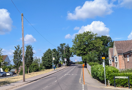 |
| Cross the railway bridge then turn right on Station Road |
1: From Brookmans Park village cross the railway bridge then turn right on Station Road. Head N along Station Road for 180m until you reach Bradmore Lane on the left (location -
https://w3w.co/float.smooth.woke), see image below.
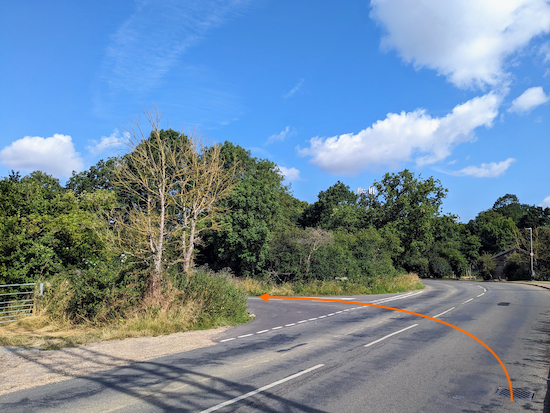 |
| Turn left then head W down Bradmore Lane |
Turn left then head W down Bradmore Lane. After 490m you will reach a footpath on the right (location -
https://w3w.co/woes.verbs.first), see image below.
 |
| Turn right on North Mymms footpath 7 |
2: Turn right on North Mymms Footpath 7 then walk through the hedgerow for 20m until you reach an open field (location -
https://w3w.co/unions.washed.ended), see image below.
 |
| North Mymms Footpath 7 crosses an arable field |
North Mymms Footpath 7 now heads in a westerly direction crossing an arable field (see the line of the orange arrow on the image below).
However this public right of way is is rarely reinstated after crops have been sown. We have reported this to Hertfordshire County Council's rights of way (ROW) team.
Your options are to follow the right of way in the direction of the orange arrow and trample the crop, or do what many walkers have done which is to keep to your left then walk round the edge of the field until you reach the point where North Mymms footpath 7 meets the hedgerow (location -
https://w3w.co/forced.wedge.coast), see map of the unofficial detour below.
 |
| Right of way in green, unofficial detour in orange |
When you reach the other side of the arable field continue on North Mymms footpath 7 heading W for 90m, with the hedgerow on the left and field on the right Continue until you reach the corner of a field (location -
https://w3w.co/unit.attend.pumps), see image below.
 |
| Keep right then head N, with the field on the right |
Keep right then head N, with the woodland on the left and field on the right, for 75m until you reach a footpath on the left heading into the woodland (location -
https://w3w.co/clip.lucky.melon). Ignore this path and continue heading N then NNE now on North Mymms footpath 32, with the hedgerow on the left and field on the right, for 135m until you reach a footpath on the left at the point where the path bends right (location -
https://w3w.co/robe.tests.wake), see image below.
 |
| Turn left on North Mymms footpath 30 |
3: Turn left on North Mymms footpath 30 then follow it SW for 95m through the woods to a footbridge (location -
https://w3w.co/motion.spend.nature), see image below.
 |
| Cross the footbridge then continue on North Mymms footpath 30 |
Cross the footbridge then continue, still on North Mymms footpath 30, until you reach a field (location -
https://w3w.co/smiles.newly.sleep), see image below.
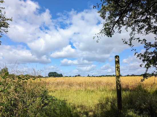 |
| Turn left at the field then head SSW |
Turn left at the field then head SSW for 100m until the footpath bends right (location -
https://w3w.co/fingernails.pace.motel), then head W for 190m until you reach the cycle track running alongside Swanland Road (location -
https://w3w.co/vouch.voted.undulation), see image below.
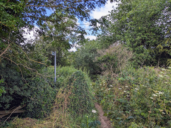 |
| Turn left on the cycle track then walk S |
4: Turn left on the cycle track then walk S for 190m until you reach the junction with Warrengate Road (location -
https://w3w.co/that.debate.smile).
* If you want refreshments you can turn left at this point and visit The Woodman Inn at Water End (location - https://w3w.co/talent.wonderfully.begin).
 |
| Cross Swanland Road at the junction then take North Mymms bridleway 82 |
5: Cross Swanland Road at the junction then take North Mymms
bridleway 82 (location -
https://w3w.co/foam.calm.fresh) which goes over the A1(M) via a footbridge.
6: When you reach the other side of the A1(M) follow the path as it curves right then right again before reaching Tollgate Road (location -
https://w3w.co/orbit.motion.head).
Turn right on Tollgate Road then head S for 40m, walking under the footbridge you just crossed and continuing until the road bends to the right and a byway heads S alongside the A1 (location -
https://w3w.co/tall.discouraged.cakes), see image below.
 |
| Follow North Mymms BOAT 5 |
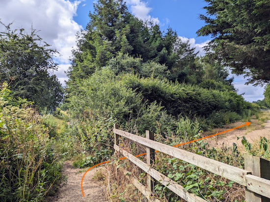
Follow North Mymms BOAT (
byway open to all traffic) 5 SSE along the W side of the A1(M) for 140m until you come to a bridleway on your right after a line of fir trees on the right (location -
https://w3w.co/wide.shut.sung), see image below.
 |
| Turn right then head SW on North Mymms bridleway 1 |
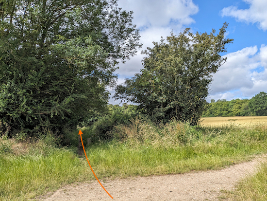
7: Turn right then head SW on North Mymms bridleway 1 for 770m until you reach a crossing in the track (location -
https://w3w.co/dairy.safe.span), see image below.
 |
| Continue heading SW, still on North Mymms bridleway 1 |
Continue heading SW, still on North Mymms bridleway 1, for 540m with Cangsley Grove on your right until you meet a footpath gate on your left (location -
https://w3w.co/bikes.speeds.often), see image below.
 |
| Turn left through the gate on North Mymms footpath 1 |
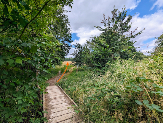
8: Turn left through the gate on North Mymms footpath 1 then head SW and diagonally downhill across a meadow for 130m to a footbridge (location -
https://w3w.co/mile.solar.album), see image below.
 |
| Cross the footbridge then climb uphill and head diagonally SW |
Cross the footbridge then climb uphill and head diagonally SW across a meadow for 340m until you reach North Mymms bridleway 2 (location -
https://w3w.co/chimp.cloth.hails), see image below.
 |
| Turn left on North Mymms bridleway 2 |
9: Turn left on North Mymms bridleway 2 then continue heading S through woodland.
I've often wondered whether this bridleway could have been the route referred to in Chapter VI of Dickens'
'Bleak House'? As a well-established byway at the time it is certainly one possibility.
"At Barnet there were other horses waiting for us, but as they had only just been fed, we had to wait for them too, and got a long fresh walk over a common and an old battle-field before the carriage came up. These delays so protracted the journey that the short day was spent and the long night had closed in before we came to St. Albans, near to which town Bleak House was, we knew."
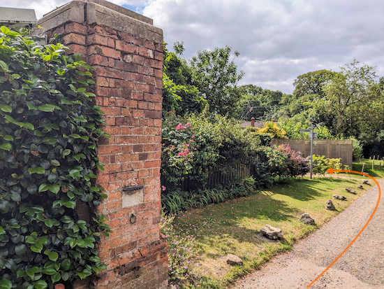
Continue along North Mymms bridleway 2 for 770m until it drops down to a cottage on the left and a byway on the left immediately after the cottage (location -
https://w3w.co/quit.shunts.people), see image below.
 |
| Turn sharp left on the track immediately after the cottage |
10: Turn sharp left on the byway immediately after the cottage (location -
https://w3w.co/finger.clay.quest) then follow Ridge
restricted byway 11 which soon becomes North Mymms restricted byway 3 after crossing the parish boundary.
Head NE for 1.7km through Mymmshall Wood and Hawkshead Wood eventually reaching a footpath leading to a footbridge over the A1(M) (location -
https://w3w.co/bottle.cake.sands) see image below.
 |
| Cross the footbridge over the A1(M) |
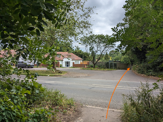
11: Cross the footbridge then follow the path round until you reach Swanland Road (location -
https://w3w.co/worked.circle.verge), see image below.
 |
| Cross Swanland Road then head E until you reach Warrengate Road |
Cross Swanland Road then head E down a lane for 75m until you reach Warrengate Road (location -
https://w3w.co/magic.prom.offers), see image below.
 |
| Turn left then head NNE along Warrengate Road |
12: Turn left then head NNE along Warrengate Road with the houses on your left and Mimmshall Brook on your right for 500m until you reach a footpath on the right (location -
https://w3w.co/elbow.tried.jazz), see image below.
 |
| Turn right then cross Mimmshall Brook on a footbridge |
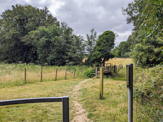
13: Turn right on North Mymms footpath 11 then cross Mimmshall Brook on a footbridge (look out for kingfishers at this point), then continue along an elevated wooden walkway.
Continue along North Mymms footpath 11 for 560m ignoring a footpath to your right (location -
https://w3w.co/oven.nerve.inspector) and passing Brick Kiln Wood on your left. Follow this path until you reach a gate (location -
https://w3w.co/refers.change.driver), see image below.
 |
| Go through the gate, turn right, then cross a footbridge |
14: Go through the gate, turn right, then cross a footbridge (location -
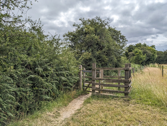
https://w3w.co/sides.match.salad). After crossing the footbridge, turn left then follow the footpath as it heads E for 300m, with the hedgerow on the left and field on the right. Continue until you reach a gate (location -
https://w3w.co/senior.ending.stores), see image below.
 |
| After going through the gate turn left then cross a footbridge |
15: After going through the gate turn left, cross another footbridge, then follow the footpath, North Mymms footpath 9, NE for 570m until you reach Station Road (location -
https://w3w.co/pardon.trash.train). Cross Station Road then turn right and head back to Brookmans Park Station.
Interactive Map


Hi David, Footpath 8 off Bradmore Lane is blocked at the moment by flytipping. I have reported it on the council's website. It meant I had to go back and take the earlier path that you mention. I went round the outside of the field so wasn't too bad. Enjoyed the rest of the walk - I don't think I saw a single person - my ideal walk!
ReplyDeleteHi Emma, thanks for the tip. What a pity. Well done reporting it. David
ReplyDelete