5.1 miles (8.2 km) with 115m of total ascent
 |
| A narrowboat on the Grand Union Canal |
There is a cafe at the Wigginton Village Shop at the start and finish point as well as a pub, The Greyhound. We have another walk from Wigginton, Walk 159: Wigginton South-West Loop.
Getting there
There are bus stops close to The Greyhound at the start of the walk (location - https://w3w.co/inspected.masterful.guard), which are served by the numbers 199 and 397 buses. There are also bus stops in the village served by the 207 and 398. You can check bus times at Intalink.
Fly through preview of walk
If you want to check what sort of landscape you will be crossing before you set off on this walk you can view a short 3D video of the route below. It's created using the free version of Relive.
Directions
GPX or KML files for this walk. We've added What3Words location references for those who use that system. If you print these walks you might want to use the green PrintFriendly icon at the bottom of these directions to delete elements such as photographs.
 |
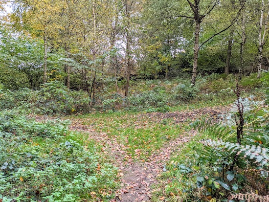
| Wigginton footpath 8 heading E from Chesham Road - point 1 |
 |
| The gate leading to Lower Wood - point 2 |
 |
| When the path splits, keep to the left on Wigginton footpath 8 - point 3 |
4: Turn right at the junction, then head SSE on Wigginton footpath 11 (which becomes a concrete track) for 130m until you reach Crawley's Lane (location - https://w3w.co/rural.imply.offshore). Turn left on Crawley's Lane, then follow it NE for 110m as it passes under the A41.
5: After walking under the A41, look out for a byway on the right, 50m after the underpass (location - https://w3w.co/reverted.drifting.conned).
 |
| Take the second path through the gate of Tinkers Lodge |
6: Turn right on Tring Road, then head SE for 40m looking out for Wharf Lane on the left (location - https://w3w.co/captive.diets.highlighted). Head ENE along Wharf Lane for 70m until you cross the Grand Union Canal (location - https://w3w.co/accompany.policy.irrigate).
 |
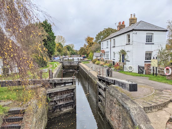
| Cowroast Lock on The Grand Union Canal |
 |
| The sign at Cowroast Lock |
7: Continue under the bridge then take the steps on your right immediately after the bridge and climb them to reach Station Road. Turn right on Station Road, then cross the bridge and head S for 20m until you reach Beggars Lane on the left (location - https://w3w.co/intervals.dwarf.dive). Head S on Beggars Lane for 160m looking out for a footpath on the right (location - https://w3w.co/status.paradise.shook).
 |
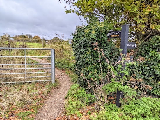
| Aldbury footpath 66, which is also The Ridgeway leaving Beggars Lane |
8: Turn right on Aldbury footpath 66, which is The Ridgeway, then head SW for 800m until you reach the A4251 (location - https://w3w.co/defrost.generally.daisy).
 |
| Cross the A4251 to reach Wigginton footpath 14 |
10: Turn right on The Twist then head NW for 15m looking out for a footpath on your left (location - https://w3w.co/quality.caressed.lemons). Take this path, Wigginton footpath 20, then follow it SSW for 160m before it swings to the right then heads W for 320m before reaching Fox Road (location - https://w3w.co/opts.wooden.backed).
 |
| Turn left on Tring Town footpath 80 then head SSE |
12: Cross Upper Tring Park then continue heading SSE for 110m, still on Tring Town footpath 80, until the path bends to the right, then to the left and continues for 400m until it reaches Wick Road (location - https://w3w.co/announced.infringe.storage).
13: Turn left on Wick Road, then follow it ENE for 250m looking out for a footpath on the right after Wigginton recreation ground.
14: Take this footpath, Wigginton footpath 9, then head S for 100m, passing The Wigginton Village Shop and cafe on the right, before reaching Chesham Road where you turn left and head back to The Greyhound.


Did this walk from Wiggington today and really enjoyed it. Great variety with fields, woods and canals and stopped at the Village Shop and Cafe at the end for a delicious coffee and cake. Excellent instructions and we will certainly do this one again. Thanks for listing it. (Not sure if the print facility is there at the bottom of the page?)
ReplyDeleteHi,
ReplyDeleteGlad you enjoyed it. Are you trying to print from the web or from mobile? The print facility is just below the interactive map at the bottom of the page on the online version of the site. Just click on the green 'PrintFriendly' icon then delete any elements you don't want before printing.
If you are trying to print from the mobile, click the three dots at the top right of the walk page then click on 'desktop version'. When it loads scroll down to the green Printfriendly icon below the interactive map and click it. Once Printfriendly loads, scroll through clicking on any elements, such as photos, that you don't want to print (in order to save trees), and then click print making sure your mobile has a wifi link to a printer.
Hope that helps.
Thanks again for your feedback.
David
I usually use the icon at the bottom of the page on the web version but couldnt see it for this walk.....
DeleteSorry to hear that. I have checked three times and the share bar is there beneath the interactive map at the bottom of the page.
DeletePlease try clearing your cache and then refresh the page. Perhaps it's a cacheing issue on your computer?
David
Thanks for your help. I've realised the icons etc are missing because of all the privacy and security software my sons has recently put on the computer🙄
DeleteAh, thanks for explaining. Yes, privacy software can limit sharing functionality. Glad you found the reason.
ReplyDeleteDavid