Welcome to Hertfordshire Walker

Download and enjoy our FREE walks

Showing posts with label 25m-50m. Show all posts

Walk 299: Thorley West Loop

4.9 miles (7.9 km) with 43m of total ascent


Looking back along Thorley footpath 13 before point 23
This is an excellent walk for those fascinated by WWII archaeology. You will cross what was once RAF Sawbridgeworth. You will walk along parts of the airfield's perimeter track, pass some aircraft parking bays, as well as a few wartime buildings on the Woodside Trading Estate and Shingle Hall Farm. You will also pass a WWII pillbox.

Walk 298: Bury Green Loop

5.7 miles (9.3 km) with 48m of total ascent


A footpath at point 8 in the walk
This is a great walk for lovers of 'chocolate box' cottages. The picturesque hamlet of Bury Green where the walk starts is full of them. You will then walk across some wonderful rolling countryside with excellent views. You will cross several livestock fields, including one with a broken 'Bull in Field' sign. We didn't see a bull but we did see cattle in the distance. There is an optional detour which we haven't tested. You will also walk around the edge of a polo field where you might spot a polo match taking place.

Walk 292: Panshanger Park Boundary Loop

3.9 miles (6.3 km) with 49m of total ascent


Looking towards the River Mimram at point 8
This is another walk in the beautiful Panshanger Park. We have several walks in this area. Unlike the others, this walk enters the park in the north-west corner then follows the boundary of the park making a loop round the ecologically important River Mimram. 

Walk 291: Stapleford West Loop

2.8 miles (4.5 km) with 38m of total ascent


Stapleford footpath 4 between points 7 & 8
This short walk south and west of Stapleford includes public rights of way that have not featured in our collection before. The wide open views to the west of the River Beane are excellent. There is also a lovely stretch of the route alongside the River Beane which those who are working through our collection of walks might recognise.

Walk 273: Radwell Meadows East Loop

1.8 miles (2.9 km) with 27m of total ascent


The footpath between points 9 & 10
This is a lovely short walk for the summer months when the fields at Radwell Meadows Country Park are ablaze with wildflowers, and butterflies follow you along the footpaths. It's ideal for those who like shorter walks with minimal up and down. The route loops through the meadows in the River Ivel valley crossing the river twice.

Walk 268: Rabley Heath South Loop

3.6 miles (5.8 km) with 43m of total ascent


Knebworth footpath 10 towards the end of the walk
This is a lovely gentle circular walk along well-defined paths over undulating countryside with some great views. At various points you will be serenaded by the sound of skylarks above, broken only by the occasional plane. The route involves some lane walking, but they are quiet lanes and there are verges where you can stand to one side if needed. We met three cars only.

Walk 252: Gustard Wood South-East Loop

3.7 miles (5.9 km) with 44m of total ascent


Wheathampstead footpath 42
This is a lovely walk exploring the countryside to the south-east of Gustard Wood near Wheathampstead. We added this short route to the collection because it follows a number of public rights of way not visited by any of our other loops that feature Gustard Wood.

Walk 239: Willows Lakes West Loop

3.5 miles (5.6km) with 27m of total ascent


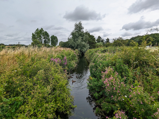
The River Colne at Willows Lakes

This walk starts in Colney Heath then circles Willows Lakes, a series of former quarries which are now part of a private fishery. It's a great walk for anyone interested in wild flowers, butterflies, and bird spotting. The route follows public rights of way around the site and keeps away from the private footpaths which are accessible to anglers only.

Walk 238: Hertford Heath South-East Loop

2.7 miles (4.3km) with 47m of total ascent


Hertford Heath bridleway 4 between points 15 & 16
Hertford Heath bridleway 4 between points 16 & 17
This short loop follows both public rights of way and other trails across Hertford Heath, Golding's Wood, and Much Wood. Those with children might enjoy exploring 'Hertford Heath Fairy Trail' between points 5 & 6 on the walk. The walk starts and finishes at The Goat pub/restaurant and passes close to The College Arms.

Walk 234: Northaw Great Wood Red Trail

0.75 miles (1.18km) with 28m of total ascent


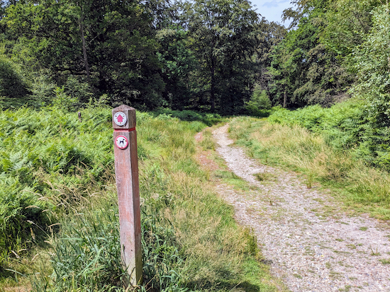
The red trail at Northaw Great Wood
This is one of the shortest walks on Hertfordshire Walker and is one of three in Northaw Great Wood. It's ideal for those who are unable to walk a great distance and need easy access to the trails from a car park. However the red trail, although short, does involve some up and down with a total ascent of 28m. Some of the paths can be muddy after rain. The route has plenty of shade if you want to escape the heat.

Walk 233: Northaw Great Wood Blue Trail

1.45 miles (2.33km) with 43m of total ascent


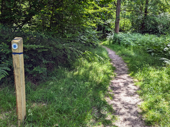
A sign post along the blue trail in Northaw Great Wood
The blue trail at Northaw Great Wood is ideal for those who want a shady walk with easy access from a car park. It loops inside the longer yellow trail and circles the shorter red trail. All three trails are signposted but not all forks are marked, which is why we have created separate walks for all three with GPX navigation files which you can use to follow the routes on a compatible mobile device.

Walk 230: Welwyn Garden City Short Loop

2 miles (3.3 km) with 42m total ascent


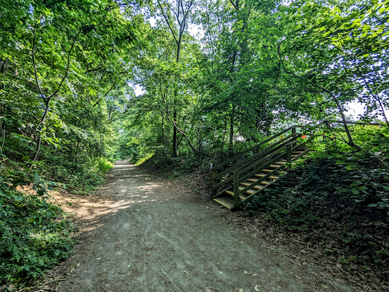
The Ayot Greenway through Sherrardspark Wood
We've had many requests for walks in the shade and for walks on the flat, so we decided to add this short walk to try to meet both needs. The route starts and finishes in the car park at Campus West in Welwyn Garden City then heads west along the eastern section of Ayot Greenway through Sherrardspark Wood, which is one of Hertfordshire's largest and most important oak and hornbeam woodlands, before returning the same way.

Walk 217: Bramfield South-East Loop

3.2 miles (5.2 km) with 29m of total ascent


Bramfield bridleway 9 between points 5 & 6
This is our fourth walk from Bramfield, this time exploring the countryside to the SE of the village. We have created this route in response to a request in our recent survey for shorter and flatter walks. The route crosses several arable fields. Some of the paths will get ploughed over at certain times of the year and walking can be difficult until the rights of way are reinstated. The walk passes The Grandison pub/restaurant close to the finish. To see all our walks from Bramfield click here.

Walk 214: Great Amwell Riverside Loop

5.7 miles (9.2 km) with 38m of total ascent


The New River path close to the start/finish point
This walk follows two riverside long-distance paths. You will head north-west on the New River Path and then south-east along the River Lee Navigation Path. The route passes close to two villages that are named in the Domesday Book, Great Amwell (Emmewell) and Stanstead Abbotts (Stanstede).

Walk 211: Wormley West Loop

3.7 miles (6 km) with 27m of total ascent


The path through Bencroft Wood at the start of the walk
This is a lovely walk following trails through deep woodland, passing through nature reserves and crossing arable farmland. There are a few sections in the woods where leaves and fallen trees can obscure the route. If you have a smartphone with GPS you will find the free navigation files helpful in such cases. I have added photographs to my description of the route to try to clarify certain turning points in the woodland.

The route crosses one livestock field where horses were grazing when we tested the walk. You will walk past The Woodman & Olive pub/restaurant at Wormley West End. There is also a short section where a public footpath is in the process of being rerouted. I have provided maps to show the current status of the right of way. The starting point for the walk is three miles W from Broxbourne Station by road.

Walk 192: Burnham Green West Loop

3.5 miles (5.7 km) with 36m of total ascent


Datchworth footpath 16 at the start of the walk
This walk offers a great mix of wide open views, at the beginning and towards the end, as well as shaded sections through woodland. It starts at The White Horse in Burnham Green then cuts through Harmer Green Wood before looping back via Harmer Green. 

Walk 187: Ickleford North Loop

6.3 miles (10.1 km) with 43m of total ascent


Cross the footbridge then head NNW across the field
 
This is our third walk from Ickleford, this time exploring the countryside to the NW of the village following well-defined footpaths and bridleways over rolling countryside with excellent views. There is one short stretch along a main road, but it is along a pedestrian footpath and takes about five minutes. The walk starts outside The Plume of Feathers pub. There is a second pub, The Old George, a short detour from the start/finish point.

We have been informed that Holwell footpath 2 at point 9 in these directions will be closed until 22 May 2025, which means you will have to do a lot of walking along a busy A-road. So we suggest you save this walk until later in the summer. You have 294 other walks to choose from.

Walk 184: Tyttenhanger Green Loop

5.1 miles (8.2 km) with 34m of total ascent


Photograph taken along the way Image courtesy of Emma Boylan
The view between points 4 & 5
Image courtesy of Emma Boylan
This walk includes a section of The Alban Way which is the route of the former Hatfield to St Albans branch line. If you are interested in the history of the Hatfield to St Albans branch line we have embedded a video at the foot of these directions. The route for this walk passes close to two pubs, both called The Plough, one in Sleapshyde and the other in Tyttenhanger Green. The start of the walk is 3.5 miles WSW of Hatfield station by road. You will be aware of the A414 for much of this walk.

Walk 140: Ashwell West Loop

6.9 miles (11 km) with 47m of total ascent


Ashwell restricted byway 2
The bridleway heading towards Arbury Banks Hill Fort
This is an excellent walk for those who want wide open views across unspoilt countryside. The walk passes by or close to four pubs, and you will walk alongside the site of Arbury Banks, a series of iron-age hillforts. There is little shelter along the way, so this might not be great in bright sunlight, heavy rain, or howling gales.

Walk 120: Ver Valley Loop

3.9 miles (6.3 km) with 39m of total ascent


Moor Mill at the start of the walk
This walk explores the part of the Ver Valley south of St Albans and north of the M25 as well as an area south of the motorway. It’s a walk rich in history with the route passing a former Belgic settlement where the Romans built a villa. As the route crosses the M25 the area around the motorway is a bit messy and noisy, but the walk is worth doing because of the importance of the history and the fact that the River Ver is one of only 200 chalks streams in the world.

Facebook group rules

Facebook group rules
We have set 10 rules for our Hertfordshire Walker Facebook group which are designed to help keep the group focused on walking in the Hertfordshire countryside

Promoted charity: The Trussell Trust

Promoted charity: The Trussell Trust
Supporting those locked in poverty

Search This Site