Welcome to Hertfordshire Walker

Download and enjoy our FREE walks

Showing posts with label 175m-200m. Show all posts

Walk 296: Hitchwood Long Loop

7.2 miles (11.6 km) with 186m of total ascent


The bridleway between points 18 and 19
This is a walk for lovers of wide open spaces. It offers amazing views as it crosses the undulating countryside north-east of Hitchwood. The route follows well-defined rights of way and some quiet country lanes as it weaves its way past Rush Green and St Paul's Walden. The walk passes two pubs along the way.

Walk 154: Whitwell Loop

7.2 miles (11.5 km) with 188m of total ascent


St Paul's Walden restricted byway at point 7
This walk circles the village of Whitwell, following footpaths, bridleways, and byways, over rolling hills with views across open countryside. It has a fair amount of up and down as it crosses the River Mimram twice before dropping down towards Kimpton then looping back. The walk starts and finishes at The Bull Inn, Whitwell, then passes close to The Strathmore Arms at St Paul's Walden.

Walk 146: Flamstead West Loop

8.6 miles (13.8 km) with 179m of total ascent


Flamstead footpath 47 between points 7 & 8
This is an excellent walk that starts along narrow footpaths and continues along bridleways with wide, open views across the north-west Hertfordshire countryside. There is some great scenery and, when we walked in July 2021 the hedgerows were ablaze with wild flowers. There is a short stretch of lane walking between points 16 and 17, but it's a quiet lane and we were passed by one car only.

Walk 122: Therfield North Loop

6.1 miles (9.7 km) with 174m of total ascent


View between points 2 and 3
This walk offers wide open views across the NE Hertfordshire countryside and passing through the beautiful landscape around the Pen Hills. On a clear day you are supposed to be able to see Ely cathedral from one of the highest points. There is plenty of up and down so you need to be fairly fit. The walk starts and finishes at The Fox and Duck pub/restaurant in Therfield.

Walk 116: Frithsden North-West Loop

5.9 miles (9.5 km) with 176m total ascent

Great Gaddesden bridleway 10 mentioned in point 4 below Image by Hertfordshire Walker released via Creative Commons BY-NC-SA 4.0
Great Gaddesden bridleway 10 mentioned in point 4
This walk mixes woodland, hills, valleys, cute hamlets, and open views across the undulating Hertfordshire countryside. It starts and ends at a pub. The route passes through Frithsden Beeches. Be prepared for several ups and downs; you need to be able to climb hills for this walk. And it can be muddy in places, so if you are worried about slipping you might want to take a stick. The walk crosses a golf course.

Walk 78: Welwyn North-East Loop

7.6 miles (12.3 km) with 188m of total ascent


Photograph taken along the route of Walk 78: Welwyn NE Loop  by Hertfordshire Walker released under Creative Commons BY-NC-SA 4.0
 
This walk offers some really good ups and downs with a steady climb at the halfway point, a pub two-thirds of the way round, a stretch that will fascinate train lovers, and wide, open fields with excellent views. There is some walking along quiet country lanes.

Walk 65: Mimmshall Brook Loop

8.4 miles (13.6 km) with 177m total ascent


View along Mimmshall Brook
 
This walk retraces parts of the route of a Victorian ramble through North Mymms written in 1893. We've adapted it considerably, and have chosen public footpaths to avoid main roads. Along the route you will come across a bridge over Mimmshall Brook which is said to be haunted by the ghosts of Dick Turpin and a local witch, and is plagued by a swarm of 'repulsive' black flies. But don't worry, we didn't see a thing when we visited.

Walk 53: Essendon East Loop

6.5 miles (10.5 km) with 194m total ascent


Photograph of the footbridge on Walk 53: Essendon East Loop
The stile at point 8 in the walk
This walk from Essendon heads to Howe Green then on to Bayford before passing Little Berkhamsted then looping back to Essendon. The route crosses Essendon golf course twice and includes a fair amount of up and down. There are two pubs along the way.

Walk 34: Essendon South Loop

6 miles (9.6 km) with 186m total ascent


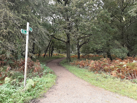
The ridge between point 7 and 8
This walk is a combination of two of our shorter walks which links the paths around Wildhill to those north-east of Little Berkhamsted. You might get muddy if you are walking after rain because there are two paths along the way that can get churned up. There are some nice views between points 7 and 8.

Walk 23: Hatfield-Wildhill-Brookmans Park

8.5 miles (13.7 km) with 182m total ascent


Image taken along Walk 23: Hatfield-Wildhill-Brookmans Park by David Brewer and released under Creative Commons
 
A station-to-station linear walk from Hatfield station, along the Lea Valley and over to West End, Essendon and then via Wildhill to Brookmans Park. Ideal if you want to leave the car at home and have a few pints along the way. The route can be muddy in places after rain. Some gentle hill climbing involved.

We have archived this walk becaue the crossing of the A414 dual carriageway at point 6 has become too dangerous. Sorry about that. Please choose another walk from the 290+ that are free to download. Thanks.

Facebook group rules

Facebook group rules
We have set 10 rules for our Hertfordshire Walker Facebook group which are designed to help keep the group focused on walking in the Hertfordshire countryside

Promoted charity: The Trussell Trust

Promoted charity: The Trussell Trust
Supporting those locked in poverty