5.3 miles (8.4 km) with 119m of total ascent
 |
| Knebworth footpath 25 at point 8 |
You will walk through the grounds of the Knebworth House estate on public rights of way. You do not have to pay an admission charge to use the public footpaths that cross the estate so long as you don't stray from them and don't visit any of the estate facilities, which includes the cafe and toilets.
The Knebworth House Estate stages concerts and other events, and, in some cases, the public rights of way will be closed while events take place. Please check on the estate's website before you set off to avoid disappointment.
Several fields along the route have been left uncultivated, resulting in an abundance of wild flowers, bees, and butterflies. We saw several Speckled Wood and Meadow Brown butterflies along this stretch. You will also pass through woodland with three ancient burial barrows from the Bronze Age and Roman period - all listed by Historic England. As with Walk 76, this walk starts and finishes at the Lytton Arms.
Getting there
There are bus stops near Manor Farm in Old Knebworth (location - https://w3w.co/waddle.sticky.bound), which is served by the number 44 bus. You can check bus times at Intalink.
Fly through preview of walk
If you want to check what sort of landscape you will be crossing before you set off on this walk you can view a short 3D video of the route below. It's created using the free version of Relive.
Directions
 |
| Map for Walk 156: Old Knebworth North Long Loop Click on the map for a larger version Created on Map Hub by Hertfordshire Walker Elements © Thunderforest © OpenStreetMap contributors There is an interactive map below these directions |
1: As you face the Lytton Arms take the footpath that runs down the left (NE) side of the pub (location - https://w3w.co/never.aspect.artist). This is Knebworth footpath 14 which you follow ESE for 130m to a footpath crossing (location - https://w3w.co/translated.basis.mouth).
Continue heading straight ESE, still on Knebworth footpath 14, through the crop until you reach a footpath T-junction (location - https://w3w.co/window.noted.count) in the middle of the field.
2: Turn left on Knebworth footpath 13, then head N for 390m until you reach Park Lane (location - https://w3w.co/deeper.waters.scam).
3: Turn right on Park Lane then walk ESE for 150m until you reach the point where the lane narrows just before the houses on your left. Cross the lane then take the footpath just before the first house (location - https://w3w.co/feared.cube.lung).
4: Head NNE along Knebworth footpath 16 for 530m first passing a play area on your right. Go through a gate then continue through the next field with the hedgerow on your left and the field on your right. Continue with Cowpasture Wood on your left and a field on your right until you reach the corner of the field where you go through a gate (location - https://w3w.co/forced.full.lifted).
Turn left, still on Knebworth footpath 16, and, keeping the woodland on your left and field on your right, head NW. When you reach the corner of the field continue straight and uphill ignoring the path on your right until you reach Old Knebworth Lane (location - https://w3w.co/maps.recent.shared).
5: Across the lane and almost opposite to your left, you will see a gate leading to the Knebworth House estate.
Please read the sign on the gate which contains a number of rules and requests for walkers using the public footpaths that cross the estate. A photograph of the sign is below, but I have copied it for those who want to print these directions without the images.
 |
| Photograph of deer at Knebworth courtesy of Sarah Hurst-Cox |
Notice to Footpath Walkers
You are most welcome to enjoy the Footpaths, we simply asked that you stay on them, and keep all dogs on leads. If you are tempted to use our facilities, further explore the park, gardens, special events, and playground, please be honest and buy a ticket. We do check tickets. Not only will this help support the future of the park, but it enables us to insure your safety. Have a good day!
 |
| The notice to walkers on Knebworth House estate |
* At some point along this path you might meet a member of staff checking for tickets. If you are a legitimate walker passing through you do not need one, but staff are employed to check that people are in fact passing through the estate on the public rights of way rather than visiting the house and grounds.6: The path enters the churchyard via a gate and emerges the other side to the left of the church, also via a gate (location - https://w3w.co/digits.hook.rocky).
Continue heading W, now on Knebworth footpath 19, for 140m with Knebworth House on your left, until you reach the estate road (location - https://w3w.co/dollar.things.locked). At the crossroads head NNE on Knebworth footpath 21 down an avenue of trees for 350m in the direction of the distant woodland.
 |
| Knebworth House viewed from point 5 above |
Follow Knebworth footpath 22 as it heads WSW with the woodland on your right and the fields on your left for 120m. At the point where the path forks, take the right-hand fork (location - https://w3w.co/bids.scarcely.paused), see image below.
 |
| Knebworth footpath 24 heading into woodland |
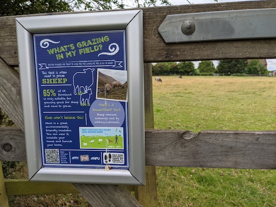
Alongside the footpath you will see the first of several noticeboards that explain how the fields you are passing are being used.
 |
| The first sign alongside Knebworth footpath 24 |
 |
| The second sign alongside Knebworth footpath 24 |
 |
| Go through the gate then turn right heading to the left of the building |
9: Turn left on Knebworth footpath 27, then head NW across a field for 270m until you reach the hedgerow and a footpath junction (location - https://w3w.co/fakes.blur.skips).
10: Turn right at the hedgerow then head NE for 40m, now on Knebworth footpath 28, until the path swings to the left (location - https://w3w.co/skins.proper.wing). At this point the path becomes Langley footpath 13 and heads NW for 380m to a junction (location - https://w3w.co/hardly.zooms.sleepy).
When we walked this route in late August 2021 the field was ablaze with wildflowers which were attracting various butterflies, including a Speckled Wood butterfly, see image below, and a Meadow Brown.
 |
| Speckled Wood butterfly alongside Langley footpath 13 |
12: Cross the road then take Langley footpath 8 heading SW for 430m until you cross the parish boundary (location - https://w3w.co/zone.calls.asset) at which point the path you are on becomes Knebworth footpath 34 and continues heading SW for another 730m until it reaches a lane (location - https://w3w.co/draw.luxury.silent).
Along the way you will see another sign explaining how the field you are passing through is being used, see image below.
 |
| Information sign alongside Knebworth footpath 34 |
14: Turn left and enter Graffridge Wood on Knebworth footpath 38 then head E through woodland for 800m until you reach the B656 (location - https://w3w.co/quite.eagles.salad). This is a particularly pleasant stretch of woodland rich in history.
 |
| Knebworth footpath 38 heading east through Graffridge Wood |
 |
| The Roman burial mound just north of the footpath through the woods |
The footpath goes to the north of the first Bronze Age bell barrow which is a funerary monument belonging to the period 1500-1100 BC (location - https://w3w.co/atoms.beside.regard).
The route then passes close to a Roman barrow and another Bronze Age bowl barrow (location - https://w3w.co/decide.jumped.amuse). According to Historic England, "earthen barrows are the most visually spectacular survivals of a wide variety of funerary monuments in Britain dating to the Roman period. Constructed as steep-sided conical mounds, usually of considerable size and occasionally with an encircling bank or ditch, they covered one or more burials, generally believed to be those of high-ranking individuals".
15: When you reach the B656, cross the road and walk down the track on the opposite side for 10m before taking the footpath leading off to the right (location - https://w3w.co/target.defend.juror), see image below.
 |
| Knebworth footpath 19 heading SE off the track |
Ignore the path on the left and continue heading SE, now on Knebworth footpath 20, with the field on your left and the boundary fence on your right.
You will pass through a number of gates then reach a footbridge (location - https://w3w.co/slug.wipes.bleat). Continue with the hedgerow on your left and field on your right until you reach the Park Lane (location - https://w3w.co/scouts.mini.refuse).
16: Turn left on Park Lane and head NE for 10m then turn right down Slip Lane heading SE for 300m looking out for a footpath on your left (location - https://w3w.co/sharp.renew.gown).
17: Take this path, Knebworth footpath 19, as it heads NE for 250m across the fields to meet the path on your left, Knebworth footpath 14 (location - https://w3w.co/zealous.divide.trip), which you walked earlier. Turn left and follow this footpath back to the Lytton Arms.


Have done the shorter walk 76 quite a few times but tried this longer loop yesterday and we thought it was a great addition to the original - very open countryside with lovely views. We took the wrong path between points 8 and 9 around Burleigh Farm partly because we were distracted but two very friendly donkeys coming to say hallo to us as we walked through their field! But we got back on track again and thoroughly enjoyed the rest of the walk. Would certainly do it again. Thanks for another excellent walk.
ReplyDeleteThanks for the feedback. I am glad you enjoyed the extra loop, we enjoyed adding it. Nice to hear that you met friendly donkeys and were able to get back on track.
ReplyDeleteDavid
This is a very nice walk, with carpets of bluebells in the woods in April.
ReplyDeleteThank you for taking the time to share it, and all the others on here.
Yes, we love that walk. Might do it again to see the bluebells you mention.
DeleteDavid
Stunning walk, great variety of field and woodland paths and points of interest, adding it to our favourites list 👍🏻
ReplyDeleteWe love this walk. A favourite of ours. And the Lytton Arms is a great pub. Thanks for the feedback. David
DeleteVery enjoyable indeed, my first visit to the grounds of Knebworth House and very impressed. And always a bonus to have a good pub at the end of the walk. Thanks!
ReplyDeleteYes, a nice walk, and the Lytton Arms is a cracking pub. Glad you enjoyed it.
Delete