3.8 miles (6.1 km) with 125m of total ascent
 |
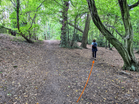
| The view approaching point 10 in the walk |
This is a really nice walk that starts and finishes at Welwyn North Station then explores the countryside E of the railway line on well-defined footpaths and bridleways. There are some good views across rolling countryside and stretches through woodland.
There is one pub close to the start and finish point and one a short detour from point seven at the halfway point. Take some loose change because you will pass a farm store with an honesty box in the middle of woodland where you can buy free-range eggs, honey and vegetables.
Getting there
There are bus stops close to the start and finish of the walk which are served by the number 203 and 204 buses. You can check bus times at
Intalink.
Check the route before you set off
If you want to check what sort of landscape this walk covers before setting off you can view a short 3D video of the route below. It's created using the free version of
Relive.
Directions
 |
Map for 210: Digswell East Loop
Click here or on the map for a larger version
Created on Map Hub by Hertfordshire Walker
Elements © Thunderforest © OpenStreetMap contributors
There is an interactive map below the directions |
Those with GPS devices can download
GPX or
KML files for this walk. We've added
What3Words location references for those who use that system. If you print these walks you might want to use the green
PrintFriendly icon at the bottom of these directions to delete elements such as photographs.
 |
| Welwyn North Station |
1: With your back to
Welwyn North Station (location -
https://w3w.co/third.bind.minds), walk straight ahead to Adele Avenue (location -
https://w3w.co/tanks.patrol.invite) then head ESE for 80m until you reach a fork (location -
https://w3w.co/robe.damp.sadly). Keep right at the fork then head SE for 40m until you reach New Road (location -
https://w3w.co/trial.fend.moon).
Turn right on New Road then head S for 350m along the pedestrian pavement until you reach a bridleway on the left (location -
https://w3w.co/pure.index.trunk), see image below
 |
| Turn left on Welwyn bridleway 37 then head E |
2: Turn left on Welwyn bridleway 37 then head E for 460m until you reach a junction with a bridleway on the left (location -
https://w3w.co/battle.burns.snows), see image below.
 |
| Ignore the bridleway on the left and continue on Welwyn bridleway 37 |
3: Ignore the bridleway on the left and continue on Welwyn bridleway 37, now heading ESE for 325m to a junction (location -
https://w3w.co/maker.vine.asking), see image below.
 |
| Continue heading ESE now on Tewin bridleway 7 |
4: Ignore the footpaths on the right and left and continue heading ESE now on Tewin bridleway 7 for 150m until you reach woodland (location -
https://w3w.co/poems.pass.hands).
 |
| Tewin bridleway 7 approaching the woodland |
Continue on Tewin bridleway 7 climbing uphill through the woodland for 230m until you reach open fields on the left (location -
https://w3w.co/famous.basin.memory). Continue along Tewin bridleway 7 for 170m until you reach a footpath on the left (location -
https://w3w.co/mops.riding.tiger), see image below.
 |
| Continue heading ESE, still on Tewin bridleway 7 |
5: Ignore the footpath on the left and continue heading ESE, still on Tewin bridleway 7, for 370m until you reach a track on the left (location -
https://w3w.co/many.froth.casino), see image below.
 |
| Turn left on Tewin footpath 17 then head ENE |
6: Turn left on Tewin footpath 17 then head ENE for 480m until you reach a junction (location -
https://w3w.co/shaky.farms.spoke) where you turn left on Tewin BOAT 1 (
byway open to all traffic), see image below.
* At this point you could take a 460m detour to visit The Rose & Crown in Tewin (location - https://w3w.co/shirt.homes.span). To visit the pub turn right at point 7 then head E for 220m on Tewin footpath 17 then left on Tewin footpath 41 for 240m.
 |
| Tewin BOAT 1 heading NNW to Margery Wood |
7: If you don't take the detour to the pub head NNW on Tewin BOAT 1 for 230m until the path goes through Margery Wood (location -
https://w3w.co/dime.zone.engine), see image below.
 |
| Continue through Margery Wood |
Continue through Margery Wood, still on Tewin Boat 1, for 160m until you reach a junction (location -
https://w3w.co/tools.pilots.curving), see image below.
 |
| Head NW at the junction, keeping left of the tree |
8: Head NW at the junction, keeping left of the tree (pictured above), now on Tewin bridleway 6, for 365m until you reach woodland (location -
https://w3w.co/purely.ship.dive), see image below.
 |
| Head uphill and NW through Dawley Wood |
Head uphill and NW through Dawley Wood, still on Tewin bridleway 6, for 130m until you reach the top of the hill (location -
https://w3w.co/video.flags.relate). On your right you should see a farm produce stall with an honesty box, see images below. The stall has been set up by
Dawley Wood Farm.
 |
| Dawley Wood Farm honesty stall |
 |
| Dawley Wood Farm honesty stall |
9: After passing the stall Tewin bridleway 6 heads downhill for 280m to a junction (location -
https://w3w.co/when.taps.organ), see image below.
 |
| Cross the junction then head NW on Welwyn bridleway 36 |
10: Cross the junction then continue heading NW, now on Welwyn bridleway 36, for 430m until you reach Pennyfathers Lane and a junction with a path joining from the left (location -
https://w3w.co/trendy.type.title) and a thatched cottage on the right, see image below.
 |
| Head NW along Pennyfathers Lane |
11: Head NW along Pennyfathers Lane for 240m until you reach New Road in Harmer Green (location -
https://w3w.co/aims.damage.brands), see image below.
 |
| Cross New Road then head NW along Harmer Green Lane |
 |
Head NW along Harmer Green Lane
|
12: Cross New Road then head NW along Harmer Green Lane, see orange arrow on the first image above. Continue along Harmer Green Lane for 170m looking out for a footpath on the right (location -
https://w3w.co/limit.orders.return), see image below.
 |
| Turn right on Welwyn footpath 38 |
13: Turn right on Welwyn footpath 38 then head W for 100m until you reach a gate with a footpath to the left (location -
https://w3w.co/sports.loyal.dance), see image below.
 |
Welwyn footpath 38 heading to the left of the gate
Image courtesy of Gerry Gross |
Continue heading W, still on Welwyn footpath 38 for 310m until you reach a junction (location -
https://w3w.co/remain.sides.hooks), see image below.
 |
| Turn left on Welwyn footpath 29 then right on Welwyn footpath 53 |
14: Turn left at the junction on Welwyn footpath 29 head S for 5m then branch right on Welwyn footpath 53 (location -
https://w3w.co/report.punchy.unrealistic), see the line of the orange arrow on the image above. The image below shows Welwyn footpath 53 heading to the right from Welwyn footpath 29.
 |
| Welwyn footpath 53 branching right from Welwyn footpath 29 |
Welwyn footpath 53 now winds SW through Lockleys Wood, see image below.
 |
| Welwyn footpath 53 winds SW through Lockleys Wood |
Follow Welwyn footpath 53 for 310m then SE for 70m to reach a junction (location -
https://w3w.co/guilty.onions.cabin), see image below.
 |
| Turn right on Welwyn footpath 54 |
15: Turn right on Welwyn footpath 54 then head S then SW for 90m until you reach Warren Way (location -
https://w3w.co/index.swim.hiding). The map below shows the route through Digswell back to the station.
Turn left on Warren Way then left again and continue, still on Warren Way now heading SSW for 150m until you reach the junction with Foxley Grove and Woodside Road (location -
https://w3w.co/audit.glory.join).
 |
| Turn left on Woodside Road |
Turn left on Woodside Road then head S for 45m looking for a path on the left at the side of a house (location -
https://w3w.co/storm.alive.wished), see image below.
 |
| Turn left on the path and follow back to Welwyn North Station |
16: Turn left on the path then follow it ESE for 140m back to Welwyn North Station car park and the access to the station (location -
https://w3w.co/moon.spoken.grows).
* The Cowper Arms pub/restaurant (location - https://w3w.co/paint.moss.atoms) is 150m W of the station. To reach the pub turn right out of the station car park then right on Station Road and the pub will be on your right.
Interactive map


Great walk, did it yesterday. Great views and lovely woods.
ReplyDeleteWonderful, so glad you enjoyed it Sarajane. Thanks for the feedback.
DeleteMy children (5 and 7) did this walk today and really enjoyed it - thank you very much for sharing 😊
ReplyDeleteWonderful, glad you enjoyed it. Impressed that your 5 and 7 year old children managed some of those hills. They must be great little hikers! :-)
DeleteAmazing walk, and so well explained for someone who is starting walking as a hobbie.
ReplyDeleteGreat hobby to take up. We love walking. Glad you enjoyed the walk.
DeleteI've been walking mainly from your walks over the last 18 months and have to say this was one of the best! I increased it slightly to 5.6 miles by going north at point 10 then back to point 11. I've mentioned your site quite often on my Instagram site for people to follow your walks. If you use Insta look for walking_hertfordshire which is my blog name. Your walks are superb, keep up the great work
ReplyDeleteHi Nick, thanks for those kind words. We have sometimes walked the extension you mention. Thanks for sharing it for those who want a slightly longer walk. And thanks for the mentions on Instagram. I have followed you. Cheers.
DeleteDave
Hi Dave another lovely walk yesterday even though weather was not brilliant lots of country side views and tree colours amazing . Recognised Harmer Green Lane from a previous walk but reverse direction. Thanks Yet Again. IR. PS The addition of ‘Relive’ Brilliant giving even more information about possible muddy fields this time of year.
ReplyDeleteYes, the Relive is a neat tool for just that purpose; it gives a quick overview of where you will be walking. Thanks for the feedback Ian.
Delete