4.1 miles (6.5 km) with 72m of total ascent
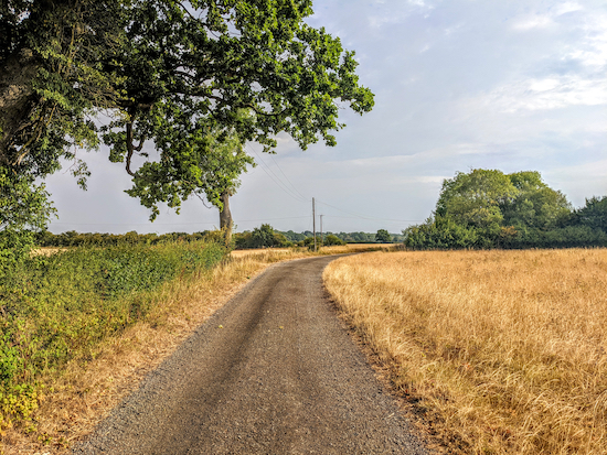 |
| Bengeo Rural footpath 3 between points 2 & 3 |
This is a lovely walk over the rolling countryside NE of the village of Tonwell. It follows well-defined paths across arable land and cuts through sections of woodland. There are great views along much of the walk. The route starts and finishes at the
Robin Hood & Little John, which is 2.7 miles NW from Ware town centre by road.
Getting there
There are bus stops close to the start of the walk (location -
https://w3w.co/lodge.retail.stones), which are served by the number 38 and 38A buses. You can check bus times at
Intalink.
Fly through preview of walk
If you want to check what sort of landscape you will be crossing before you set off on this walk you can view a short 3D video of the route below. It's created using the free version of
Relive.
We didn't encounter any livestock on this walk, but there were signs asking dog owners to keep their pets on a lead. In each case the horses were behind a fence. The fields were on the right between points 4 and 5 and on the left between points 6 and 7, where the sign says that horses are recovering from injury, see image below.
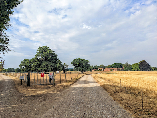 |
| The field between points 6 and 7 where horses are recovering from injury |
Directions
 |
Map for Walk 198: Tonwell North-East Loop
Click on the map for a larger version
Created on Map Hub by Hertfordshire Walker
Elements © Thunderforest © OpenStreetMap contributors
There is an interactive map below the directions |
Those with GPS devices can download
GPXGPX or
KML files for this walk. We've added
What3Words location references for those who use that system. If you print these walks you might want to use the green
PrintFriendly icon at the bottom of these directions to delete elements such as photographs.
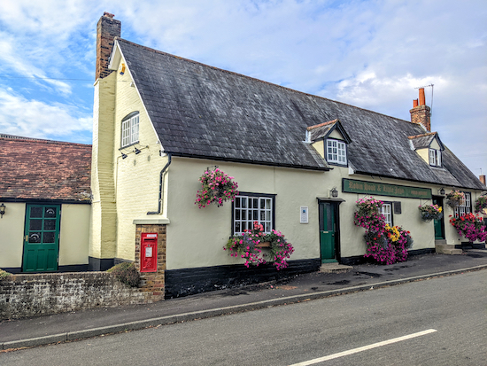 |
| The Robin Hood & Little John in Tonwell |
1: With your back to
The Robin Hood & Little John in Tonwell (location -
https://w3w.co/gone.crest.headed) turn right then head ESE for 50m until you reach Temple Lane on your left (location -
https://w3w.co/fear.remedy.snap). Turn left on Temple Lane then head N for 210m until you reach the end of the lane (location -
https://w3w.co/gladiators.drove.every), see image below.
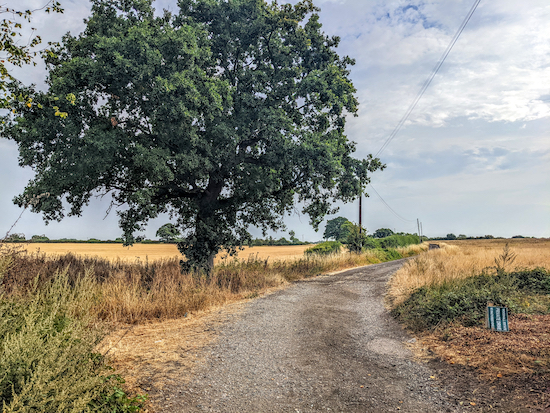 |
| Bengeo Rural footpath 3 at the end of Temple Lane |
2: Head NE on Bengeo Rural footpath 3 for 660m until you reach a footpath junction (location -
https://w3w.co/curl.hood.small), see image below.
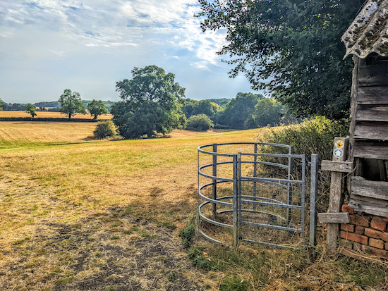
3: At the junction ignore the footpath on the left and head NE, now on Bengeo Rural footpath 4, for 40m keeping to the left of the barn (see orange arrow on the image above) and follow the path to the corner of the barn and a gate (location -
https://w3w.co/length.length.joke), see image below.
 |
| Turn right at the corner of the barn still on Bengeo Rural footpath 4 |
Turn right at the corner of the barn and then head SE, with the barn on the right and the field on the left, cross a footbridge and continue for 160m until you cut through the hedgerow to reach a gate, a footbridge, then a track (location -
https://w3w.co/chairs.atomic.lakes) see image below.
 |
| Cross the footbridge then turn left on Bengeo Rural footpath 4 |
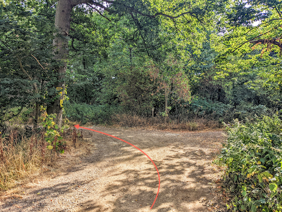
Cross the bridge then turn left, still on Bengeo Rural footpath 4, then follow it E for 120m, with the hedgerow on the left and field on the right until you enter Bourne Wood and then a junction (location -
https://w3w.co/animal.shots.items), see image below.
 |
| Turn left on Bengeo Rural footpath 16 then follow it NE |
3: Turn left on Bengeo Rural footpath 16, then follow it NE for 1.2km to a junction (location -
https://w3w.co/over.look.jets), see image below.
 |
| Turn left on Bengeo Rural bridleway 1 then head NW |
4: Turn left on Bengeo Rural bridleway 1 then head NW for 520m until you reach the edge of Home Wood and Low Wood at which point the bridleway crosses the parish boundary where it becomes Sacombe bridleway 5 (location -
https://w3w.co/stuff.decay.diary), see image below.
 |
| Bengeo Rural bridleway 1 approaching the parish boundary |
5: Continue through Home Wood and Low Wood heading NW on Sacombe bridleway 5 for 360m until you leave the woodland (location -
https://w3w.co/flame.shells.trains), then head W, still on Sacombe bridleway 5, for 250m until you reach a junction with a bridleway on the right (location -
https://w3w.co/whips.think.yours), see image below.
 |
| Keep heading straight at the junction, still on Sacombe bridleway 5 |
6: Ignore the bridleway on the right at the junction and keep heading straight, still on Sacombe bridleway 5, then head SW for 510m until you reach a junction (location -
https://w3w.co/dizzy.about.splice), see image below.
 |
| Turn left on Sacombe bridleway 12 |
7: Turn left on Sacombe bridleway 12 then head SW for 680m until you reach a junction (location -
https://w3w.co/slime.bond.fully), see image below.
 |
| Turn left at the junction on Sacombe footpath 12 |
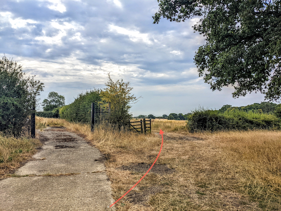
8: Turn left at the junction on Sacombe footpath 12 then head SE for 50m to a gate (location -
https://w3w.co/sang.report.output), see image below.
 |
| Keep right at the gate, still on Sacombe footpath 12 |
Continue on Sacombe footpath 12, see orange line on the image above. After 240m you will cross the parish boundary (location -
https://w3w.co/sentences.poetic.frost) where the path you are on becomes Bengeo Rural footpath 3. Continue heading SE for 610m until you reach the fork you encountered earlier in the walk (location -
https://w3w.co/clots.tree.period), see image below.
 |
| Turn right at the fork still on Bengeo Rural footpath 3 |
9: Turn right at the fork, still on Bengeo Rural footpath 3, then head SW for 920m back to the start point.
Interactive map


Brilliant walk! Easy to follow, all flat and lots of lovely countryside and stunning views. Amazing to see Sacombe House and estate as well, beautiful! thank you
ReplyDeleteHi Ann, glad you enjoyed it. We did too. Thanks for the feedback. Dave & Ellie
DeleteAnother Enjoyable Walk, Woods, Grass Footpaths, Farm Tracks and Lane Walking. Lovely Views. Thank You . .IR.
ReplyDeleteYes, it's a nice walk with a good mix as you reported.
DeleteVery enjoyable walk, clear simple directions, thank you.
ReplyDeleteGlad you enjoyed it. Thanks for the feedback. David
DeleteIs it reasonably easy to park?
ReplyDeleteIt was when we tested the walk. We parked along Ware Road. There were no restrictions at the time. I am not sure if that is still the case.
DeleteAnother lovely walk which we competed today. Blue skies, fleecy white clouds and lots of ox-eye daisies. Clear instructions- no problems. Thank you
ReplyDeleteSo glad you enjoyed the walk. Thanks for the feedback. David
Delete