4.3 miles (7km) with 126m of total ascent
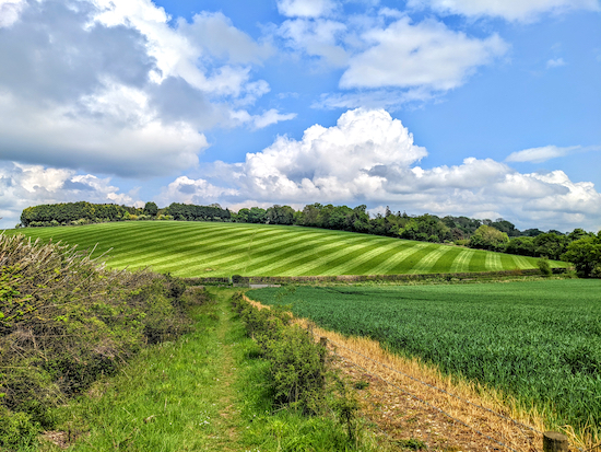 |
| The view approaching point 6 in the walk |
We created this walk following a request for a shorter version of
Walk 172, the Breachwood Green NE Loop (6.1 miles). This route misses out the hamlet of Ley Green and, instead, cuts through the beautiful Kingswalden Park. There are an estimated 300 oak trees in the park, many about 400 years old. One is called the Domesday Oak because it is thought to be more than 1,000 years old.
This walk across the rolling Chiltern Hills - be ready for some steep up and down - starts and finishes at
The Red Lion in Breachwood Green, where we have enjoyed refreshments on previous walks. You will hear the sound of air traffic taking off and landing at nearby Luton airport, but it's worth putting up with for the views across open countryside that this walk offers.
Getting there
The nearest bus stops to the start of the walk are on Oxford Road (location -
https://w3w.co/objective.though.slot) and Chappell Road (location -
https://w3w.co/foot.differ.libraries) in Breachwood Green close to The Red Lion pub. That stop is served by the number 88. Alternatively, you could start the walk at The Green in Peter's Green (location -
https://w3w.co/loved.assist.gallons) close to The Bright Star between points 9 & 10. That stop is served by the number 44. You can
check the local bus schedule at Intalink.
Fly through preview of walk
If you want to check what sort of landscape you will be crossing before you set off on this walk you can view a short 3D video of the route below. It's created using the free version of
Relive.
Directions
 |
Map for Walk 176: Breachwood Green Short Loop
(click here or on the map for larger version)
Created on Map Hub by Hertfordshire Walker
Elements © Thunderforest © OpenStreetMap contributors
There is an interactive map below these directions |
GPS navigation files
Those with GPS devices can download
GPX or
KML files for this walk. We've added
What3Words location references for those who use that system. If you print these walks you might want to use the green
PrintFriendly icon at the bottom of these directions to delete elements such as photographs.
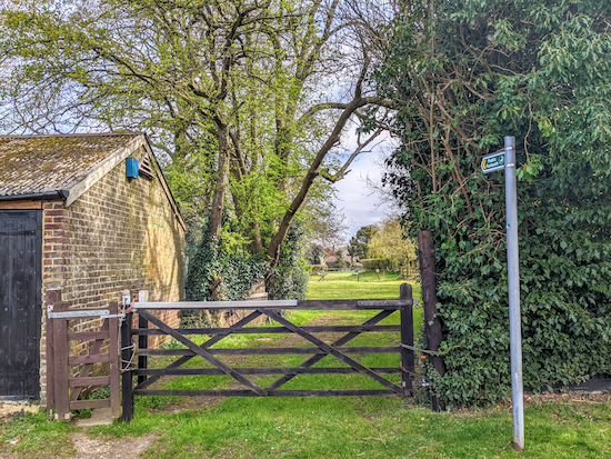 |
| King's Walden footpath 15 at the start of the walk |
1: With your back to
The Red Lion pub (location -
https://w3w.co/unsightly.regret.monk) turn left then head N on Chapel Road for 120m until you reach the second footpath on the right (location -
https://www.redlionbreachwoodgreen.co.uk/), see image above.
2: Turn right on King's Walden footpath 15, then head NE for 50m to a gate where you turn left and head N for 90m to another gate (location -
https://w3w.co/conceals.graphic.mavericks), see image below.
 |
| Follow King's Walden footpath 15 across the field (see line of yellow arrow) |
3: Go through the gate then head NE and uphill for 120m (following the line of the yellow arrow in the image above) until you reach a white-topped post in the middle of the field (location -
https://w3w.co/rigid.pulled.agency). When we walked this way in early May 2022 the crop of beans was knee high, but the path was still visible.
* This is a slightly different route from that shown on the OS map, which has King's Walden footpath 15 heading E then N to reach point 4. The OS map then has King's Walden footpath 14 heading NE across the field before turning SE along the side of Watkin's Wood. Rather than trample through the crop we followed the well-trodden route between the marker posts. See map below which shows the OS route for King's Walden footpath 15 in blue and the OS route for King's Walden footpath 14 in red. The route we took, following a path already worn through the crop, is in green.
 |
The well-trodden detour between points 3, 4 & 5
We followed the green line, the OS map follows the blue and red lines
Created on Map Hub by Hertfordshire Walker
Elements © Thunderforest © OpenStreetMap contributors
|
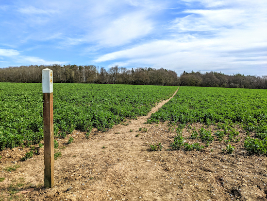 |
| King's Walden footpath 14 heading ENE across the field |
4: When you reach the marker post in the middle of the field turn right on King's Walden footpath 14 then head ENE for 200m, until you reach woodland (location -
https://w3w.co/runways.grass.mainframe).
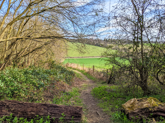 |
| King's Walden footpath 14 leaving the woodland then heading downhill |
5: Continue heading NE through woodland, with Watkin's Wood on the left and Lord's Wood on the right, for 210m then, as you emerge from the woodland, head downhill for 230m until you reach Lilley Bottom Road (location -
https://w3w.co/feuds.putter.landscape).
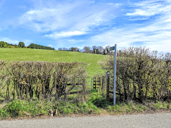 |
| Head NE and uphill on King's Walden footpath 14 |
6: Cross Lilley Bottom Road and continue heading NE and uphill, still on King's Walden footpath 14, for 400m until you reach Garden Wood and a junction (location -
https://w3w.co/blissful.pickup.scratches).
 |
| Turn left at the junction then head N on King's Walden footpath 19 |
7: When you reach the top of the hill turn left at the junction then head N on King's Walden footpath 19 for 490m until you reach Church Road (location -
https://w3w.co/stack.workflow.marriage).
8: Turn right on Church Road then follow it NE and uphill for 240m until you reach a footpath on the right (location -
https://w3w.co/remission.punters.chew).
 |
| King's Walden footpath 23 heading SE off Church Road |
9: Turn right on King's Walden footpath 23 then head SE for 240m until you reach a tree-lined avenue (location -
https://w3w.co/refuse.intensely.clattered).
 |
| King's Walden footpath 23 heading SE across parkland |
10: Cross the avenue then continue heading SE through Kingswalden Park for 440m until you reach a track (location -
https://w3w.co/classed.toned.twee). Continue heading SE, still on King's Walden footpath 23, for 590m until you reach Miserable Lane at Frogmore (location -
https://w3w.co/dwarf.vocab.apricot).
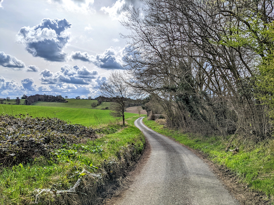 |
| Head S and SW on Miserable Lane for 700m |
11: Turn right on Miserable Lane then head S and SW for 700m until you reach Lilley Bottom Road (location -
https://w3w.co/tailwind.ivory.attitudes).
12: Turn left on Lilley Bottom Road then head SE for 120m until you reach a lane on the right (location -
https://w3w.co/sonic.supposed.lines). Take this lane then head SW and uphill for 230m until you reach a footpath on the left (location -
https://w3w.co/develops.winded.slept).
 |
| St Paul's Walden footpath 17 heading ESE |
13: Turn left on St Paul's Walden footpath 17 then head ESE for 90m until the path bends right and heads SSW for 380m to reach a junction (location -
https://w3w.co/replenish.quit.trials). There were two fallen trees blocking the footpath when we did this walk on April 2022 and also a month later in May 2022. We have
reported it to the Hertfordshire County Council Rights of Way team.
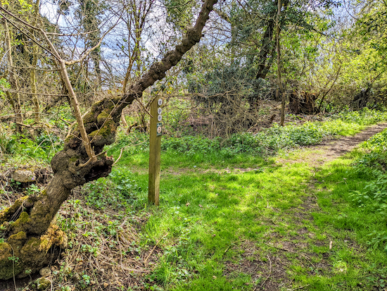 |
| Keep right at the junction, now on St Paul's Walden footpath 18 |
14: Keep right at the junction, now on St Paul's Walden footpath 18, then head SW for 100m until you reach a lane (location -
https://w3w.co/column.elite.resonated).
15: Turn left on the lane then head S for 60m to a junction (location -
https://w3w.co/automatic.handfuls.newsstand). Keep right at the junction then head SSW along Chapel Row for 180m until you cross Law Hall Lane (location -
https://w3w.co/blushed.compliant.glades) then continue for 45m until you reach Bendish Lane (location -
https://w3w.co/blanket.neckline.historic).
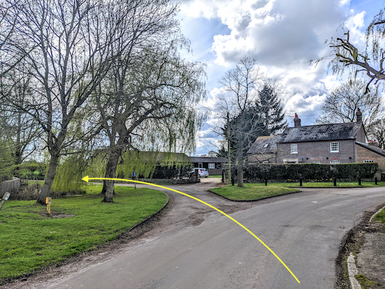 |
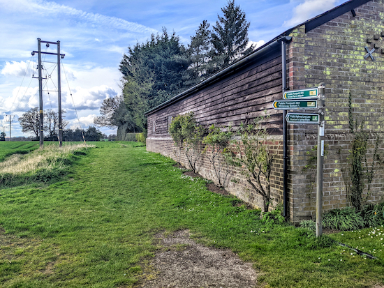
| Take the footpath on the right just after the barn |
16: Turn right on Bendish Lane then head SW for 45m to another junction (location -
https://w3w.co/overused.masterful.glad) where you turn left then head SSW for 30m looking for a footpath on the right (location -
https://w3w.co/trace.bedrock.lads) just after a barn. You follow the yellow arrow on the image above then turn right on the footpath where the arrow stops.
 |
| St Paul's Walden footpath 24 heading W |
Take this footpath, St Paul's Walden footpath 24, then head W, SW, then NW for 370m until you reach Dane Street (location -
https://w3w.co/scare.ditched.snowy).
 |
| St Paul's Walden footpath 20 heading NW back to the starting point |
17: At Dane Street turn left then head SW for 10m looking out for a footpath on the right (location -
https://w3w.co/incline.sharp.upward). Follow this path, St Paul's Walden footpath 20, NW for 860m until you reach the junction of Lower Road and Oxford Road in Breachwood Green (location -
https://w3w.co/across.toxic.juicy). Head W on Oxford Road to return to the starting point.
Interactive map
Regular users of this site will notice that this walk covers some sections of three other walks in this series but walked in reverse. They are:


Hi Dave was out early because of heat . Yes did recognise parts of walk from others I’ve done especially the up hill from Lilley Bottom Road that’s a beast 😂🤣 still enjoyed it. Thank You Again. .IR.
ReplyDeleteYes, quite a climb and it must have been hard in this weather. Hope you took enough water.
DeleteDid this walk yesterday at point 3 the field is now completely ploughed and there is no footpath just a way marker in the middle. Bit inconsiderate on the person that owns that land
ReplyDeleteUnfortunately ploughed rights of way are a common problem this time of the year. It always makes walking difficult until the path is reinstated. The farmer has 14 days to make good. I hope it didn't spoil your walk.
Deletehttps://www.hertfordshirewalker.uk/p/tips.html#faults
FYI In Oxford Road , a few yards from the start of this walk there is a bus shelter where you can change into your boots in comfort, there are also books available!
ReplyDeleteThanks for the tip, Gerry
Delete