6.5 miles (10.5 km) with 110m of total ascent
 |
| Nuthampstead footpath 13 between points 10 & 11 |
This walk starts in
Nuthampstead then heads S to the village of
Anstey. The name Anstey apparently means a narrow, one-way footpath, and there will be plenty of these along the way. You then visit
Barkway, which is listed in the
Domesday book as
Birchwig, meaning Birch Way. The village has a number of 15th and 16th century properties. The route passes three pubs.
During WWII, Nuthampstrad was the home of the 55th Fighter Group and subsequently the 398th Bombardment Group of the U.S. Army Air Forces.
B-17 Flying Fortress heavy bombers were flown from here on missions over occupied Europe.
* The walk involves 1.8 miles of lane walking but the lanes are quiet and there are verges where you can step out of the way if a vehicle approaches. There is one 300m stretch along the B1368 south of Barkway where there is no pavement for pedestrians, however there is a verge you can use if traffic approaches. The route also crosses a golf course.
Getting there
There are bus stops in Barkway close to point 13 in the walk (location -
https://w3w.co/replenish.however.crumble), which are served by the number 27 bus. You can check bus times at
Intalink.
Stuart Johnson, the owner of The Woodman Inn where the walk starts and finishes, says that people doing this walk are welcome to park in the pub's car park (location -
https://w3w.co/costly.still.lifters) if they intend to buy refreshments before or after their walk. Please check with the pub before parking in case the situation has changed since this walk was published.
Alternatively, there is a possible parking spot just after point 18 where there is a small concrete layby (location -
https://w3w.co/heckler.raves.journey) which looks big enough for a couple of cars. We have marked it in blue on the maps below.
Fly through preview of walk
If you want to check what sort of landscape you will be crossing before you set off on this walk you can view a short 3D video of the route below. It's created using the free version of
Relive.
Directions
 |
Map for Walk 142: Nuthampstead South-West Loop
Click on the map for a larger version
Created on Map Hub by Hertfordshire Walker
Elements © Thunderforest © OpenStreetMap contributors
There is an interactive map below these directions |
Those with GPS devices can download
GPX or
KML files for the walk. We've added
What3Words references for those who use that system. If you print these walks you might want to use the green
PrintFriendly icon at the bottom of these directions to delete elements.
1: From
The Woodman Inn car park take the path that starts in the NE corner (location -
https://w3w.co/breathing.pushes.proofs) and head SE. This path is also the
Hertfordshire Way. Follow it for 320m until you reach a T-junction. (location -
https://w3w.co/contour.losing.brisk).
 |
| The footpath heading SE out of The Woodman Inn car park |
2: Turn right at the T-junction and follow the concrete track, still the Hertfordshire Way, SW for 720m until you reach woodland and a crossing (location -
https://w3w.co/origins.insolvent.inserted).
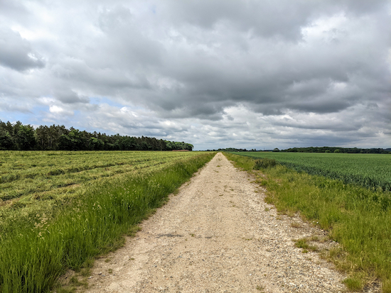 |
| The Hertfordshire Way heading S from point 2 |
3: Turn right, still on the Hertfordshire Way (see image below), and head SW for 180m with the woodland on your left and the fields on your right until you reach a junction (location -
https://w3w.co/predict.crusaders.decking).
 |
| Turn right at the junction and continue on The Hertfordshire Way - point 3 |
At the junction head S, now on Anstey footpath 13 which is also the Hertfordshire Way, and continue with the woodland on your left and the field on your right. You then head SW for 500m until you reach Mill Lane (location -
https://w3w.co/adjust.profited.request).
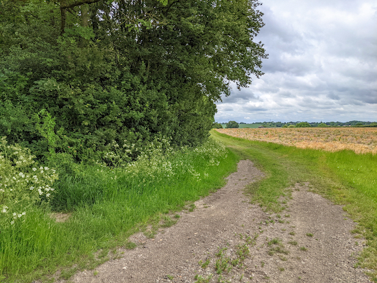 |
| Heading S on Anstey footpath 13 |
4: Turn left on Mill Lane and head SE for 220m until you reach a footpath on the right (location -
https://w3w.co/enclosing.fairly.printers).
5: Turn right on Anstey footpath 6 and head SW for 130m until you reach a footbridge (location -
https://w3w.co/worksheet.streaking.bits).
 |
| The footbridge on Anstey footpath 6 |
6: Cross the bridge and continue heading SE, still on Anstey footpath 6, for 410m until you reach a footpath junction (location -
https://w3w.co/soft.snuck.yacht).
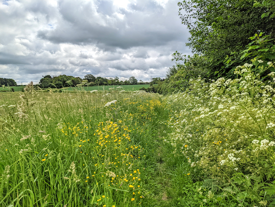 |
| Anstey footpath 6 heading SE |
7: Turn right on Anstey footpath 7 and head W for 280m to Hare Street (location -
https://w3w.co/lordship.assets.stale).
 |
| Anstey footpath 7 heading W |
8: Turn right on Hare Street and head N and uphill for 110m until you reach St George's Church.
* At this point you could take a short detour to visit The Blind Fiddler pub which is 290m NE in Anstey village.
 |
| The Blind Fiddler free house in Anstey village |
If you don't want to take the detour to the pub continue along the footpath that runs to the left of the church (location -
https://w3w.co/overlaps.fork.initiated). This is Anstey footpath 2. Follow Anstey footpath 2 NNW for 680m until you reach a lane (location -
https://w3w.co/spurring.sheets.smallest).
9: Turn left on the lane. There isn't a pavement on this lane, but it is quiet and there is a good grass verge most of the way where you can step off the road if a vehicles approaches. Follow this lane as it weaves its way NNW for 1km until you reach a footpath on your left (location -
https://w3w.co/trembles.chief.clashing).
 |
| Nuthampstead footpath 13 heading WNW |
10: Take this path, Nuthampstead footpath 13, and follow it WNW. The path goes along the edge of Barkway Park golf course and crosses some fairways as well as following the
River Quin in places. Continue for 910m until the footpath turns left (location -
https://w3w.co/grazed.yawned.linguists).
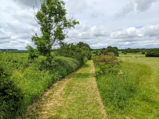 |
| Nuthampstead footpath 13 alongside Barkway Park golf course |
11: Turn left and head W, now on Barkway footpath 25, for 260m until you reach London Road (location -
https://w3w.co/cashier.pianists.obligated).
12: Turn right on London Road. There isn't a pavement for pedestrians along this road but there is a grass verge where you can step out of the way of traffic. Head NNW and against the traffic for 300m at which point you will find a pavement on the left-hand side of the road. Continue for 150m until you reach
The Tally Ho pub/restaurant on your right (location -
https://w3w.co/repeating.contrived.caused). Continue past the pub for another 110m until you reach Gas Lane on your right (location -
https://w3w.co/hence.senses.videos).
13: Turn right on Gas Lane, which is also Barkway restricted byway 10, and head E for 190m until you reach a field (location -
https://w3w.co/siesta.plots.evoke). Follow the path diagonally NE across the field for 220m (see yellow arrow in image below) until you reach a junction (location -
https://w3w.co/dizzy.liquid.fitter).
 |
| Follow the path diagonally NE across the field |
14: Turn right on Barkway footpath 12 and head E for 90m before the path swings right and heads S for 40m before reaching a footpath on the left (location -
https://w3w.co/newspaper.happen.trucked). This is Nuthampstead footpath 3, which at this stage is also the Hertfordshire Way (see image below).
 |
| Nuthampstead footpath 3 heading E |
Follow Nuthampstead footpath 3 as it heads E for 820m until you reach a footpath junction with signpost on your left and a path on your right going through the hedgerow (location -
https://w3w.co/digestion.sadly.glow), see image below.
 |
| When you reach the post on the left take the footpath on the right |
15: Turn right on Nuthampstead footpath 5, go through the gap, then head SE for 50m, through another gap in the hedge (see image below), and then continue heading SE for 240m until you reach a lane (location -
https://w3w.co/snippet.liked.catchers).
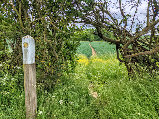 |
| Nuthampstead footpath 5 going through the gap in the hedge - point 15 |
16: Turn right on the lane and head SW for 280m until you reach Nuthampstead Road (location -
https://w3w.co/costumes.suggested.wept). Cross Nuthampstead Road and take the lane opposite heading SE and uphill for 210m until you reach a bend in the road and a bridleway on the left (location -
https://w3w.co/kickbacks.nutrients.organs).
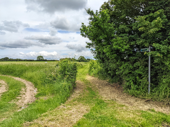 |
| Nuthampstead bridleway 6 heading SE |
17: Take this bridleway, Nuthampstead bridleway 6, and follow it SE for 1km until you reach a lane (location -
https://w3w.co/joints.salsa.silent).
* At this junction there is a strip of concrete at the side of the lane, which we have marked in blue on the maps above and below. This might be a place to park (location - https://w3w.co/puddles.carriage.with), but do check for any restrictions which might have been introduced since this walk was published.
18: Turn left on the lane and follow it as it zig-zags in a NE direction for 920m back to The Woodman Inn and the starting point.
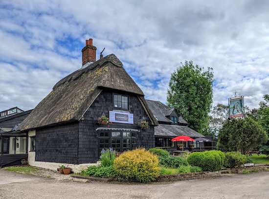 |
| The Woodman Inn Nuthampstead |
This is our second walk from The Woodman Inn, Nuthampstead. The other is
Walk 141: Nuthampstead North-West Loop 7.7 miles with 440ft of ascent.
Interactive map


Walked this route today, it was, once again, a lovely walk, and in our opinion, equally as good as walk 141. Now with both walks from Nuthampstead completed we earned and thoroughly enjoyed a delicious meal in The Woodman. Thanks again for your very clear route and instructions
ReplyDeleteGlad you enjoyed it Maggie. Thanks for letting us know.
ReplyDeleteDavid
Walked this route 10 April 2022. It's really lovely walk with the added 'feature' of the old runway of Nuthampstead USAF base (first photo in directions).
ReplyDeleteWe measured it, via Strava, at 7.62 miles / 12.19km. We possibly added 500m because of where we parked, but we didn't go wrong, honest! Has anyone else noticed this is a mile longer than it's 6.5 mile tag?
Hi Andrew,
DeleteGlad you enjoyed it. Did you get a chance to check out the USAF museum at The Woodman pub at the start/finish point? Well worth a visit, as is the pub which has loads of memorabilia on the walls.
Strange your Strava showed it as 7.62 miles (12.19km). I use MapHub to plot the route and that shows the distance as being 6.56 miles (10.6km). I then double check when we walk the route using two apps. The paid-for OS has the walk as 6.53 miles (10.51km), and the free-to-use Komoot app shows the walk as being 6.64 miles (10.7km).
So I am not sure where the extra miles has come from. That is a mystery. I hope it didn't spoil your walk.
Thanks for the feedback
David
Hi David, sounds like you've done a more thorough job of measuring the distance with different data sources, so it's more likely to be an error with Strava. And it certainly didn't spoil the walk - it's a lovely one.
DeleteWe didn't go in the Woodman, but checked out the two monuments outside.
Again, thanks for all your work on planning and posting these walks - much appreciated.
Hi Andrew,
DeleteMy wife, Ellie, wears a Fitbit and that often comes up with a different distance reading than my apps. Never figured out why. In the old days I use to measure distances with a bit of wet cotton pressed down on an OS map. :-)
David
haha, I was barely more sophisticated - before digital methods I used dividers set to 50m. All my old OS maps have little perforations in them, and a 10km route would be accurate to within +/- 500m at best.
DeleteWow that must have been some runway. Another brilliant walk .Thanks . Enjoyed a lovely pint of Bomber Group 389. Just to let you know Stuart Johnson has left The Woodman . Gavin Turl is now in charge.
ReplyDeleteYes, quite a walk for anyone interested in WWII aviation history. Glad you enjoyed it. Dave
Delete